Premium
 Download
Edit
Download
Edit
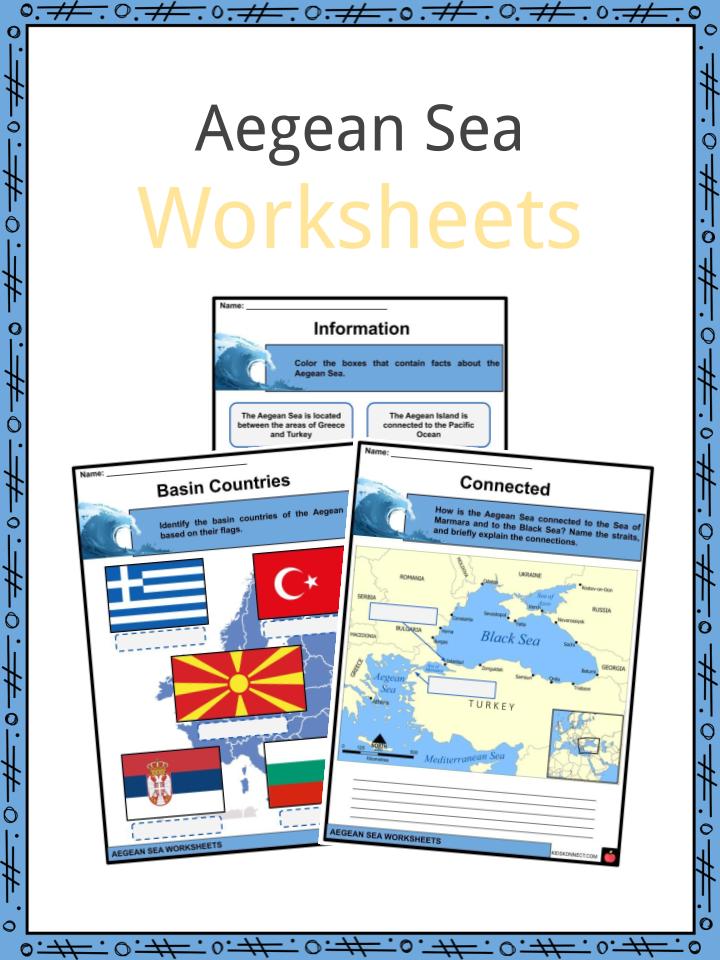
Download the Aegean Sea Facts & Worksheets
Click the button below to get instant access to these worksheets for use in the classroom or at a home.
Download This Worksheet
This download is exclusively for KidsKonnect Premium members!
To download this worksheet, click the button below to signup (it only takes a minute) and you'll be brought right back to this page to start the download!
Sign Me Up
Edit This Worksheet
Editing resources is available exclusively for KidsKonnect Premium members.
To edit this worksheet, click the button below to signup (it only takes a minute) and you'll be brought right back to this page to start editing!
Sign Up
Not ready to purchase a subscription? Click to download the free sample version Download sample
Download This Sample
This sample is exclusively for KidsKonnect members!
To download this worksheet, click the button below to signup for free (it only takes a minute) and you'll be brought right back to this page to start the download!
Sign Me Up
Table of Contents
The Aegean Sea is an elongated embayment, or arm, of the Mediterranean Sea, which can be found between the Greek and Anatolian peninsulas.
See the fact file below for more information on the Aegean Sea or alternatively, you can download our 24-page Aegean Sea worksheet pack to utilise within the classroom or home environment.
Key Facts & Information
INTRODUCTION
- The Aegean Sea is historically important with regards to the civilization of Ancient Greeks who lived in the area around the coast of the Aegean Sea and in the Aegean Islands.
- The floor of the Aegean Sea is composed mainly of limestone.
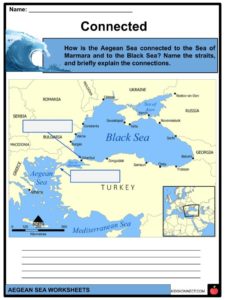
- The Aegean Sea is connected to the Sea of Marmara and the Black Sea through the Dardanelles strait and the Bosphorus (or Bosporus) strait.
- Some cities that can be found on the Aegean Sea coastline include Athens, Thessaloniki, Volos, Kavala and Heraklion in Greece, and İzmir and Bodrum in Turkey.
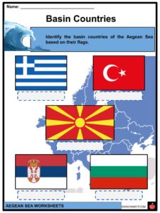
- Aegean Sea basin countries include Greece, Turkey, North Macedonia, Serbia, and Bulgaria.
EXTENT
- The limits of the Aegean Sea are defined by the International Hydrographic Organization as follows: On the south from Cape Aspro to Cum Burnù, through the island to Cape Prasonisi, to Vrontos, to Castello Point, across to Cape Plaka, to Agria Grabusa, to Cape Apolitares, to Psira Rock, across to Cape Trakhili, to the Northwest point, and to Cape Santa Maria.
GEOGRAPHY
- Within the waters of the Aegean Sea, the Aegean Islands can be found, which contain: Kythera, Antikythera, Crete, Kasos, Karpathos and Rhodes.
- The eastern boundary of the Aegean Sea is marked by the Anatolian Peninsula, while the western boundary is marked by the mainland of Greece.
- Several seas can be found within the Aegean Sea including the Thracian Sea, which is located to the north of the Aegean Sea, the Icarian Sea, which is located to the east, the Myrtoan Sea, which is located to the west, and the Sea of Crete, which is located to the south of the Aegean Sea.
- The Greek regions that border the Aegean Sea include Attica, Central Greece, Central Macedonia, Crete, Eastern Macedonia and Thrace, North Aegean, Peloponnese, South Aegean, and Thessaly.
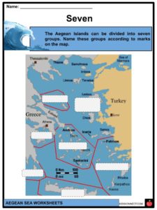
- The Aegean Islands can be divided into seven (7) groups: (1) Northeastern Aegean Islands, (2) East Aegean Islands, (3) Northern Sporades, (4) Cyclades, (5) Saronic Islands, (6) Dodecanese, (7) Crete.
- The Aegean Sea is connected to the Sea of Marmara by the Dardanelles which can be found to the northeast of the Aegean Sea.
HYDROLOGY
- The oceanography of the Aegean Sea is controlled mainly by the regional climate.
- The climate of the Aegean Sea largely mirrors the climate of Greece and Western Turkey.
- Along the coast of the Aegean Sea lie numerous Greek and Turkish settlements.
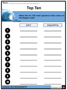
- The ten (10) most populous urban areas around the Aegean Sea include Athens, İzmir, Thessaloniki, Heraklion, Volos, Çanakkale, Chania, Rhodes, Alexandroupoli, and Kavala.
BIODIVERSITY
- The Aegean Sea is considered as one of the most biodiverse regions in the entire Mediterranean as it houses marine mammal species that are at risk.
- Fishes are Greece’s second largest agricultural export and Greece has the largest fishing fleet of Europe.
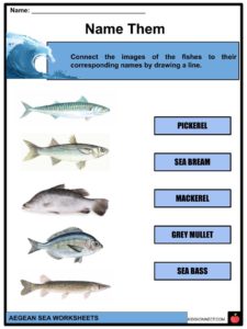
- Fishes that can be caught in the Aegean Sea include sardines, mackerel, grouper, grey mullets, sea bass, and seabream. Some other fishes include anchovy, boops, and pickerel.
PROTECTED AREAS
- Greece has established several marine protected areas along its coasts.
- The National Marine Park of Alonnisos Northern Sporades is considered as the current largest marine protected area in Europe.
- This marine park is located in the region of the Northern Sporades Islands, which can be found in the northern Aegean Sea.
ECONOMY
- Several ports can be found on the Aegean Sea, including the Port of Piraeus that can be found in Athens. This port is considered as the largest passenger port in Europe and third largest in the world.
- Some other ports that can be found in the Aegean Sea include the Port of Thessaloniki and Palouki.
- Fishing is also one of the major industries of coastal areas around the Aegean Sea.
- Tourism is also one of the industries of the areas in the Aegean Sea.
The Aegean Islands are significant tourist destinations. - There are five sites in the Aegean Islands that are considered as UNESCO World Heritage sites. These five (5) sites are the following: (1) the Monastery of Saint John the Theologian and the Cave of the Apocalypse in Patmos; (2) the Pythagoreion and Heraion of Samos in Samos; (3) the Nea Moni of Chios; (4) the island of Delos, and the (5) Medieval City of Rhodes.
Aegean Sea Worksheets
This is a fantastic bundle which includes everything you need to know about the Aegean Sea across 24 in-depth pages. These are ready-to-use Aegean Sea worksheets that are perfect for teaching students about the Aegean Sea which is an elongated embayment, or arm, of the Mediterranean Sea, which can be found between the Greek and Anatolian peninsulas.
Complete List Of Included Worksheets
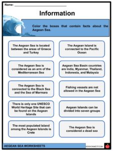
- Aegean Sea Facts
- Information
- Basin Countries
- Connected
- Seven
- Name Them
- Top Ten
- Travel Time!
- Sites
- Protected Place
- Writing
Link/cite this page
If you reference any of the content on this page on your own website, please use the code below to cite this page as the original source.
Link will appear as Aegean Sea Facts & Worksheets: https://kidskonnect.com - KidsKonnect, June 24, 2020
Use With Any Curriculum
These worksheets have been specifically designed for use with any international curriculum. You can use these worksheets as-is, or edit them using Google Slides to make them more specific to your own student ability levels and curriculum standards.