Premium  Download Edit
Download the Landforms Facts & Worksheets
Click the button below to get instant access to these worksheets for use in the classroom or at a home.
Download This Worksheet
This download is exclusively for KidsKonnect Premium members!
To download this worksheet, click the button below to signup (it only takes a minute) and you'll be brought right back to this page to start the download!
Sign Me Up
Edit This Worksheet
Editing resources is available exclusively for KidsKonnect Premium members.
To edit this worksheet, click the button below to signup (it only takes a minute) and you'll be brought right back to this page to start editing!
Sign Up
Not ready to purchase a subscription? Click to download the free sample version Download sample
Download This Sample
This sample is exclusively for KidsKonnect members!
To download this worksheet, click the button below to signup for free (it only takes a minute) and you'll be brought right back to this page to start the download!
Sign Me Up
Table of Contents
Landforms, such as mountains, valleys, plains, or plateaus, are physical characteristics of the Earth’s surface that define the landscape. They also consist of underwater features like ocean basins and mid-ocean ridges and coastal features like bays
or peninsulas.
See the fact file below for more information on Landforms, or you can download our 27-page worksheet pack to utilize within the classroom or home environment.
Key Facts & Information
TOPOGRAPHY
- Topography is the study of how the land’s surface is shaped, including all of its peaks and valleys.
- The Greek words “topo” (for place) and “graphia” (for writing or recording) are the origins of the word topography.
- Topographic maps are those that depict topography.
- Elevation can be clearly seen on topographic maps. There are many ways to estimate elevation, including surveying techniques that include looking down on the Earth’s surface and utilizing pulsed laser light to highlight a target in the landscape.
GEOLOGICAL PROCESS: WEATHERING
- One key factor in the formation of various landforms is weathering. Weathering is influenced by both temperature and precipitation. The same is true for soil, minerals, and rock pressure. These represent mechanical weathering in action. Rocks, minerals, and soil can all degrade as a result of chemical interactions.
- The materials of the Earth are broken down by mechanical weathering. Frost weathering, also known as cryofracturing, is one instance. It occurs when water seeps through small rock fissures. When water freezes, it expands, causing the rock to crumble.
- Mechanical weathering can also result from internal Earth pressure. Different gases and liquid rock, known as magma, are trapped beneath the planet’s surface. These materials are under intense pressure and heat. Sometimes, pressure-releasing fissures form when magma and gases climb toward the surface. That is what a volcano does when it erupts!
- The chemical characteristics of materials on the Earth’s surface alter as a result of chemical weathering.
- Carbonation is one example of chemical weathering. It occurs when calcium carbonate-containing rocks are exposed to acid rain (CaCO3). For instance, carbonation frequently causes limestone to degrade.
- Chemical weathering is another effect of oxidation. The air’s oxygen interacts chemically with several types of landforms.
GEOLOGICAL PROCESS: EROSION
- The geological process of erosion is when earthen materials are moved and worn away by elements of nature like wind or water.
- Erosion occurs when the water or glacier ice is muddy, the wind is dusty, or both. The brown color shows that soil and rock fragments are being transferred from one location to another while suspended in the fluid (air or water). Sediment refers to this transported material.
- The sun itself is an instrument for erosion! Rocks grow when they heat up. Sometimes, expanding rocks will split and disintegrate.
GEOLOGICAL PROCESS: DEPOSITION
- Depositional landforms are the physical manifestation of processes that deposit rocks or sediments after they have been carried there by gravity, wind, or flowing water.
- Beaches, deltas, glacial moraines, sand dunes, and salt domes are a few examples. While some depositional landforms develop over thousands of years, others might undergo significant alteration in just a few months.
- Since the glaciers that dropped the sediments melted, those produced by their movements have remained mostly intact.
- Many other depositional landforms are subject to change. Beaches’ coasts shift with the tides and may erode or move closer to the ocean when waves add more silt or remove it.
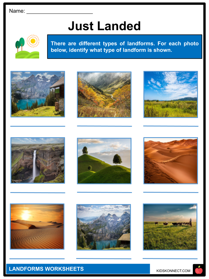
TYPES OF LANDFORMS: MOUNTAINS
- Mountains are landforms that rise over their surroundings. They were created as a result of tectonic processes, earthquakes, volcanic eruptions, and the erosion of the land by wind, water, and ice. There are mountains on land and in the seas.
- One such enormous catastrophe, which began roughly 55 million years ago, eventually gave rise to the Himalayas in Asia. The Himalayas contain thirty of the tallest mountains in the world.
- Mountains are frequently used to define natural borders between nations. Their height can affect weather patterns by slowing down storms that originate from the ocean and drawing moisture out of the clouds.
TYPES OF LANDFORMS: HILLS
- A piece of land that rises above everything around it is called a hill. It appears to be a small bump in the Earth. Hills are great places to get a nice view because they are higher than anything else around them.
- To prevent flooding, many people erect their houses and villages on hills.
- The US Geological Survey states that there is no formal difference between hills and mountains. The main difference between a mountain and a hill is elevation, to put it simply. The most well-known distinction between the two is probably that a mountain is taller than a hill. A mountain summit is usually thought to be considerably more distinct and pointed than the peak of a hill. The third difference between mountains and hills is that whereas hills are more likely to be found standing alone, mountains are typically part of a large mountain range.
TYPES OF LANDFORMS: VALLEYS
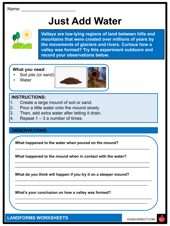
- Valleys are low-lying regions of land between hills and mountains that were created over millions of years by the movements of glaciers and rivers. They can be either V-shaped valleys or U-shaped valleys, depending on their shape. Glaciers create U-shaped valleys, whereas rivers running downstream create V-shaped valleys.
- A valley has a “head” where it starts in the hills or mountains, “sides” where it rises up on either side and a “floor” where it is the most level. In some valleys, the opening can be seen between two hills, mountains, or cliffs, forming the valley’s “entry.” Sometimes, “gorge” describes a location where a valley is extremely narrow and has high cliffs.
TYPES OF LANDFORMS: DESERTS
- Deserts are dry areas of land that have little or no vegetation because they receive insufficient rainfall. They are generally found in locations that receive little to no precipitation and are, in terms of wind direction, leeward of a mountain range. Deserts have extremely dry atmospheric conditions and hot summer days.
- Even though many deserts have summer daytime highs of well above 100°F (37.8°C), they can get quite chilly at night.
- Most of the time, clouds and water vapor act as a blanket to trap heat. But there aren’t enough clouds and water vapor in deserts for this to happen.
- Some deserts are always cold; in fact, Antarctica is home to the world’s largest desert. Antarctica is a desert because, although covered in snow and ice, it hardly ever experiences rain or snow.
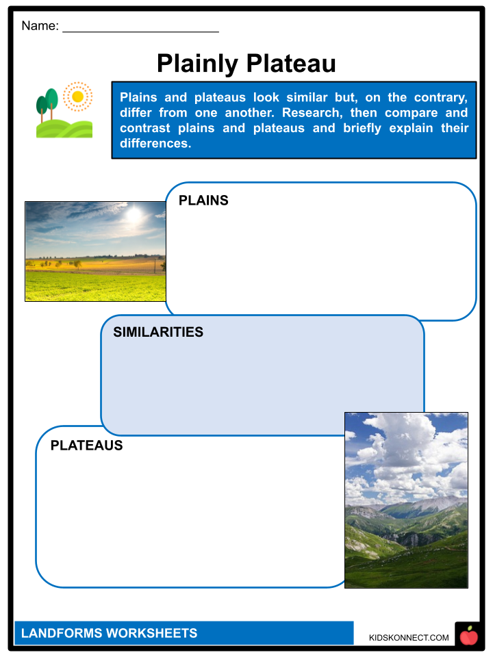
TYPES OF LANDFORMS: PLAINS
- Plains are low-relief regions on the Earth’s surface that are flat. It might have been created by the sedimentation of soil that had been washed down from the tops of hills and mountains, or it might have been caused by flowing lava that had been deposited by the forces of wind, water,
and ice. - Many plains are grasslands, including the Great Plains, which cover much of central North America.
- Plains can also be deserts. The Sahara, a large desert in North Africa, contains plains in some areas.
- There are plains on other planets. Large plains can be found on Mercury, and numerous probes have been planted on Mars‘ boulder-strewn plains.
TYPES OF LANDFORMS: PLATEAUS
- A plateau is a flat, high landform with at least one side that rises dramatically above the surroundings. Every continent has plateaus, which occupy one-third of the surface of the planet. Together with hills, mountains, and plains, they make up one of the four main types of landform.
- Dissected plateaus and volcanic plateaus are the two different types of plateaus. As the Earth’s crust moves upward, a dissected plateau develops. The gradual clash of tectonic plates is what causes the uplift.
- A volcanic plateau is created by a series of minor volcanic eruptions that gradually pile up over time and produce lava flows that eventually form a plateau.
Landforms Worksheets
This fantastic bundle includes everything you need to know about Landforms across 27 in-depth pages. These ready-to-use worksheets are perfect for teaching kids about Landforms, such as mountains, valleys, plains, or plateaus, which are physical characteristics of the Earth’s surface that define the landscape.

Download includes the following worksheets
- Landforms Facts
- Plainly Plateau
- Land of the True
- Just Landed
- Landslide
- Ain’t No Mountain High Enough
- Just Add Water
- Deserts
- Home is Where the Land is
- Landed Words of Wisdom
- Protector of the Land
Frequently Asked Questions
What is a landform?
A landform is a natural feature of the Earth’s surface, such as mountains, valleys, plateaus, or plains.
How are landforms formed?
Landforms are formed through a combination of geological processes, such as erosion, deposition, volcanic activity, and tectonic activity, which can cause the Earth’s surface to rise, fall, and change shape over time.
What is the difference between a hill and a mountain?
Hills are lower in elevation than mountains and have a rounded or sloping summit, while mountains are taller and have a pointed summit.
What is a glacier?
A glacier is a large mass of ice that moves slowly over land and can cause significant changes to the landscape, such as the formation of U-shaped valleys and moraines.
What is a plateau?
A plateau is a flat, elevated area of land that is higher than the surrounding areas and often has steep cliffs or slopes at its edges. Plateaus can be formed through geological processes such as uplift or volcanic activity.
Link/cite this page
If you reference any of the content on this page on your own website, please use the code below to cite this page as the original source.
Link will appear as Landforms Facts & Worksheets: https://kidskonnect.com - KidsKonnect, February 16, 2023
Use With Any Curriculum
These worksheets have been specifically designed for use with any international curriculum. You can use these worksheets as-is, or edit them using Google Slides to make them more specific to your own student ability levels and curriculum standards.


