Premium  Download Edit
Download the Mekong River Facts & Worksheets
Click the button below to get instant access to these worksheets for use in the classroom or at a home.
Download This Worksheet
This download is exclusively for KidsKonnect Premium members!
To download this worksheet, click the button below to signup (it only takes a minute) and you'll be brought right back to this page to start the download!
Sign Me Up
Edit This Worksheet
Editing resources is available exclusively for KidsKonnect Premium members.
To edit this worksheet, click the button below to signup (it only takes a minute) and you'll be brought right back to this page to start editing!
Sign Up
Not ready to purchase a subscription? Click to download the free sample version Download sample
Download This Sample
This sample is exclusively for KidsKonnect members!
To download this worksheet, click the button below to signup for free (it only takes a minute) and you'll be brought right back to this page to start the download!
Sign Me Up
Table of Contents
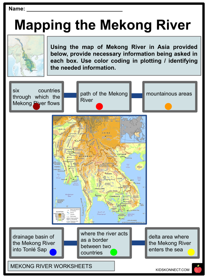
The Mekong River is identified as the longest river in Southeast Asia, the 7th longest in the whole of Asia, and the 12th longest river in the world. This river has about 2,700 miles (4,350 km). Approaching southeastern Qinghai province, China, it runs via the eastern part of the Yunnan province and Tibet Autonomous Region, after which it forms part of the international border between Thailand and Laos, as well as Myanmar (Burma) and Laos.
See the fact file below for more information on the Mekong River, or you can download our 28-page Mekong River worksheet pack to utilize within the classroom or home environment.
Key Facts & Information
Names
The Mekong River has many names, depending on the country.
- Vietnamese: ‘Big River’ or ‘Great River.’
- Kamui: ‘canal river.’
- In ancient times Khmuic people called it ‘giant canal river’ or ‘deep canal river’ respectively.
Course
- Its source is the Sanjiangyuan National Nature Reserve on the Tibetan Plateau, in the “three rivers source area.” The reserve protects the headwaters of the Yellow (Huang He), Yangtze, and Mekong Rivers, flowing from north to south through the Tibetan Autonomous Region, Yunnan Province, and the Three Parallel Rivers Area in the Hengduan Mountains, with the Yangtze to the east and the Salween River (Nu Jiang in Chinese) to the west.
- The Mekong then flows along the China-Myanmar border for about 10 kilometers (6.2 miles) until it approaches the tripoints of China, Myanmar, and Laos.
- It then flows southwest, forming the borders of Myanmar and Laos for about 100 kilometers (62 miles) until it reaches the tripoint of Myanmar, Laos, and Thailand.
- This is also where the Ruak River (which follows the Thai-Myanmar border) and the Mekong meet. The area of this tripoint is sometimes labeled the Golden Triangle. However, the name also refers to the much wider area of those three countries that were notorious as drug-producing regions.
- The Tonlé Sap river and lake system join the river on the right bank of Phnom Penh. When the Mekong is low, the Tonle Sap acts as a tributary, with water flowing from the lake and river into the Mekong. When the Mekong floods, the flow reverses: the Mekong floodwaters flow up the Tonle Sap.
PHYSICAL FEATURES
- More than 313,000 square miles (810,000 square km) of land are covered by the Mekong River, which runs from the Tibetan Plateau to the South China Sea. Among all rivers in the continent of Asia, only the Ganges and Yangtze have more significant minimum flows.
- The difference in physical conditions above and below the Mekong’s descent from the Yunnan highlands divides it into two major sections. The upper Mekong River flows 1,215 miles (1,955 kilometers) through a long, narrow valley that cuts through the mountains and plateaus of southwestern China.
- The Mekong River goes up in the Tibetan Plateau between the Salween and Yangtze rivers in its upper reaches; the streambed has severely cut into the rugged landscape through which it flows. The Mekong River drains approximately 8,000 square miles (21,000 square kilometers) of territory in Myanmar along its route between Myanmar and Laos. The Mekong stimulates cooperation and competition among Cambodia, Laos, Thailand, and Vietnam in its more gentle lower stretches, where it forms a significant portion of the border between Laos and Thailand.
DRAINAGE BASIN
- The Mekong Basin is divided into the “upper Mekong basin” in Tibet and the “lower Mekong basin” from Yunnan to the South China Sea. The most precipitous drop in the Mekong occurs in the upper Mekong basin, a 2,200-kilometer stretch from where it rises to its mouth (1,400 mi).
- It drops 4,500 meters (14,800 feet) here before entering the lower basin where the borders of Thailand, Laos, China, and Myanmar form the Golden Triangle.
- The river flows for another 2,600 km (1,600 mi) downstream from the Golden Triangle, through Laos, Thailand, and Cambodia, before entering the South China Sea via a complex delta system in Vietnam.
Upper Basin
- The upper basin accounts for 24% of the total area and 15-20% of the water flowing into the Mekong River. The catchment area is narrow and steep. Soil erosion has been a significant issue, with the upper basin accounting for approximately 50% of the sediment in the river.
- The river and its tributaries are confined by narrow, deep gorges in China’s Yunnan Province. In this part of the basin, the tributary river systems are small. Only 14 have catchment areas larger than 1,000 km2 (390 sq mi).
- Still, this region has experienced the most significant loss of forest cover per square kilometer in the entire river system due to unchecked demand for natural resources.
- The river changes in Simao and Xishuangbanna Prefectures as the valley opens up, the floodplain expands, and the river becomes more expansive and slower.
- Soils recover from shifting upland agriculture (slash and burn) in 10 to 20 years, but vegetation does not.
- Due to shifting and permanent agriculture, forest cover has been steadily reduced in the basin over the last three decades. The combined effects of these activities on the river regime have not been quantified. However, the hydrological impacts of land cover changes caused by the Vietnam War were quantified in two lower Mekong River basin sub-catchments.
Lower Basin
- In the lower basin, major tributary systems emerge. These systems are classified into two types: tributaries that contribute to significant wet season flows and tributaries that drain low-lying areas with lower rainfall.
- The lower Mekong basin almost surrounds Laos. The river’s hydrology is shaped primarily by its climate, landscape, and land use. Because of the mountainous terrain, only 16% of the country is farmed using lowland terraces or upland shifting cultivation.
- Soils recover from shifting upland agriculture (slash and burn) in 10 to 20 years, but vegetation does not.
- Due to shifting and permanent agriculture, forest cover has been steadily reduced in the basin over the last three decades. The combined effects of these activities on the river regime have not been quantified. However, the hydrological impacts of land cover changes caused by the Vietnam War were quantified in two lower Mekong River basin sub-catchments.
- Over 95% of the Mekong’s flows have joined the river as it enters Cambodia. From here on down, the terrain is flat, and water levels rather than flow volumes govern how water moves across the landscape.
- The seasonal cycle of changing water levels in Phnom Penh causes the Tonle Sap River to reverse its flow into and out of the Great Lake.
- Phnom Penh is the starting point for the Mekong River’s delta system. The mainstream begins to split into an increasing number of branches at this point.
- The Mekong delta in Vietnam is heavily farmed, with little natural vegetation remaining. There is less than 10% forest cover.
- Forest cover in Vietnam’s Central Highlands fell from over 95% in the 1950s to around 50% in the mid-1990s.
- The leading causes of land use and landscape change are agricultural expansion and population pressure. Drought and flooding are common hazards in the Delta, which many believe is the most vulnerable to upstream hydrological change.
GEOLOGY
- When compared to other significant rivers, the internal drainage patterns of the Mekong are peculiar. Dendritic tributary networks that resemble branching trees are present in the majority of big river systems that drain the interiors of continents, including the Amazon, Congo, and Mississippi.
- Such patterns typically emerge in basins with gentle slopes where the underlying geological structure is relatively homogeneous and stable, exerting little or no control over river morphology.
- In contrast, the Salween, Yangtze, and especially the Mekong tributary networks are complex, with different sub-basins frequently exhibiting distinct drainage patterns.
- These intricate drainage systems evolved in an environment where the underlying geological structure is heterogeneous and active. It is the primary factor controlling the course of rivers and the landscapes they carve out.
- The tertiary elevation of the Tibetan Plateau played an essential role in the formation of the southwest monsoon, the dominant climatic control influencing the hydrology of the Mekong Basin.
- Understanding the nature and timing of Tibet’s (and Vietnam’s Central Highlands’) elevation helps explain the provenance of sediment reaching the delta and Tonle Sap Great Lake today.
- Because much of the Mekong basin is underlain by a relatively stable continental block, it is not usually considered a seismically active area.
- Nonetheless, earthquakes and tremors are common in northern Laos, northern Thailand, Myanmar, and China parts of the basin.
- These earthquakes rarely exceed 6.5 on the Richter scale and are unlikely to cause significant damage.
HISTORY
- Due to the difficulty of exploring the river, it has divided rather than united the people who live nearby. The first known settlements date back to 210 BCE, with Ban Chiang serving as a prime example of early Iron Age culture.
- The Funan Indianised-Khmer culture of the Mekong delta was the first recorded civilization. Coins from the Roman Empire were discovered during excavations at Oc Eo, near modern An Giang.
- Around the 5th century, the Khmer culture Chenla state took over. The Khmer empire of Angkor was the region’s last great Indianized state.
- Around the time of the fall of the Khmer empire, the Mekong served as the front line between the newly developing states of Siam and Tonkin (North Vietnam), with Laos and Cambodia, then on the coast, split between their influence.
- António de Faria of Portugal was the first European to encounter the Mekong in 1540.
- The Dutchman Gerrit van Wuysthoff launched an expedition up the river as far as Vientiane in 1641–1642, while the Spanish and Portuguese organized missionary and trading operations.
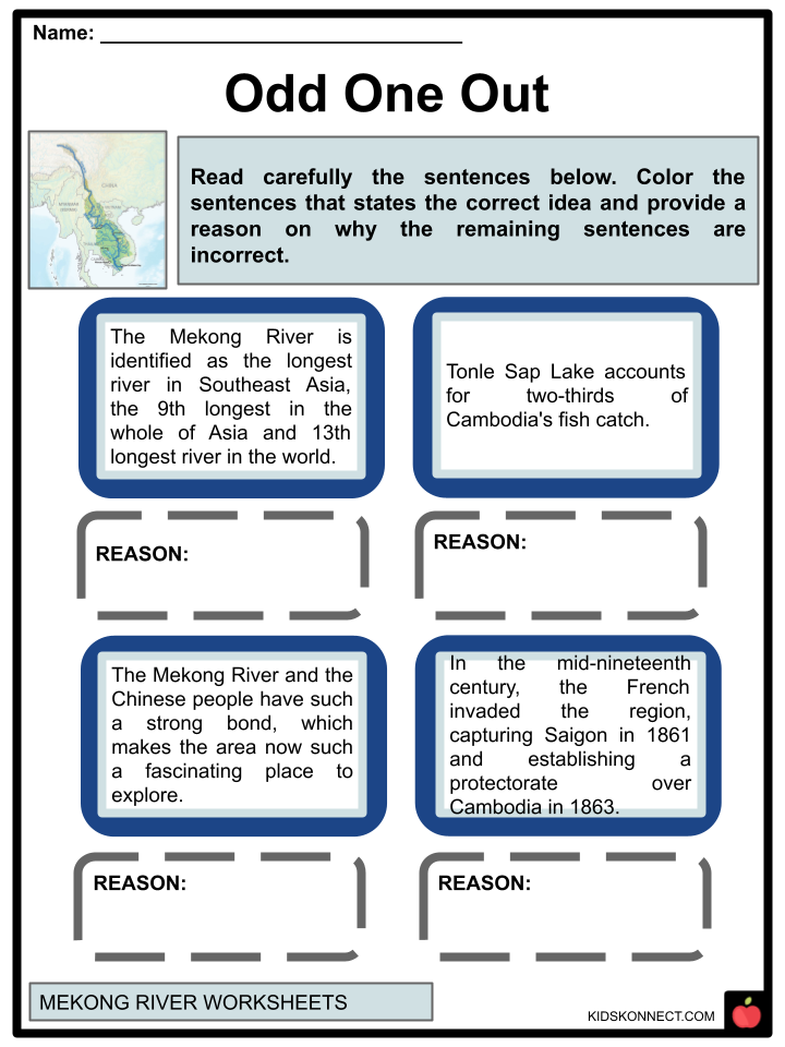
- In the mid-nineteenth century, the French invaded the region, capturing Saigon in 1861 and establishing a protectorate over Cambodia in 1863.
- Between 1866 and 1868, the Ernest Doudard de Lagrée and Francis Garnier-led French Mekong Expedition ascended the river from its mouth to Yunnan. This was the first comprehensive European exploration.
- The mighty Mekong River played an essential role in the rise and fall of the Khmer Empire.
- This river artery is the world’s 12th longest and Asia’s 7th largest. There are six countries between its source on the Tibetan Plateau and its mouth in the South China Sea, including the modern nations of Cambodia and Vietnam. In the first century CE, Khmer ancestors established the kingdom of Funan on its banks, with the Mekong Delta as its heartland.
- Fast forward a few centuries to 802 CE, when a man named Jayavarman II established the Khmer Empire.
He settled further north, near the great Tonle Sap lake, after conquering and uniting a series of smaller kingdoms. He declared himself not just a leader, but a ‘chakravartin,’ or ‘god-king,’ bestowing political and religious authority on himself and his successors. The capital he established was the city of Angkor, which grew rapidly into the most significant urban structure of the pre-industrial world, ushering in the Angkor Period.
Hydrological Heritage
- The Mekong River and the Khmer people have such a strong bond, which makes the area now such a fascinating place to explore.
- The stories of this advanced society, which relied heavily on the river for all aspects of life, can still be seen carved into temple walls and stamped into the physical landscape.
- The Khmer Empire permanently altered the region’s natural hydrology and catchment areas, and the sophisticated irrigation system of Angkor was unprecedented.
NATURAL HISTORY
- In the Mekong, new species are regularly found. In 2009, scientists described 145 previously unknown species from the region, including 29 fish species, two bird species, ten reptiles, five mammals, 96 plants, and six amphibians.
- Between 1997 and 2015, the region discovered two new species per week on average. The Mekong Region has the highest concentration of WWF Global 200 ecoregions in mainland Asia, with 16 WWF Global 200.
- No other river has as many species of large fish. The largest include three species of Probarbus barbs, which can grow to a length of 1.5 meters (5 feet) and weigh up to 70 kilograms (150 pounds), the giant freshwater stingray (Himantura polylepis, also known as H. Chao Phraya), which can grow to a minimum length of 5 meters (16 feet), a maximum width of 1.9 meters (6 feet 3 inches), and the giant pangasius (Pangasius sanitwongsei) (Pangasianodon gigas).
- The last three can reach 3 m (10 ft) in length and weigh 300 kg (660 lb). Dams, flood control, and overfishing have all significantly reduced these populations.
- The endangered Siamese crocodile (Crocodylus siamensis) lives in small isolated pockets along the Mekong River in northern Cambodia and Laos.
- Crocodylus porosus, a saltwater crocodile, used to wander from the Mekong Delta up the river into Tonle Sap and beyond. However, it is currently extinct in the river, as well as probably in Vietnam and Cambodia.
ENVIRONMENTAL ISSUES
- Due to the cumulative effects of climate change, an increase in upstream dams, and other artificial activities, including deforestation, sand mining, intensive irrigation for agriculture, and wetland conversion, the Mekong River ecosystem is on the edge of irreversible collapse.
- The Mekong River’s changing hydrological conditions, including unpredictable droughts, floods and reduced river sediments, have wreaked havoc on agricultural production and inland fishery. Tonle Sap Lake accounts for two-thirds of Cambodia’s fish catch, the primary protein source for the country’s population.
- What is the connection between Vietnamese farmers in the Mekong Delta who are giving up rice farming to move to Ho Chi Minh City, the nation’s economic center, in search of a better life, urban farmers in Phnom Penh who are observing a drastic reduction in lake and wetland areas, and Cambodian sand dredgers along the banks of the Mekong River?
- Or between Laotian miners in Xaysomboun Province, near Vientiane, and peasant farmers in northern Thailand’s mountainous provinces, who are increasingly reliant on expanding corn monoculture in the hands of multinational corporations?
Mekong River Worksheets
This fantastic bundle includes everything you need to know about the Mekong River across 28 in-depth pages. These ready-to-use worksheets are perfect for teaching kids about the Mekong River, identified as the longest river in Southeast Asia, the 7th longest in the whole of Asia, and the 12th longest river in the world.
Complete List of Included Worksheets
Below is a list of all the worksheets included in this document.
- Mekong River Facts
- Mekong River
- Odd One Out
- First Word
- Mapping the Mekong River
- Activities in Mekong River
- Effects of Damming
- Protect Mekong
- Let’s Visit Mekong
- Relevance of Mekong River
- Mekong in News
Frequently Asked Questions
What is the Mekong River known for?
Spanning almost 3,000 miles from the Tibetan plateau to the South China Sea, the Mekong River is home to one of the world’s most amazing inland fisheries. Indeed, it is responsible for up to 25 percent of all freshwater catches worldwide and provides sustenance and employment opportunities for around tens-of-millions people.
Why is the Mekong River called the mother of all rivers?
The Mekong River is aptly named the “Mother of Waters” due to its extraordinary importance in sustaining people’s lives throughout six countries. Boasting an estimated 60 million users, it offers food and revenue for many individuals while also functioning as a shipping avenue facilitating transportation. With such vital significance, there is no denying why it has been forever regarded as one of the world’s most influential rivers.
How dirty is the Mekong River?
The Mekong is one of the most contaminated rivers on our planet, with an estimated 40 thousand tonnes of plastic discharged into oceans yearly.
Link/cite this page
If you reference any of the content on this page on your own website, please use the code below to cite this page as the original source.
Link will appear as Mekong River Facts & Worksheets: https://kidskonnect.com - KidsKonnect, December 28, 2022
Use With Any Curriculum
These worksheets have been specifically designed for use with any international curriculum. You can use these worksheets as-is, or edit them using Google Slides to make them more specific to your own student ability levels and curriculum standards.


