Premium
 Download
Edit
Download
Edit
Download the Prime Meridian Facts & Worksheets
Click the button below to get instant access to these worksheets for use in the classroom or at a home.
Download This Worksheet
This download is exclusively for KidsKonnect Premium members!
To download this worksheet, click the button below to signup (it only takes a minute) and you'll be brought right back to this page to start the download!
Sign Me Up
Edit This Worksheet
Editing resources is available exclusively for KidsKonnect Premium members.
To edit this worksheet, click the button below to signup (it only takes a minute) and you'll be brought right back to this page to start editing!
Sign Up
Not ready to purchase a subscription? Click to download the free sample version Download sample
Download This Sample
This sample is exclusively for KidsKonnect members!
To download this worksheet, click the button below to signup for free (it only takes a minute) and you'll be brought right back to this page to start the download!
Sign Me Up
Table of Contents
The starting point for measuring east and west distances around Earth is the prime meridian, the 0° longitude line. Historically, various standards have been used or supported for Earth’s prime meridian. The IERS Reference Meridian is the Earth’s current worldwide standard prime meridian, and it is derived from but differs somewhat from the former standard, the Greenwich Meridian.
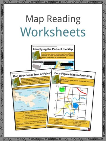
See the fact file below for more information about Prime Merdian, or download the comprehensive worksheet pack, which contains over 11 worksheets and can be used in the classroom or homeschooling environments.
Key Facts & Information
OVERVIEW
- In contrast to an equator, defined by the axis of rotation, a prime meridian for a planetary body that is not tidally locked (or at least not in synchronous rotation) is wholly arbitrary.
- However, for astronomical bodies that are tidally locked (more precisely, synchronous), prime meridians are decided by the face of the orbit that is constantly inward (a planet facing its star or a moon facing its world), much as equators are determined by rotation.
- The Earth’s and moon’s longitudes are calculated east and west from their prime meridian (at 0°). Longitude is measured from 0° (the prime meridian) to 360° for all other Solar System planets.
- West longitudes are employed when a body’s rotation is prograde (or ‘direct,’ like Earth), which means that its rotational movement is the same as its orbital direction. If the orbit is retrograde, east longitudes are utilized.
INTERNATIONAL PRIME MERIDIAN
- The prime meridian is random, which means it might be anywhere. The 0° longitude line can be any line of longitude (a meridian). However, there is an international consensus that the Greenwich Meridian in England is the official prime meridian.
- Governments did not always agree on the Greenwich meridian as the prime meridian, making long-distance navigation problematic. Countries released longitude maps and charts based on the meridian flowing through their capital city.
- France issued maps with a line of 0° longitude going through Paris, and China‘s cartographers gave maps with 0° longitude going through Beijing. They published even materials depending on local meridians in various sections of the same nation.
- Finally, the United States called a worldwide convention. In 1884, President Chester Arthur convened officials from 25 countries to choose a single standard meridian.
- They picked the meridian that runs through Greenwich, England’s Royal Observatory, and the Greenwich Meridian became the international prime meridian standard.
PRIME MERIDIAN AT GREENWICH
- The Greenwich Meridian was chosen as the common zero of longitude and standard of time worldwide by delegates (forty-one delegates from twenty-five nations) to the International Meridian Conference hosted in Washington, D.C., United States, in October 1884.
- Sir George Airy established the historic prime meridian, headquartered at the Royal Observatory in Greenwich, in 1851. It had been characterized by the position of the Airy Transit Circle from his initial observation.
- Before time, it was determined by a series of older transit devices, the first of which was obtained by Edmond Halley, the second Astronomer Royal, in 1721. It was installed in the Observatory’s extreme northwest corner, between Flamsteed House and the Western Summer House.
- The location, which is now part of Flamsteed House, is about 43 meters west of the Airy Transit Circle, or about 2 seconds in longitude. At the 1884 International Meridian Conference, Airy’s transit circle was recognized in principle (with French delegates who pushed for the approval of the Paris meridian abstaining) as the Prime Meridian of the globe.
- All of these Greenwich meridians were discovered by making an astronomical observation from the Earth’s surface and orienting a plumb line along the direction of gravity at the surface.
- This astronomical Greenwich meridian was transmitted worldwide, first using the lunar distance technique. Through chronometers carried on ships, then through telegraph lines carried by undersea communications cables, and finally through radio time signals.
- Using these methodologies, the North American Datum 1927, or NAD27, an ellipsoid whose surface best fits the average sea level in the United States, was one distant longitude finally constructed on the Greenwich meridian.
IERS REFERENCE MERIDIAN
- Beginning in 1973, the International Time Bureau, and later the International Earth Rotation and Reference Systems Service, moved away from optical devices like the Airy Transit Circle and toward methods like moon laser ranging, satellite laser ranging, and very-long-baseline interferometry.
- The new methodologies resulted in the IERS Reference Meridian, whose plane crosses through the Earth’s center of mass. On the other hand, the plane created by the Airy transit is impacted by vertical deflection (the local vertical is affected by influences such as nearby mountains).
- Because of the shift from utilizing the local vertical to a meridian centered on the center of the Earth, the contemporary prime meridian is 5.3′′ east of the astronomic Greenwich prime meridian through the Airy Transit Circle. It equates to 102 meters at Greenwich’s latitude.
- The Bureau International de l’Heure (BIH) formally acknowledged this in 1984 through its BTS84 (BIH Terrestrial System), which eventually became WGS84 (World Geodetic System 1984) and the numerous International Terrestrial Reference Frames (ITRFs).
- Since 1984, the line of 0° longitude over the Earth’s surface has gently migrated toward the west from this changed location by a few millimeters; that is, toward the Airy Transit Circle or the Airy Transit Circle has shifted toward the east, relying on your point of view.
- It became feasible to produce a more precise and detailed world map with the arrival of satellite technology. With these advancements came the need to establish a reference meridian that, although derived from the Airy Transit Circle, would also account for the impact of the movement of tectonic plates and differences in how the Earth spun.
- As an outcome, the International Earth Rotation and Reference Systems Service, which specifies and maintains the relationship between longitude and time, developed the IERS Reference Meridian, generally used to indicate the Earth’s prime meridian (0° longitude).
- Airy’s transit circle wanders northeast at around 2.5 cm each year relative to this Earth-centered 0° longitude, based on observations of satellites and celestial compact radio emitters (quasars) from numerous coordinated sites worldwide.
- It is also the reference meridian for the Global Positioning System of the United States Department of Defense, as well as WGS84 and its two formal variations, the ideal International Terrestrial Reference System (ITRS) and its implementation, the International Terrestrial Reference Frame (ITRF). The International Date Line on Earth is based on the longitude 180° opposite the IRM.
UTC
- The prime meridian is also responsible for Coordinated Universal Time (UTC).
- UTC never changes for daylight savings time or any other reason. UTC is the standard for the time, just as the prime meridian is the standard for longitude. All nations and regions base their time zones on UTC.
- The world is divided into 24 time zones. Suppose an event occurs at 11:00 a.m. in Houston, Texas, USA. 4:00 p.m. in Orlando, Florida, United States, 9:00 p.m. in Morocco, 6:00 a.m. in Kolkata, India, Honolulu, Hawaii, USA. The event took place at 4:00 p.m. UTC.
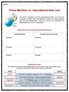
- The prime meridian also aids in the establishment of the International Date Line. Because the Earth’s longitude is 360°, the 180° longitude line is the midway point from the prime meridian.
- The International Date Line is known as the meridian at 180° longitude. As you cross the International Date Line, you either add (going west) or remove (going east) (going east.)
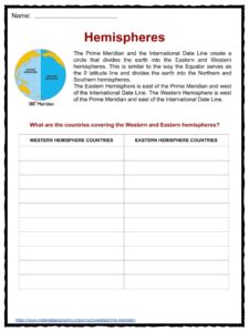
HEMISPHERES
- The International Date Line and the Prime Meridian form a circle that divides the Earth into the Eastern and Western Hemispheres. It is analogous to how the Equator acts as the 0° latitude line and divides the Earth into northern and southern hemispheres.
- The west of the International Date Line; east of the prime meridian is the Eastern Hemisphere. The Eastern Hemisphere is home to most of the Earth’s landmasses, including all of Asia, Australia, and most of Africa.
- The Western Hemisphere is located west of the prime meridian and east of the International Date Line. The Americas, the western area of the British Isles (including Ireland and Wales), and the northwestern region of Africa are all part of the Western Hemisphere.
LASER MERIDIANS
- The prime meridian is now defined by a laser beam pointing north from the Royal Observatory in Greenwich, England.
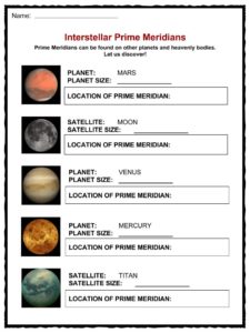
PLANETARY PRIME MERIDIANS
- Not only does the Earth have a prime meridian.
- Scientists use craters and other geographical features to indicate prime meridians on other planets and celestial bodies.
- The prime meridian of Mars runs via the Airy-0 crater. The Earth’s moon’s prime meridian is near the Bruce crater.
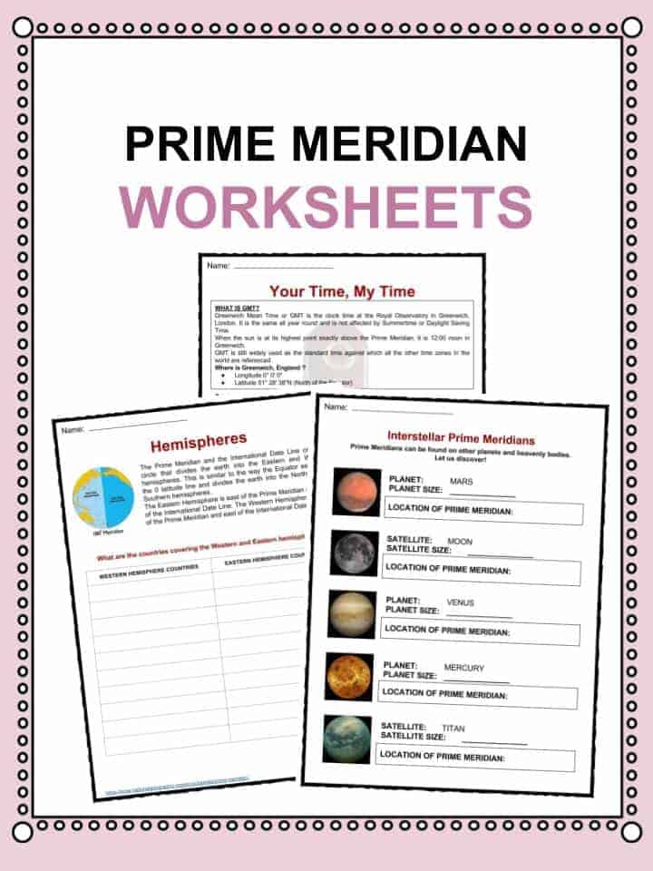
Prime Meridian Worksheets
This bundle contains 11 ready-to-use Prime Meridian Worksheets that are perfect for students who want to learn more about Prime Meridian, which is an imaginary line around the globe connecting equal longitude points (a coordinate that specifies the east/west position of a location on the Earth’s surface). The prime meridian is a line of geographical longitude that is defined at 0°.

Download includes the following worksheets:
- Prime Meridian Facts
- Is the Prime Meridian Permanent?
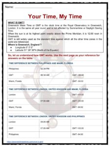
- Your time, my time
- Hemispheres
- Prime Meridian vs. International Date Line
- Interstellar Prime Meridians
- Word Building
Frequently Asked Questions
What is a prime meridian?
The beginning point for measuring east and west distances around Earth is the prime meridian, the 0° longitude line.
Can the prime meridian be located anywhere else?
The prime meridian is random, which means it might be anywhere. The 0° longitude line can be any line of longitude (a meridian).
Where is the international prime meridian located?
There is an international consensus that the Greenwich Meridian in England is the official prime meridian.
How does the prime meridian affect time?
The prime meridian is also responsible for Coordinated Universal Time (UTC). UTC never changes for daylight savings time or any other reason, and all nations and regions base their time on UTC.
Is the earth the only planet with a prime meridian?
Not only does the Earth have a prime meridian, and the prime meridian of Mars runs via the Airy-0 crater. The Earth’s moon’s prime meridian is near the Bruce crater.
Link/cite this page
If you reference any of the content on this page on your own website, please use the code below to cite this page as the original source.
Link will appear as Prime Meridian Facts & Worksheets: https://kidskonnect.com - KidsKonnect, July 17, 2017
Use With Any Curriculum
These worksheets have been specifically designed for use with any international curriculum. You can use these worksheets as-is, or edit them using Google Slides to make them more specific to your own student ability levels and curriculum standards.