Download the The State Of West Virginia Facts & Worksheets
Click the button below to get instant access to these worksheets for use in the classroom or at a home.
Download This Worksheet
This download is exclusively for KidsKonnect Premium members!
To download this worksheet, click the button below to signup (it only takes a minute) and you'll be brought right back to this page to start the download!
Sign Me Up
Edit This Worksheet
Editing resources is available exclusively for KidsKonnect Premium members.
To edit this worksheet, click the button below to signup (it only takes a minute) and you'll be brought right back to this page to start editing!
Sign Up
Download This Sample
This sample is exclusively for KidsKonnect members!
To download this worksheet, click the button below to signup for free (it only takes a minute) and you'll be brought right back to this page to start the download!
Sign Me Up
West Virginia is a state located in the Appalachian region of the Southern United States. It is bordered by Virginia to the southeast, Kentucky to the southwest, Ohio to the northwest, Pennsylvania to the north, and Maryland to the northeast. See the fact file below for more information about the state of West Virginia or download the comprehensive worksheet pack which can be utilised within the classroom or home environment.
Capital
Charleston
Became a State
June 20, 1863 (35th)
Location
Appalachia/southern United States
Area
24,230 sq. miles (41st)
Population
1,859,815 (37th)
Major Cities
Charleston, Huntington, Parkersburg, Wheeling, Morgantown
Products
livestock, coal, oil drilling, farming (on a limited basis because of the mountainous terrain over much of the state
Climate
humid subtropical climate in lower elevations of the extreme southwestern part of the state, with hot, humid summers and cold winters – the rest of the state has a humid continental climate with warm to hot, humid summers and cold winters
Yearly Precipitation
averages 41 inches
Professional Sports Teams
no professional sports teams
Major Waterways
Guyandotte River, Greenbrier River, Ohio River
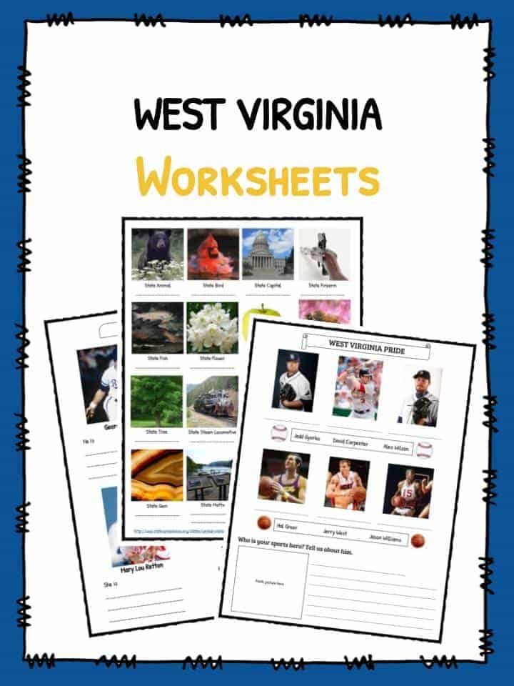
Most Famous Citizens
Pearl S. Buck (author)
George Brett (baseball player)
Stonewall Jackson (Confederate general)
Mary Lou Retton (gymnast)
Chuck Yeager (test pilot)
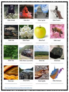
State Symbols
Bird – Cardinal
Flower – Rhododendron
Animal – Black Bear
Tree – Sugar Maple
Insect – Monarch Butterfly
West Virginia Worksheets
This bundle contains 8 ready-to-use West Virginia Worksheets that are perfect for students who want to learn more about West Virginia which is a state located in the Appalachian region of the Southern United States. It is bordered by Virginia to the southeast, Kentucky to the southwest, Ohio to the northwest, Pennsylvania to the north, and Maryland to the northeast.


Download includes the following worksheets:
- Take me Home, Country Roads
- Pearl S. Buck
- Famous WV Citizens
- State Symbols
- West Virginia Pride
- Multiple Choice
- Key Answers
Link/cite this page
If you reference any of the content on this page on your own website, please use the code below to cite this page as the original source.
Link will appear as The State Of West Virginia Facts & Worksheets: https://kidskonnect.com - KidsKonnect, March 1, 2017
Use With Any Curriculum
These worksheets have been specifically designed for use with any international curriculum. You can use these worksheets as-is, or edit them using Google Slides to make them more specific to your own student ability levels and curriculum standards.