Premium
 Download
Edit
Download
Edit
Download the Bering Land Bridge Theory Facts & Worksheets
Click the button below to get instant access to these worksheets for use in the classroom or at a home.
Download This Worksheet
This download is exclusively for KidsKonnect Premium members!
To download this worksheet, click the button below to signup (it only takes a minute) and you'll be brought right back to this page to start the download!
Sign Me Up
Edit This Worksheet
Editing resources is available exclusively for KidsKonnect Premium members.
To edit this worksheet, click the button below to signup (it only takes a minute) and you'll be brought right back to this page to start editing!
Sign Up
Not ready to purchase a subscription? Click to download the free sample version Download sample
Download This Sample
This sample is exclusively for KidsKonnect members!
To download this worksheet, click the button below to signup for free (it only takes a minute) and you'll be brought right back to this page to start the download!
Sign Me Up
Table of Contents
The Bering Land Bridge Theory states that a broad plain of land named Beringia emerged in the Ice Age after the lowering of sea levels that connect Asia and North America, causing migration and life to find their way between two continents, which are discovered and studied in recent archaeological and scientific studies.
See the fact file below for more information about the Bering Land Bridge Theory, or you can download our 28-page Bering Land Bridge Theory worksheet pack to utilize within the classroom or home environment.
Key Facts & Information
CHARACTERISTICS OF BERINGIA
- Beringia is a land area connected by the Lena River in Russia and the Mackenzie River in Canada that appeared as sea levels changed during the Ice Age. The land bridge extends up to 1,600,000 square kilometers in area.
- The name “Beringia” was coined in 1937 by botanist Eric Hultén through the name of explorer Vitus Bering.
LAND BRIDGES
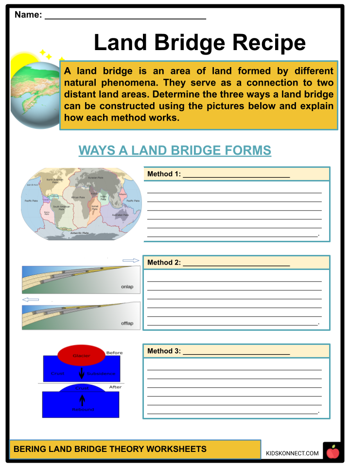
- A land bridge is an area of land that connects two separate land areas, allowing lifeforms from one location to cross/ migrate and colonize another area.
- Land bridges form by the following methods: marine regression, plate tectonics, or due to the rising seafloor in the Ice Age.
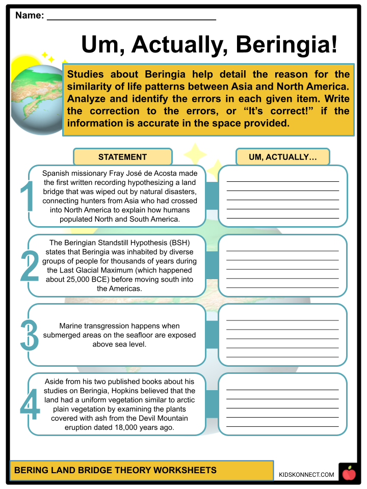
- Marine regression happens when submerged areas on the seafloor become exposed above sea level. It is the opposite of marine transgression.
- Plate tectonics is a theory stating that the Earth’s lithosphere comprises large tectonic plates that have been moving apart since 3.4 billion years ago. This theory is based on the concept of continental drift, with the validation of seafloor spreading.
- The rising of the seafloor was caused by the rise of land masses when the vast weight of ice sheets gradually decreased during the Ice Age. This is called the post-glacial rebound.
- Aside from the Bering Land Bridge, here are some other examples of land bridges:
- Adam’s Bridge, also known as Rama Setu, is a land bridge connecting India and Sri Lanka;
- Bassian Plain or Bass Strait links the country Australia and its island state Tasmania;
- De Geer Land Bridge connects Fennoscandia to northern Greenland;
- Doggerland connects the island of Great Britain to Europe. It later became submerged from the rise of sea level by around 6500 BCE.
- The Sinai Peninsula, also known as Sinai, connects Africa and Eurasia.
GENERAL INFORMATION ON LAND BRIDGE THEORIES
- Scientists, as early as the 19th century, had started noticing significant patterns of signs of life (botanical, geological, and zoological) that are found in distant areas of land. This has led to theories about different land bridges between these outlying areas to actualize a conclusion on these widely recognized discoveries hypothetically.
- Apart from land bridges, the continental drift theory is also used to explain these similar patterns of life in separate areas.
- The continental drift theory was not accepted as an explanation until the emergence of the study of plate tectonics in the early 1960s.
HISTORY AND DISCOVERIES OF BERINGIA
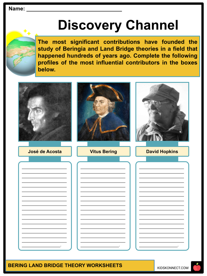
- Spanish missionary Fray José de Acosta made the first written recording hypothesizing that a land bridge still existing in his time connected hunters from Asia who had crossed into North America to explain how humans populated North and South America.
- Russian Czar Peter the Great led an expedition to explore the eastern borders of the Russian Empire with Danish explorer Vitus Bering to head the exploration of the Bering Strait region. During the two voyages of exploration by Bering in 1724 and 1741, he recorded that land and people had traveled across the Bering Strait thousands of years ago.
- Captain James Cook discovered and created detailed records of Alaska, which helped to explain the Bering Strait region and provided a great source of information on the Bering land bridge theory.
- David Hopkins, an Arctic geologist, was known for his significant contributions to the study of the Bering land bridge, which contained the following books showcasing his expertise in many branches of science:
- “The Bering Land Bridge” was published in 1967, establishing the existence of Beringia.
- “The Paleoecology of Beringia” was published in 1982.
- Hopkins believed that the land had a more diverse vegetation by examining the plants covered with ash from the Devil Mountain eruption dated 18,000 years ago.
RESEARCH STUDIES ON THE FIRST AMERICANS
- In 2013, archaeologists uncovered the remains of two newborns where one of their genes and genetic code helped to analyze how the first people migrated and traveled to America. Then, they led to the rise of different theories about their migration into the country.
- Most of the theories agree with the existence of Beringia, but their approaches to their migration differ in raised assumptions.
- USR1 refers to the name used to describe the genetic code of the 6-week-old baby uncovered by archaeologists. Their genome analysis has suggested evidence of Ancient Beringians during the migration. This group of inhabitants was different compared to Northern and Southern Native American groups.
- Theories suggesting the isolation of first Americans into Beringia during the Ice Age hypothesized that mutations in their DNAs are developed from reproduction, thus creating genetic diversity among the population.
- Archaeological finds relating to the tools and art that the first Americans used help us understand how they adapted to the changing living conditions and resources brought by the Ice Age. The skills and technology that these Native groups were able to help them survive in Alaska.
- Genetic diversity refers to the range of different inherited traits within a species. High genetic diversity will lead to many individuals with a broad inherited trait scope.
- Genetic diversity can also help to strengthen the ability of a species to resist diseases and changes in climate, along with other stresses experienced in the area.
MIGRATION AND LIFE IN BERINGIA
- Beringia includes the Chukchi Sea, Bering Sea, Bering Strait, and the Chukchi and Kamchatka Peninsulas, as well as Alaska and Yukon. It was essential to the travel of life between Asia and North America as plants, animals, and people migrated from one continent to another.
- Examining the DNA of Paleo-Americans with the DNA of Paleo-Siberians shows that the first ancestors of the Americas left Siberia between 24,000 and 21,000 years ago.
- Researchers are not sure of the specific time of migration that happened between the first Americas. The Beringian Standstill Hypothesis (BSH) states that Beringia was inhabited by diverse groups of people for thousands of years during the Last Glacial Maximum (which happened about 25,000 BCE) before moving south into the Americas. In addition, it is said that a different population that once settled in Beringia separated from their Eurasian ancestors regarding their genes and culture.
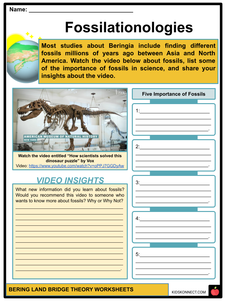
- Other significant evidence of life exists, such as fossils from dinosaurs, primates, and plants between North America and Asia around 55.8 million years ago.
- The Bering Land Bridge National Preserve was established in 1978 as a national monument and national preserve in 1980 to protect the area significant to the Land Bridge theory.
Bering Land Bridge Theory Worksheets
This fantastic bundle includes everything you need to know about the Bering Land Bridge Theory across 28 in-depth pages. These ready-to-use worksheets are perfect for teaching kids about the Bering Land Bridge Theory. The Bering Land Bridge theory states that a broad plain of land named Beringia emerged in the Ice Age after the lowering of sea levels that connect Asia and North America, causing migration and life to find their way between two continents, which are discovered and studied in recent archaeological and scientific studies.

Complete List of Included Worksheets
Below is a list of all the worksheets included in this document.
- Bering and Land Bridge Theory Facts
- Best of Beringia
- Bridge/Troubled Info
- Land Bridge Recipe
- Discovery Channel
- Um, Actually, Beringia!
- Bingo Beringia!
- Fossilationologies
- Reaction Time: Beringia
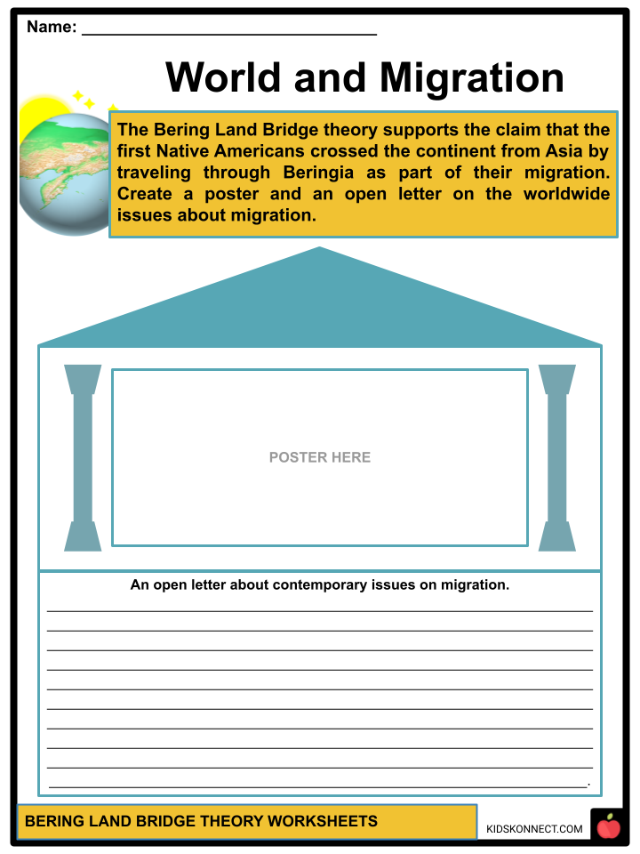
- World and Migration
- Comicality
Frequently Asked Questions
What is the Bering Land Bridge Theory?
The Bering Land Bridge Theory, also known as Beringia, is a hypothesis that explains how humans and large mammals migrated from Asia to the Americas during the last Ice Age. It suggests that a land bridge, exposed due to lowered sea levels, connected Siberia (Russia) and Alaska (USA) across the Bering Strait, allowing for the movement of people and animals.
When did the Bering Land Bridge exist?
The Bering Land Bridge is believed to have existed during periods of lower sea levels, particularly during the Pleistocene epoch, which spanned from about 2.6 million years ago to around 11,700 years ago. The most significant exposure of the land bridge occurred during the Last Glacial Maximum, around 18,000 to 21,000 years ago.
How did the Bering Land Bridge Theory impact human migration?
The Bering Land Bridge played a crucial role in human migration from Asia to the Americas. It provided a relatively ice-free and habitable corridor through which early human populations, often referred to as the First Americans, crossed into North America. These migrations led to the peopling of the Americas and the development of various indigenous cultures.
What archaeological evidence supports the Bering Land Bridge Theory?
Archaeological evidence supporting the theory includes the discovery of ancient tools, such as Clovis points, and remains of early human settlements in North and South America, which are dated to a period when the land bridge was accessible. Genetic studies of indigenous populations also provide genetic links between Native Americans and Asian populations.
How did the Bering Land Bridge disappear, leading to the separation of the Americas from Asia?
The Bering Land Bridge gradually disappeared as the Earth’s climate warmed and the last Ice Age came to an end. Rising sea levels caused the land bridge to submerge, eventually separating the Americas from Asia. The process was influenced by natural climatic changes and glacial retreat, which transformed the landscape and created the Bering Strait as we know it today.
Link/cite this page
If you reference any of the content on this page on your own website, please use the code below to cite this page as the original source.
Link will appear as Bering Land Bridge Theory Facts & Worksheets: https://kidskonnect.com - KidsKonnect, November 29, 2023
Use With Any Curriculum
These worksheets have been specifically designed for use with any international curriculum. You can use these worksheets as-is, or edit them using Google Slides to make them more specific to your own student ability levels and curriculum standards.