Premium
 Download
Edit
Download
Edit
Download the Cartography Facts & Worksheets
Click the button below to get instant access to these worksheets for use in the classroom or at a home.
Download This Worksheet
This download is exclusively for KidsKonnect Premium members!
To download this worksheet, click the button below to signup (it only takes a minute) and you'll be brought right back to this page to start the download!
Sign Me Up
Edit This Worksheet
Editing resources is available exclusively for KidsKonnect Premium members.
To edit this worksheet, click the button below to signup (it only takes a minute) and you'll be brought right back to this page to start editing!
Sign Up
Not ready to purchase a subscription? Click to download the free sample version Download sample
Download This Sample
This sample is exclusively for KidsKonnect members!
To download this worksheet, click the button below to signup for free (it only takes a minute) and you'll be brought right back to this page to start the download!
Sign Me Up
Table of Contents
Cartography is the process of making maps. It’s about creating pictures that show places like cities, mountains, and rivers. Cartographers use different tools to gather information and draw maps accurately. Maps help us find our way, understand the world around us, and make decisions about where things should go.
See the fact file below for more information about Cartography, or you can download our 28-page Cartography worksheet pack to utilize within the classroom or home environment.
Key Facts & Information
FACTS
- Greek philosopher Crates of Mallus created the earliest surviving globe in the 2nd century BCE. It was made of wood and depicted the Earth as a sphere.
- Portolan charts, used by European sailors from the 13th to the 16th centuries, were remarkably accurate for their time. They depicted coastlines, harbors, and maritime routes with great precision.
- The Fra Mauro Map was created in 1450 by the Venetian monk Fra Mauro; this map was one of the most detailed and accurate representations of the world.
- The first modern atlas, containing a collection of maps organized by geography, was published by Abraham Ortelius in 1570. It was titled “Theatrum Orbis Terrarum” (Theatre of the World).
- The advent of the Global Positioning System (GPS) in the late 20th century revolutionized navigation and mapping. It allows accurate positioning and mapping using satellites orbiting the Earth.
- In 2005, Google Maps transformed how people navigate and explore the world. It provides detailed maps, satellite imagery, street views, and real-time traffic information accessible to anyone with an internet connection.
HISTORY
- Significant events in the history of cartography have shaped the way we understand and represent the world. Here are some significant milestones:
- Early Maps. Cartography has ancient roots, with early humans creating rudimentary maps on cave walls depicting hunting grounds, water sources, and natural features. These early maps provided essential spatial knowledge for survival and navigation.
- Babylonian Clay Tablets (circa 6th century BCE). Babylonian clay tablets contain some of the earliest surviving maps, including land surveys and city plans, demonstrating early cartographic techniques and geography knowledge. The oldest known map is the “Imago Mundi,” dating back to around 600 BCE.
- Ptolemy’s “Geographia” (circa 2nd century CE). Claudius Ptolemy’s “Geographia” compiled geographical knowledge of the ancient world, including latitude and longitude coordinates and methods for projecting the Earth onto maps, laying the foundations for modern cartography.
- Age of Exploration (15th–17th centuries). During the Age of Exploration, European explorers like Christopher Columbus, Ferdinand Magellan, and James Cook conducted voyages of discovery, resulting in the mapping of new lands and the expansion of geographical knowledge.
- Mercator Projection (1569). Gerardus Mercator’s development of the Mercator projection revolutionized navigation by preserving direction, enabling accurate plotting of courses for long-distance sea travel.
- Ordnance Survey: The 19th century saw the establishment of national mapping agencies, such as the Ordnance Survey in the United Kingdom and the United States Geological Survey (USGS). These agencies conducted systematic surveys and created detailed topographic maps of entire countries, providing valuable information for military, administrative, and civilian purposes.
- Digital Cartography/ The advent of computers and Geographic Information Systems (GIS) in the 20th century revolutionized mapmaking. GIS technology enabled the creation, analysis, and visualization of spatial data with unprecedented
- OpenStreetMap. OpenStreetMap (OSM), founded in 2004, is a collaborative mapping project that enables volunteers worldwide to contribute geographic data and create accessible, editable maps of the world. OSM democratizes mapmaking by providing open-access mapping data for diverse applications, including humanitarian relief efforts, urban planning, and navigation tools.
KINDS OF MAP
- Political maps show political boundaries, such as countries, states, provinces, and cities. They often use different colors or patterns to distinguish between countries or administrative divisions.
- Physical maps depict natural features of the Earth’s surface, such as mountains, rivers, lakes, and deserts. They use contour lines, shading, and color variations to represent elevation and terrain features.
- Topographic maps provide detailed information about the terrain, including elevation contours, hills, valleys, and other physical features. They are commonly used for outdoor activities like hiking, camping, and surveying.
- Historical Maps: Historical maps depict geographical features and political boundaries from different periods in history.
- Thematic maps focus on specific themes or topics, such as population density, climate, land use, or economic activity. They use colors, symbols, or patterns to represent quantitative or qualitative data related to the chosen theme.
- Cadastral maps show property boundaries, land ownership, and land use rights. They are used for legal and administrative purposes, such as property taxation, urban planning, and land management.
- Aeronautical charts are used in aviation for flight planning and navigation. They depict airspace boundaries, flight routes, navigational aids, and terrain features to ensure safe and efficient air travel.
- Road maps focus on transportation networks, including highways, roads, streets, and intersections. They provide information about distances, landmarks, and points of interest along travel routes.
- Nautical charts are maps used for marine navigation. They provide information about water depths, navigational aids, hazards, and coastal features to ensure safe navigation at sea.
- Satellite imagery maps are created using images captured by satellites orbiting the Earth. They provide high-resolution views of the Earth’s surface and are used for environmental monitoring, urban planning, and land use analysis.
WELL-KNOWN CARTOGRAPHERS
- Throughout history, several notable cartographers have made significant contributions to the field of cartography. Here are some of the most renowned cartographers:
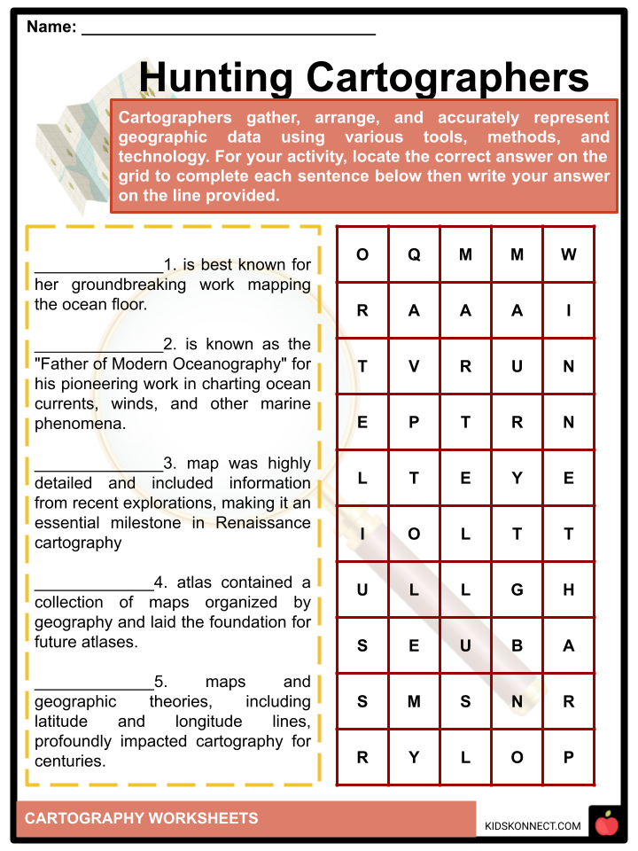
- Claudius Ptolemy (c. 100–170 CE): A Greek geographer, astronomer, and mathematician, Ptolemy authored the influential work “Geographia.” His maps and geographic theories, including latitude and longitude lines, profoundly impacted cartography for centuries.
- Gerardus Mercator (1512–1594): A Flemish cartographer and geographer, Mercator is best known for his development of the Mercator projection, a cylindrical map projection that became standard for nautical navigation due to its ability to preserve angles and rhumb lines.
- Abraham Ortelius (1527–1598): A Flemish cartographer and geographer, Ortelius is credited with producing the first modern atlas, “Theatrum Orbis Terrarum” (Theatre of the World), published in 1570. His atlas contained a collection of maps organized by geography and laid the foundation for future atlases.
- Matthew Fontaine Maury (1806–1873): An American naval officer and oceanographer, Maury is known as the “Father of Modern Oceanography” for his pioneering work in charting ocean currents, winds, and other marine phenomena. His maps and charts revolutionized maritime navigation and contributed to safer sea travel.
- Joan Blaeu (1596–1673) and Willem Blaeu (1571–1638): Dutch cartographers and publishers, the Blaeu family produced some of the most exquisite and accurate maps of the 17th century. Their atlases, including the “Atlas Maior,” were renowned for their quality and sophistication.
- John Mitchell (1711–1768): A British physician and geographer, Mitchell created the “Mitchell Map” in 1755, a highly detailed and accurate map of North America that significantly shaped colonial boundaries and territorial disputes during the 18th century.
- Henricus Martellus (c. 1430–c. 1496): A German cartographer, Martellus produced one of the most famous medieval world maps, known as the “Henricus Martellus World Map,” circa 1490. His map was highly detailed and included information from recent explorations, making it an essential milestone in Renaissance cartography.
- Marie Tharp (1920–2006): An American geologist and oceanographer, Tharp is best known for her groundbreaking work mapping the ocean floor. Her collaboration with Bruce Heezen resulted in the first comprehensive ocean floor map, revealing the Mid-Atlantic Ridge and confirming the theory of plate tectonics.
COMPASS ROSE
- A compass rose is a design on maps, charts, and compasses that displays cardinal (north, south, east, west) and intermediate directions (northeast, northwest, southeast, and southwest). It consists of a circular figure with lines or arrows, often abbreviated labels or symbols.
- The rose’s primary purpose is to help readers navigate accurately by indicating directions relative to the map’s orientation. Some compass roses may include additional information like degrees or angles, magnetic declination, or decorative elements to enhance the map’s aesthetics.
Cartography Worksheets
This fantastic bundle includes everything you need to know about Cartography across 28 in-depth pages. These ready-to-use worksheets are perfect for teaching kids about Cartography. Cartographers use different tools to gather information and draw maps accurately. Maps help us find our way, understand the world around us, and make decisions about where things should go.


Complete List of Included Worksheets
Below is a list of all the worksheets included in this document.
- Cartography Facts
- Guess the Map
- Hunting Cartographers
- Unravel Mapping
- Is it True?
- Knowing Cartographers
- Identifying Rose
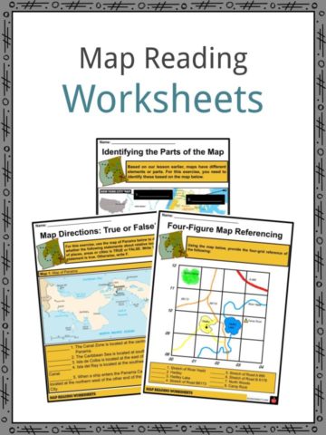
- Map Reading
- I am a Cartographer
- Creating Rose
- ME on the MAP!
Frequently Asked Questions
What is cartography?
Cartography is the art, science, and technology of creating maps. It involves the representation of geographical information on a flat surface, usually paper or a digital display, using symbols, colors, and labels to convey spatial relationships, features, and attributes of the Earth’s surface.
What are the main types of maps used in cartography?
Cartography produces various types of maps for different purposes. Some common types include topographic maps, which show elevation and terrain features; political maps, which display boundaries and borders of countries and regions; thematic maps, which focus on specific themes such as population density or climate; and navigational charts, which aid in maritime or aviation navigation.
What are map projections, and why are they necessary?
Map projections are mathematical transformations used to represent the three-dimensional surface of the Earth on a two-dimensional map. Because the Earth is roughly spherical, it is impossible to accurately represent its surface on a flat map without distortion. Map projections aim to minimize distortions in properties like area, shape, distance, and direction, but no single projection can preserve all these properties simultaneously.
What are GIS (Geographic Information Systems) and how do they relate to cartography?
GIS is a system designed to capture, store, analyze, manage, and present spatial or geographic data. It integrates hardware, software, and data for mapping and spatial analysis. Cartography often utilizes GIS to create, manipulate, and analyze geographic information, allowing cartographers to produce more accurate and informative maps.
How has technology impacted cartography?
Technology has revolutionized cartography in numerous ways. The advent of satellite imagery, aerial photography, and remote sensing has provided cartographers with detailed and up-to-date spatial data. Geographic Information Systems (GIS), computer-aided design (CAD), and digital mapping software have streamlined the map-making process and enabled the creation of dynamic and interactive maps. Additionally, web-based mapping services like Google Maps and OpenStreetMap have made maps more accessible to the general public.
Link/cite this page
If you reference any of the content on this page on your own website, please use the code below to cite this page as the original source.
Link will appear as Cartography Facts & Worksheets: https://kidskonnect.com - KidsKonnect, May 29, 2024
Use With Any Curriculum
These worksheets have been specifically designed for use with any international curriculum. You can use these worksheets as-is, or edit them using Google Slides to make them more specific to your own student ability levels and curriculum standards.