Premium
 Download
Edit
Download
Edit
Download the Kingston, Jamaica Facts & Worksheets
Click the button below to get instant access to these worksheets for use in the classroom or at a home.
Download This Worksheet
This download is exclusively for KidsKonnect Premium members!
To download this worksheet, click the button below to signup (it only takes a minute) and you'll be brought right back to this page to start the download!
Sign Me Up
Edit This Worksheet
Editing resources is available exclusively for KidsKonnect Premium members.
To edit this worksheet, click the button below to signup (it only takes a minute) and you'll be brought right back to this page to start editing!
Sign Up
Not ready to purchase a subscription? Click to download the free sample version Download sample
Download This Sample
This sample is exclusively for KidsKonnect members!
To download this worksheet, click the button below to signup for free (it only takes a minute) and you'll be brought right back to this page to start the download!
Sign Me Up
Table of Contents
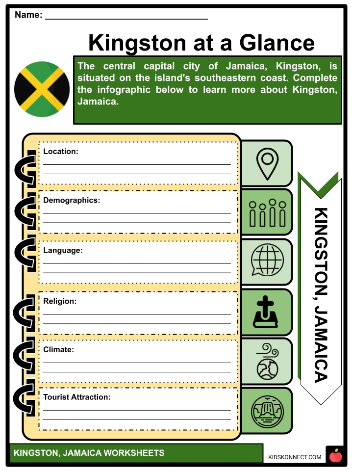
The capital city of Jamaica, Kingston, is situated on the southeasterly coast of the island and overlooks a natural harbor protected by the Palisadoes, a long peninsula connecting the town of Port Royal and the Norman Manley International Airport to the rest of the island. Kingston is the largest, mainly English-speaking city in the Caribbean.
See the fact file below for more information on Kingston, or you can download our 37-page Kingston worksheet pack to utilize within the classroom or home environment.
Key Facts & Information
HISTORY
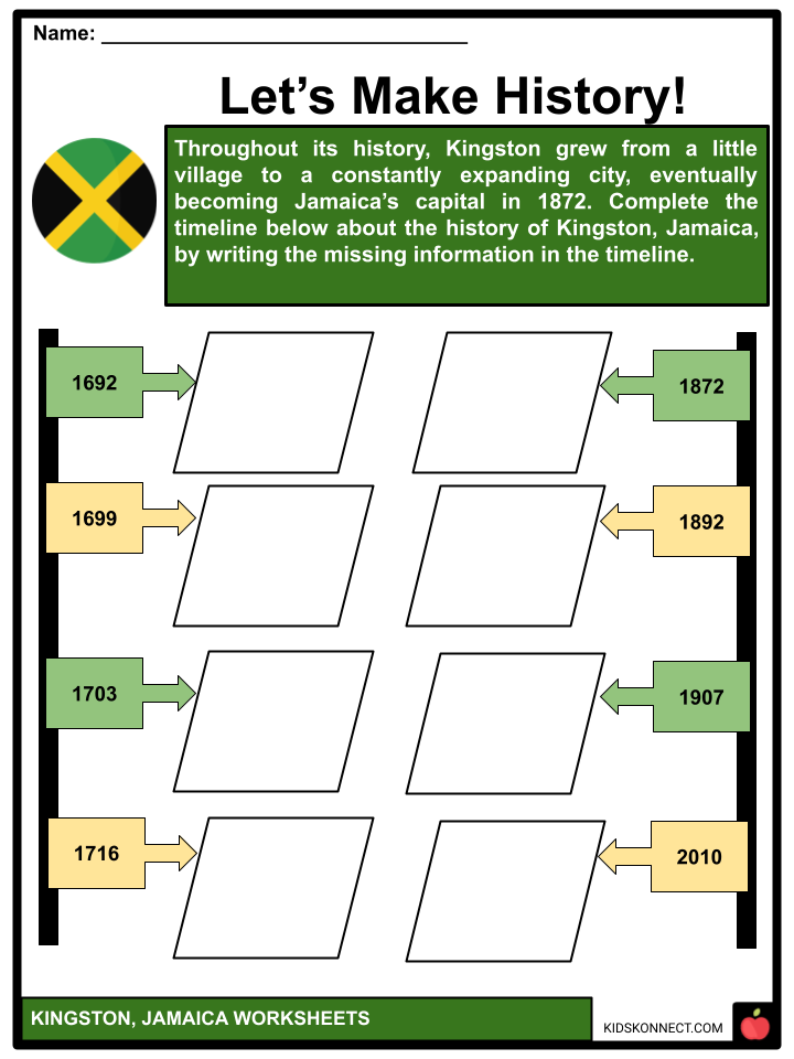
- The initial part of the city, located at the base of the Liguanea Plains, was planned to accommodate survivors of the 1692 earthquake that wrecked Port Royal and was founded on July 22, 1692. Before the earthquake, only agriculture was practiced in Kingston. The earthquake survivors established a camp on the pier, and 2,000 individuals perished from a mosquito-borne illness. The first residents lived in a tent camp on Colonel Barry’s Hog Crawle (basically a hog or pig farm).
- The town did not expand until after Port Royal was severely destroyed by fire in 1703. A grid limited by North, East, West, and Harbour Streets served as the foundation for the town plan created by surveyor John Goffe. The town’s new grid structure was designed to promote business, especially along the 66-foot (20-meter) wide major thoroughfares that facilitated travel between the port and inland plantations.
- It grew into Jamaica’s largest town and commercial hub by 1716. People could only buy property from the government on the seaside and could only add to the land they already held in Port Royal. Wealthy merchants gradually started relocating to the farmlands north on the Liguanea plains from above their establishments.
- The merchants started pushing for the administrative capital to be moved from Spanish Town, which at this point, was overshadowed by the economic activity in Kingston when Kingston had 11,000 people. The Church of St. Thomas, located on King Street, the main road, was first constructed around 1699 but was renovated following the earthquake in 1907.
- More than 3,000 brick structures could be seen in the city by the end of the 18th century. The harbor promoted trade and participated in several 18th-century naval battles. Spanish Town, the country’s capital at the time, was replaced by Kingston. Agriculture, commerce, processing, and a central transportation hub to and from Kingston and other island areas were among these roles.
- A tenth of the island’s total population, or around 25,000 people, lived in Kingston in 1788. Kingston had a substantial number of free people of color, and one in every four residents was white, making the city’s population of free people equal to two out of every five. Enslaved Black people made up the remaining three-fifths of Kingston’s population.
- In 1872, the government issued a law authorizing the transfer of government employees from Spanish Town to Kingston. A big fire broke out in Kingston in 1882. A decade later, in 1892, a coal-burning steam-generating facility on Gold Street in Kingston supplied Jamaica with electricity.
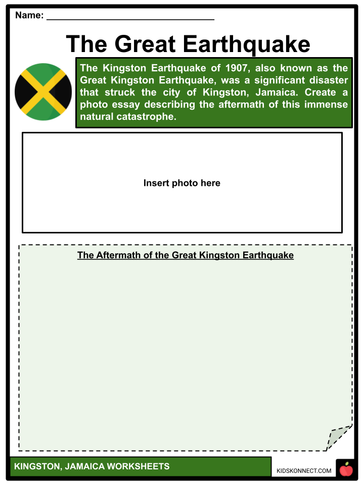
- Another 1907 Kingston earthquake claimed 800 lives and destroyed almost all of the city’s old structures south of Parade. At that time, buildings in the middle of the town were only allowed to be 60 feet (18 meters) tall. These reinforced concrete structures have three stories. The first location to violate this building regulation was construction on King Street in the city.
- Island-wide riots in the 1930s prompted the creation of political parties and trade unions to advocate for workers. The University of the West Indies Mona campus, which was established in 1948 with 24 medical students, is now located in the city.
- Kingston served as the host city for the Commonwealth Games in 1966. The democratic socialist People’s National Party (PNP) government was overthrown in the 1980 general elections; subsequent governments, which reflected the “turbulent” and “volatile” period in which Cuba and the United States fought for control over Jamaica’s culture, have been more market-oriented and centered on tourism and relations with the United States.
- Crime in the area rose throughout the 1990s, and there were many reported riots, including one in 1999, in response to an increase in fuel costs. To reduce violent crime, the Jamaican government deployed army personnel to patrol Kingston’s streets in 1999. In 2001, after “three days of unrest leave at least 27 people dead,” army personnel and armored vehicles used force to “restore order” in Kingston.
- International media attention was drawn to the Kingston disturbance in 2010, an armed struggle between the Jamaican military and police in Kingston, and the Shower Posse drug cartel. At least 73 individuals were murdered, and at least 35 others were injured during the violence, which primarily occurred between May 24 and May 25. In addition, four police officers and troops died.
DEMOGRAPHICS
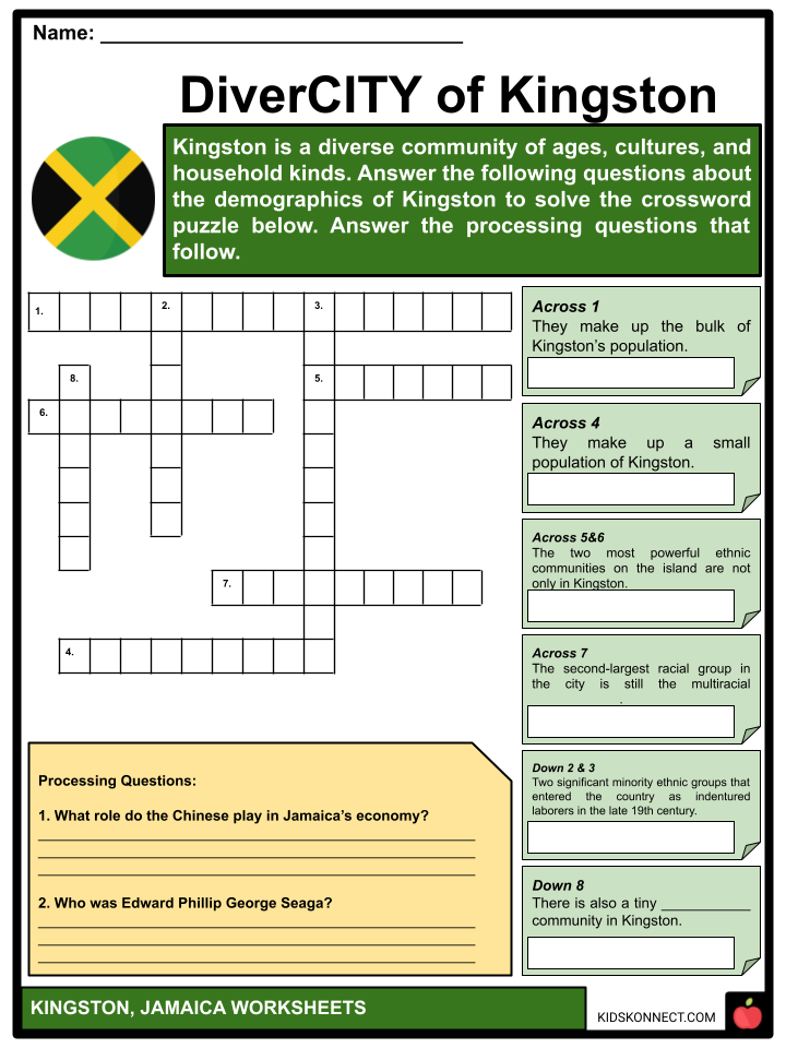
- African Americans make up the bulk of Kingston’s population. East Indians and Chinese are two significant minority ethnic groups that entered the country as indentured laborers in the late 19th century.
- Chinese people play significant roles in Jamaica’s economy, particularly in Downtown Kingston and the surrounding metropolitan area’s retail sector. There is also a small population of Europeans, primarily descended from German and British immigrants.
- One of the most potent ethnic communities on the island, not only in Kingston, comprises Syrians and Lebanese. Despite being a minority ethnic group, the Lebanese were able to provide Jamaica with Edward Phillip George Seaga, one of its prime ministers. The second-largest racial group in the city is still multiracial Jamaicans, and there is also a tiny Jewish community there.
CULTURAL LIFE
- The cultural development of Jamaica has been heavily affected by British traditions and the quest for origins in traditional forms. The latter is mostly based on the vibrant rhythmic intensity of the island’s African background.
- Jamaican culture arose through the interplay between Europe and Africa. However, phrases such as “Afro-centered” and “Euro-centered” are regularly used to express Jamaican cultural norms and values’ seeming dualism.
- Government, wellness, Christian worship, and the arts are still heavily influenced by Europe. Religious life, Jamaican Creole language, cuisine, sayings, drumming, Jamaican dances and musical rhythms, traditional medicine, and Anansi, the spider-trickster tales, all show African continuities.
Daily Life and Social Customs
- Although most Jamaicans cherish family life, traditional marriages are less popular than in most other countries. Three generations living in the same house is common. Many women work, particularly in households where men are absent, and grandparents frequently care for preschool-aged children. The majority of rich Jamaican homes employ at least one domestic servant.
- Because most adults do not have time to cook a midday meal and children usually eat at school, the main meal is nearly always served in the evening. Most weekday dinners are too hectic for families to share, but on Sundays, custom dictates that even impoverished families eat a substantial and enjoyable brunch or lunch, generally consisting of chicken, fish, yams, fried plantains, and the omnipresent rice and peas. Jerk (spiced and grilled) meat is one of Jamaica’s most popular meals.
- Clothing styles differ. Rastafarians, who make up a small percentage of the population, often wear loose-fitting clothing and long dreadlocks, a hairstyle popularized by Ethiopian Emperor Haile Selassie I in the early twentieth century.
- The anniversary of Jamaica’s independence from the United Kingdom (August 6, 1962) is celebrated annually. The Festival is sponsored by the government as part of the country’s independence celebrations. Although it shares many similarities with the region’s pre-Lenten Carnivals, the Festival encompasses a far broader range of activities, such as street dance and parades, arts and crafts exhibitions, and literary, dramatic, and musical competitions. Jamaicans have also celebrated Carnival since the late twentieth century, generally with costumed parades, music, and dancing.
RELIGION
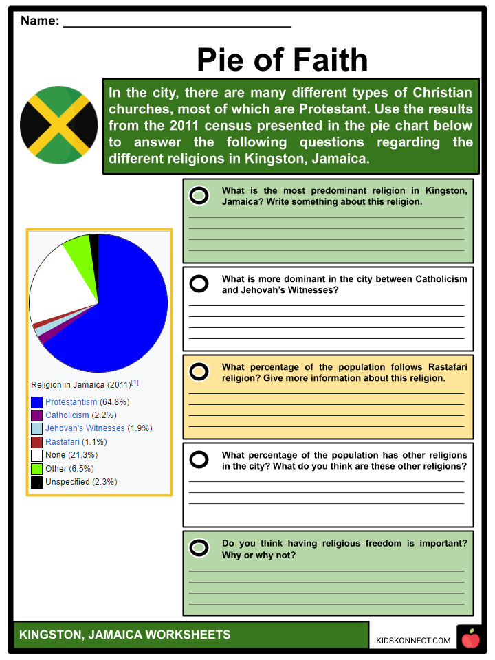
- In the city, there are many different types of Christian churches, most of which are Protestant. The Church of God, Baptist, Anglican, Methodist, Roman Catholic, Seventh-day Adventist, and Pentecostal are the principal religious belief systems.
- A sizable Roman Catholic population resides in the 1911-built Holy Trinity Cathedral, which also serves as the metropolitan archbishop’s residence.
- Holy Childhood High School and Immaculate Conception High School were created and are owned by the Franciscan Missionary Sisters of the Immaculate Heart of Mary of Our Lady of Perpetual and Help (FMS) and St. Francis Primary and Infant School in Jamaica.
- There is a sizable following for Afro-Christian syncretic faiths like the Rastafari movement. The Shaare Shalom Synagogue serves the Jewish community in Kingston. Hindu, Buddhist, and Muslim communities are also found in the city. The Islamic Education and Dawah Center and the Islamic Council of Jamaica have offices in Kingston. The Church of Jesus Christ of Latter-day Saints has three branches in the city.
ECONOMY
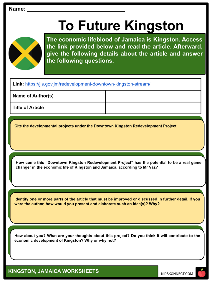
- The economic lifeblood of Jamaica is Kingston. Because Kingston is home to the bulk of government ministries and the majority of the country’s economic activities, the city plays a significant role in shaping financial policy for Jamaica. Due to Kingston’s high population density, the bulk of financial transactions takes place there, significantly boosting the local economy of Jamaica. The city also has the most universities, hospitals, and schools of any location in Jamaica. Kingston is both the island’s biggest seaport and primary transportation center.
- However, the city and the rest of Jamaica have recently experienced economic difficulties. Numerous reconstruction ideas for downtown Kingston have been undertaken to boost the local economy. Additionally, there have been initiatives to expand the region’s industrial sector and draw call centers to the city.
GEOGRAPHY AND CLIMATE
- The Blue Mountains, Red Hills, Long Mountain, and Kingston Harbour all encircle Kingston. The city is situated along the Hope River’s alluvial Liguanea Plain. There have been many earthquakes in Kingston, notably the one in 1907.
- Kingston has a hot, semi-arid climate (BSh) – a tropical wet-and-dry climate (Aw/As). Seasons are characterized by a dry season from December to April and a rainy season from May to November, which also happens to be hurricane season. Although there is seldom much rain throughout the dry season, cold stationary fronts frequently deliver heavy rains, especially in March. Due to its coastal location, Kingston is affected by the sea. However, this influence is mitigated by the city’s dense urban growth. Kingston is particularly dry compared to Portland and Saint Mary on the windward side of the Blue Mountains because it is in the rain shadow of the Blue Mountains and receives little to no rainfall from the Northeast Trade Winds.
- In the twenty-first century, Kingston has had highs of 38.8 °C and lows of 13.4 °C. Between 1895 and 1990, the total average rainfall was 813 mm, with the most significant monthly average rainfall of 177 mm in October and the lowest monthly average rainfall of 18 mm in March. Tornadoes, hail, thunder, and fog are all highly unusual occurrences.
HOUSING
- The Jamaican government built additional dwellings in the west, north, and east of Kingston in 1848 to accommodate the city’s growth. By 1860, the bulk of the white aristocracy resided on the city’s outskirts in this heavily racialized housing. Existing communities in Kingston became so crowded as the city’s population increased that wetlands in the southwest had to be filled to make room for new dwellings.
- By 1935, slums had begun to appear in the east and west of the city as a result of ongoing population increase and poverty. Later, the government razed these settlements, and the occupants were relocated to Denham Town. More than one-sixth of the displaced residents were homeless since this development only had room for 3,000 individuals. As a result, there was continued overpopulation across the city, and the crowded living circumstances impacted public health.
- Suburbanization also gained importance, and by the 1960s, this residential region had reached the Blue Mountains’ foothills. Due to a shortage of available land and ongoing consumerism, this region grew to the east of the mountains. In Kingston, squatter communities house 20% of the city’s residents. In contrast, Kingston also has some of the most affluent neighborhoods in Jamaica, including Red Hills, Norbrook, Cherry Gardens, Stony Hill, and Jack’s Hill.
PARKS
- Numerous urban parks in the city of Kingston periodically transform to suit various events and celebrations on the Jamaican calendar. Emancipation Park, Hope Garden, Devon House, National Heroes Park, St. William Grant Park, and Mandela Park are some of the most well-known parks.
Emancipation Park
- The Liguanea Club, a social and recreational organization for wealthy people, was situated on Knutsford Boulevard and possessed more than 35 acres (14 ha) of property, including the area that was once Liguanea Park and is now Emancipation Park. The seven-acre parcel of land was a gift from the club to the Jamaican government.
- While some government representatives suggested the area should be developed into a commercial zone, others thought a multipurpose entertainment complex should be constructed there. The large financial investment required for each project was not made.
- Cabinet authorized the site’s sale to the National Housing Trust in 2002, subject to the establishment and upkeep of a park there. For one Jamaican dollar, the land was transferred.
- At the park’s entrance is a bronze sculpture measuring 11 feet (about 3 meters) high by Jamaican artist Laura Facey. This striking sculpture features two sculptures of bare-chested black men and women staring upward as a representation of their triumphant escape from the atrocities of slavery.
- The public in Jamaica expressed outrage when the statue was revealed in July 2003, just in time for the park’s first anniversary. They felt that the statues’ open nudity and generous body proportions were improper for portraying black people’s independence.
Hope Gardens
- A famous tourist destination in the country is the Royal Hope Botanical Gardens, sometimes known as Hope Gardens. The most extensive botanical garden in the English-speaking Caribbean, the Hope Gardens spans 2,000 acres (809 hectares) of land.
- The Jamaican government purchased 200 acres of this area in 1880, and it was first used as a center for introducing new plants and agricultural testing for crops, including pineapple, cocoa, coffee, and tobacco. With the help of staff from Kew Gardens in England, the formal Botanical Gardens were planned out on around 60 acres (24 hectares) of this area.
- The Hope Gardens were permitted to use the name Royal Botanical in the 1950s when the Queen visited the island and was delighted with the beauty of the gardens. Along with several Jamaican native trees, the Gardens have a variety of alien species.
- Visitors may also see the Coconut Museum, the Sunken Gardens, the Orchid House, the Lily Pond, the Maze, and Palm Avenue at Hope Gardens. The Hope Gardens Zoo is a zoo that is located next to the Hope Gardens. As part of the Bring Back The Hope program, the gardens, and zoo are being renovated to enhance the physical landscape and the animal collection.
TRANSPORT
Roads
- Three of Jamaica’s four A roads—the A1 (Kingston to Lucea), the A3 (Kingston to Saint Ann’s Bay), and the A4 (Kingston to Annotto Bay)—start at the St. William Grant Park (Parade), which is located in the center of downtown Kingston. The city also has a robust network of trunk, primary, secondary, and minor roads.
- Highway 2000, Jamaica is another part of it; it passes via Portmore, Ocho Rios, and Mandeville. Recently, the public was allowed to use the “T3” stretch of Highway 2000 in Jamaica. Modern taxis, minibuses, and buses provide excellent service throughout Kingston, with significant hubs at Parade, Cross Roads, Half Way Tree, and other locations.
Buses
- The West India Electric Company and the Jamaica Public Service Company began operating electric trams when the old mule car service was phased down starting in June 1898. On March 31, 1899, the switch to the electric tram was complete. The tram service continued to run, but because of its rigidity, it could not keep up with the city’s expansion, and it was discontinued on August 7, 1948. A business known as Jamaica Utilities ran a motor bus service between 1948 and 1953. In 1953, the government abolished its franchise.
- The Jamaica Omnibus Service ran a service from 1953 to 1983, covering the areas of Spanish Town, Border, Mt. James, Bully Bay, and Port Royal at its height with over 600 vehicles. It was nationalized in 1974 and then closed down by the government in 1983.
- The Jamaica Urban Transit Company (JUTC), a contemporary bus system that runs throughout the city with main hubs at Parade, Cross Roads, Half Way Tree, and other locations, as well as minibuses and taxis, provide excellent service in Kingston.
Rail
- The now-defunct Kingston railway station had branches from Spanish Town to Ewarton, Bog Walk to Port Antonio, Linstead to New Works, and May Pen to Frankfield for the Kingston to Montego Bay main line.
Air
- The domestic airport in Kingston is Tinson Pen Aerodrome, while the international airport is Norman Manley International Airport.
Sea
- In the past, the waterfront of Kingston served as Jamaica’s primary port, with several finger piers where freighters and passenger ships could dock. The port relocated to Newport West more recently due to freight containerization.
LAW ENFORCEMENT
- The Jamaica Constabulary Force, the country’s police force, has an office on Old Hope Road close to Liguanea. The Corporate Area has several smaller police stations, including Hunt’s Bay, Matilda’s Corner, and Half-Way-Tree.
- Kingston also houses the Jamaican Supreme Court. Other courts based in Kingston include the Half-Way-Tree Resident Magistrate’s Court, Gun Court, Traffic Court, and Family Court. The headquarters of the Jamaica Defense Force (JDF) is located in Up Park Camp, close to New Kingston and Cross Roads. At Port Royal, the JDF also has a sizable naval facility.
INSTITUTIONS
- The financial, cultural, economic, and industrial hub of Jamaica is Kingston, the country’s capital. Kingston is home to major financial institutions and has the most hospitals, schools, colleges, and cultural attractions of any city on the island.
- The University of the West Indies, the Jamaica Defense Force Museum, and the Bob Marley Museum are notable Kingston monuments. The International Seabed Authority is a UN organization with its main office in Kingston.
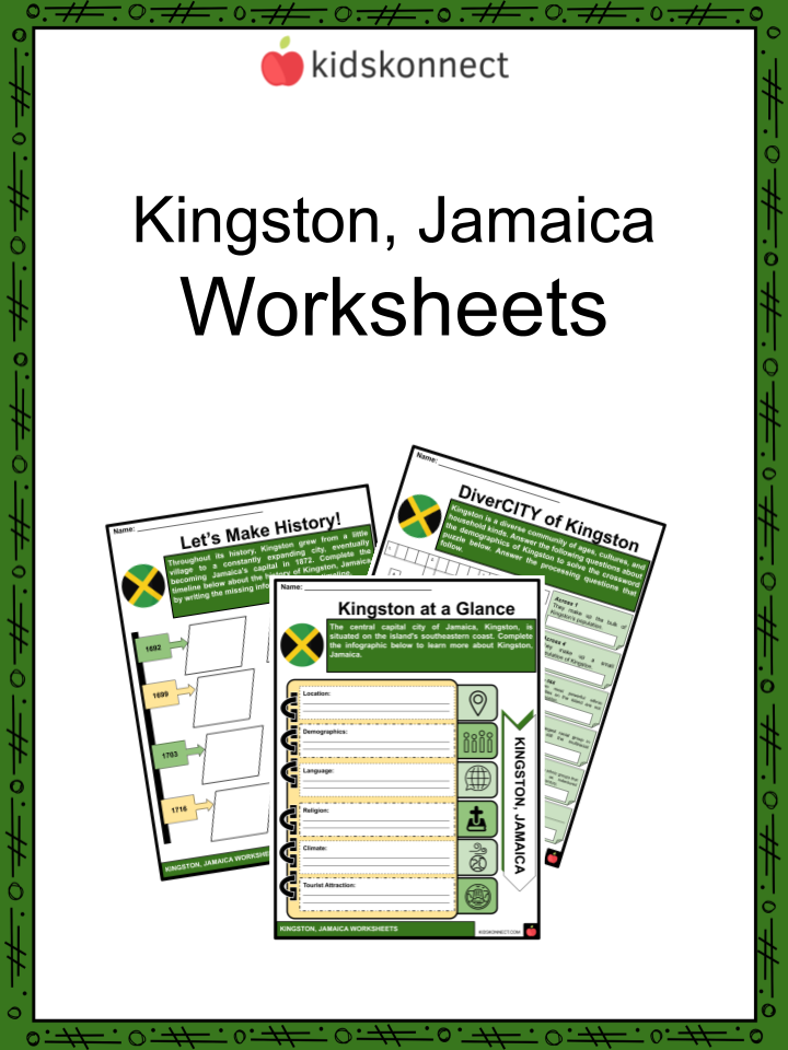
Kingston Worksheets
This fantastic bundle includes everything you need to know about Kingston across 37 in-depth pages. These ready-to-use worksheets are perfect for teaching kids about Kingston. Kingston is the largest, mainly English-speaking city in the Caribbean.
Complete List of Included Worksheets
Below is a list of all the worksheets included in this document.
- Kingston, Jamaica Facts
- Kingston at a Glance
- Let’s Make History!
- DiverCITY of Kingston
- Pie of Faith
- To Future Kingston
- The Great Earthquake
- Fill at Home
- Walk in the Park
- A Day in the Life…
- Visiting Bob Marley Museum
Frequently Asked Questions
What is the capital city of Jamaica?
The capital city of Jamaica is Kingston.
What is Kingston known for?
Kingston is known for being a vibrant cultural hub with a rich history of music, particularly reggae, which was popularized by legendary musician Bob Marley. It’s also known for its bustling markets, historical landmarks, and being a center of commerce and government in Jamaica.
What are some popular attractions in Kingston?
Some popular attractions in Kingston include the Bob Marley Museum, Devon House (a historic mansion), the National Gallery of Jamaica, Emancipation Park, and Port Royal (a historic pirate haven). The city’s vibrant street art and murals also contribute to its artistic atmosphere.
How does Kingston’s geography influence its layout?
Kingston is situated on the southeastern coast of Jamaica and is flanked by the Blue Mountains to the north. The city’s geography has led to a layout that extends from the waterfront to the foothills of the mountains. The urban area is characterized by various neighborhoods, commercial districts, and residential areas.
What is the significance of Kingston’s harbor?
Kingston Harbor is the seventh-largest natural harbor in the world. It has played a crucial role in the city’s history as a port for trade and commerce. The harbor area includes the historic Port Royal, once known as the “wickedest city in the world” during the pirate era. Today, the harbor continues to be an essential part of Kingston’s economic activities.
Link/cite this page
If you reference any of the content on this page on your own website, please use the code below to cite this page as the original source.
Link will appear as Kingston, Jamaica Facts & Worksheets: https://kidskonnect.com - KidsKonnect, September 20, 2023
Use With Any Curriculum
These worksheets have been specifically designed for use with any international curriculum. You can use these worksheets as-is, or edit them using Google Slides to make them more specific to your own student ability levels and curriculum standards.