Premium
 Download
Edit
Download
Edit
Download the Alberta Facts & Worksheets
Click the button below to get instant access to these worksheets for use in the classroom or at a home.
Download This Worksheet
This download is exclusively for KidsKonnect Premium members!
To download this worksheet, click the button below to signup (it only takes a minute) and you'll be brought right back to this page to start the download!
Sign Me Up
Edit This Worksheet
Editing resources is available exclusively for KidsKonnect Premium members.
To edit this worksheet, click the button below to signup (it only takes a minute) and you'll be brought right back to this page to start editing!
Sign Up
Not ready to purchase a subscription? Click to download the free sample version Download sample
Download This Sample
This sample is exclusively for KidsKonnect members!
To download this worksheet, click the button below to signup for free (it only takes a minute) and you'll be brought right back to this page to start the download!
Sign Me Up
Table of Contents
Alberta is a province in Western Canada. Its landscape encompasses mountains, prairies, desert badlands and vast coniferous forests. It has more than 600 lakes, and rich mineral deposits. In the west, the Canadian Rocky Mountain Parks have glaciers in the Columbia Icefields. The Waterton Glacier International Peace Park is a biosphere reserve that straddles the southern border with the USA.
See the fact file below for more information on the Alberta or alternatively, you can download our 23-page Alberta worksheet pack to utilise within the classroom or home environment.
Key Facts & Information
HISTORY AND SETTLEMENT
- The Canadian province of Alberta has a history that spans thousands of years, beginning with Indigenous groups such as the Plain Indians, Woodland Cree, and Chipewyan who lived a semi nomadic lifestyle of bison hunting, fishing, and gathering.
- After the influx of British settlers into Canada, about half of what is now the province of Alberta became a part of Rupert’s Land, which included the Hudson Bay drainage basin and surrounding area, as seen in the map to the right.
- The area was granted by Charles II of England to the Hudson’s Bay Company in 1670, which meant that other fur trading companies could not trade or do business within that area.
- Many of Alberta’s cities and towns started as fur trading posts for the Hudson’s Bay Company or the North West Company, including Fort Edmonton.
- The extreme southernmost part of Alberta belonged to the French territory of Louisiana, which was sold to the US in 1803, but the portion above the 49th parallel was ceded to the British in 1818.
- In 1882, the “District of Alberta” was created as a part of the Northwest Territories, and in 1905, the boundaries were solidified and Alberta was given provincial status.
- By the time World War I broke out, around 50% of the workforce in Alberta volunteered for overseas service.
- By the Second World War, the contributions from Alberta were substantial, offering space for internment camps for Japanese-Canadians, housing prisoners of war, establishing training grounds, and the donation of artillery and personnel.
- From the end of the Second World War, Alberta has remained a fairly conservative province in Canada.
GEOGRAPHY OF ALBERTA
- Alberta is the 6th largest province (by area) in Canada, nestled between British Columbia to the west and Saskatchewan to the east. The Northwest Territories border its north, and the US state of Montana borders it to the south.
- It is a very fertile province with plains that take up the majority of the southern portion of the province.
To the west lies the Rocky Mountains, where more trees and forests are found (as well as in the north). A line of snowy peaks can be seen along the western edges of Alberta. - Three main physical regions lie within Alberta – the Interior Plains, the Cordillera Region, and the Canadian Shield.
- Alberta is evenly scattered with rivers, and is considered to be a “well watered” province.
- Alberta’s climate varies significantly depending on where you are in the province. Southern Alberta is generally fairly dry, with some places that are humid with hot summer temperatures and extremely cold winters due to the Chinook Winds. Central Alberta is mostly covered by Aspen parkland, but is fairly dry. Northern Alberta is the coldest region, with a mostly subarctic climate where winters are long, cold, and harsh and poor conditions for agriculture and fertility.
- Edmonton is the capital of the province, and is the most northern major city in all of Canada.
- You are likely to see a wide variety of animals in Alberta, including grizzly and black bears, buffalo, bison, wolves, mountain lions, elk, moose, deer, porcupines, and many others, including a wide variety of birds and plant life.
DEMOGRAPHICS, TRADE, AND CULTURE
- Since the year 2000, Alberta has seen a high rate of growth, mostly due to a booming economy, as well as young people relocating from other provinces. This has also contributed to high birth rates and immigration.
- About 81% of the population live in urban areas, and the other 19% live in rural areas, with the Calgary-Edmonton Corridor (the geographical region between the two cities) being the most urbanized area in Alberta, and one of Canada’s four most urban regions.
- About 80% of the population use English as their default language, while about 3% said that Chinese is their first language, followed by German and French, at 2% and 1%, respectively.
- Alberta’s economy relies heavily on the petroleum industry, as well as agriculture and technology. It has one of the strongest economies in the world and ranks highly when measuring economic freedom.
- Alberta is the second-largest exporter of natural gas in the world, and the province is also recognized worldwide for its beef production.
- Wheat and canola are its primary crops, and beekeeping is popular too.
- Tourism continues to flourish, as visitors enjoy visiting the Rocky Mountains, Lake Louise, the cities of Banff and Calgary, as well as seeing the Calgary Stampede, visiting the Museum of Palaeontology in Drumheller, and generally enjoying a laid-back culture.
Alberta Worksheets
This is a fantastic bundle which includes everything you need to know about Alberta across 23 in-depth pages. These are ready-to-use Alberta worksheets that are perfect for teaching students about the Alberta which is a province in Western Canada. Its landscape encompasses mountains, prairies, desert badlands and vast coniferous forests. It has more than 600 lakes, and rich mineral deposits. In the west, the Canadian Rocky Mountain Parks have glaciers in the Columbia Icefields. The Waterton Glacier International Peace Park is a biosphere reserve that straddles the southern border with the USA.
Complete List Of Included Worksheets
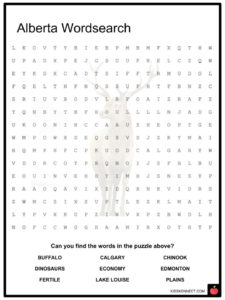
- Alberta Wordsearch
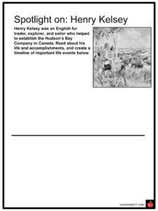
- Spotlight on: Henry Kelsey
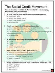
- The Social Credit Movement
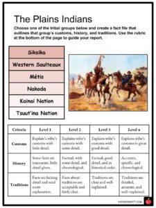
- The Plains Indians
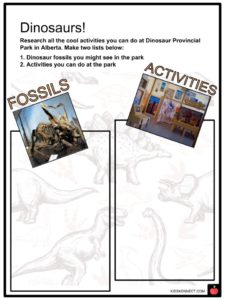
- Dinosaurs!
- Alberta Crossword
- The Chinook Winds
- Opinion Piece: Internment Camps
- Animals of Alberta
- What Alberta Means to Me
Link/cite this page
If you reference any of the content on this page on your own website, please use the code below to cite this page as the original source.
Link will appear as Alberta Facts & Worksheets: https://kidskonnect.com - KidsKonnect, March 7, 2019
Use With Any Curriculum
These worksheets have been specifically designed for use with any international curriculum. You can use these worksheets as-is, or edit them using Google Slides to make them more specific to your own student ability levels and curriculum standards.