Premium
 Download
Edit
Download
Edit
Download the Mont Blanc Facts & Worksheets
Click the button below to get instant access to these worksheets for use in the classroom or at a home.
Download This Worksheet
This download is exclusively for KidsKonnect Premium members!
To download this worksheet, click the button below to signup (it only takes a minute) and you'll be brought right back to this page to start the download!
Sign Me Up
Edit This Worksheet
Editing resources is available exclusively for KidsKonnect Premium members.
To edit this worksheet, click the button below to signup (it only takes a minute) and you'll be brought right back to this page to start editing!
Sign Up
Not ready to purchase a subscription? Click to download the free sample version Download sample
Download This Sample
This sample is exclusively for KidsKonnect members!
To download this worksheet, click the button below to signup for free (it only takes a minute) and you'll be brought right back to this page to start the download!
Sign Me Up
Table of Contents
Mont Blanc, located on the French-Italian border, serves as the highest mountain in the Alps and Western Europe, as well as the highest mountain in Europe outside of the Caucasus mountains, rising 4,807.81 m above sea level.
See the fact file below for more information on Mont Blanc, or you can download our 29-page Mont Blanc worksheet pack to utilize within the classroom or home environment.
Key Facts & Information
HISTORICAL BACKGROUND
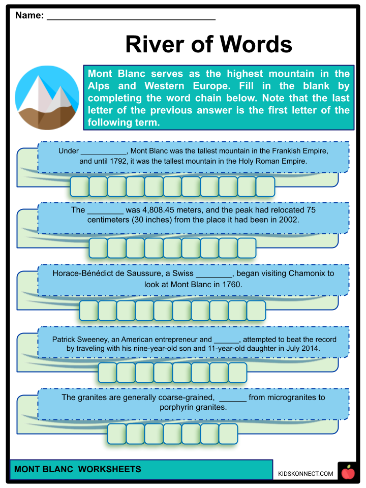
- Under Charlemagne, Mont Blanc was the tallest mountain in the Frankish Empire, and until 1792, it was the tallest mountain in the Holy Roman Empire.
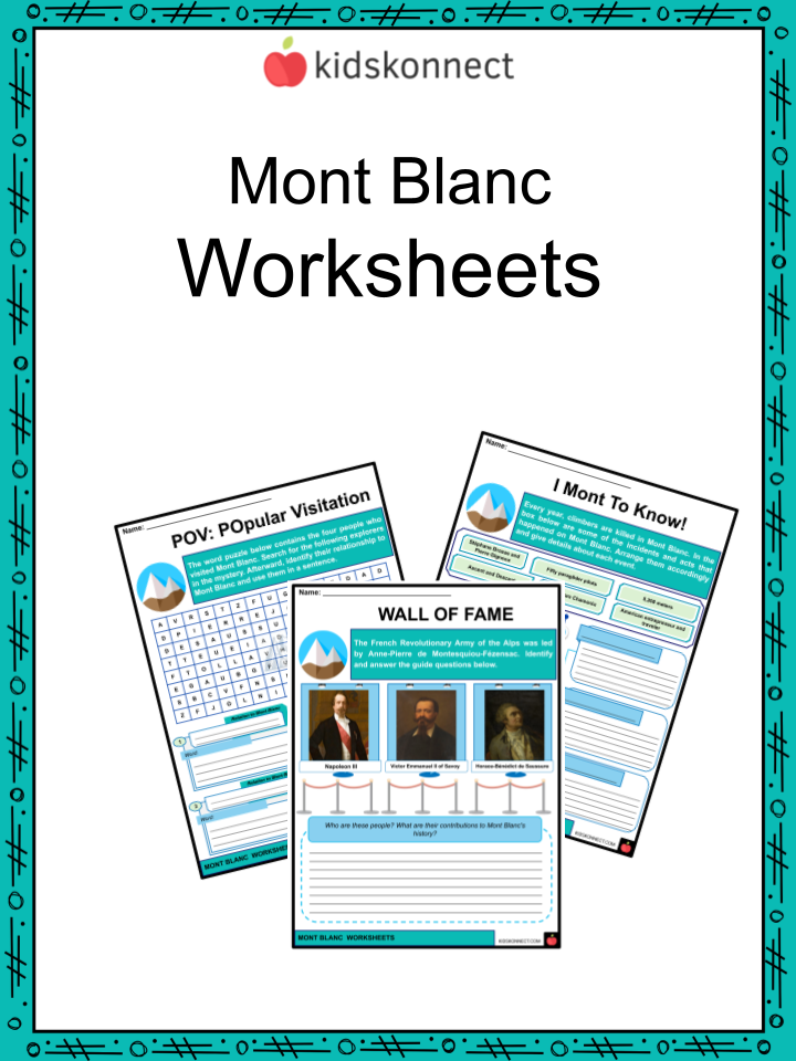
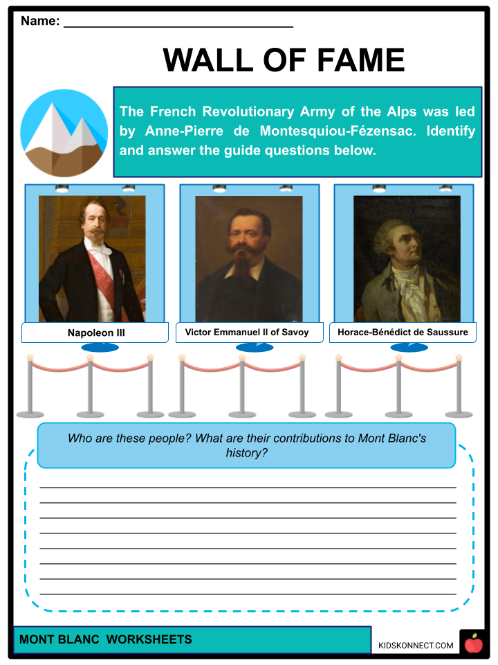
- Horace-Bénédict de Saussure, a Swiss naturalist, began visiting Chamonix to look at Mont Blanc in 1760. He attempted the top with the Courmayeur mountain guide Jean-Laurent Jordaney, a Pré-Saint-Didier native who had accompanied De Saussure on the Miage Glacier and Mount Crammont since 1774. The French Revolutionary Army of the Alps, led by Anne-Pierre de Montesquiou-Fézensac, captured Savoy without much resistance in September 1792.
- Following the Napoleonic Wars, the Congress of Vienna reinstated the King of Sardinia in his original possessions of Savoy, Nice, and Piedmont, overturning the Treaty of Paris of 1796. It was replaced by a new legal statute 45 years following the Second Italian War of Independence.
- This act was signed by Napoleon III and Victor Emmanuel II of Savoy on March 24, 1860, in Turin, and deals with the annexation of Savoy (after the French impartiality for the elections held in Tuscany, Modena, Parma, and Romagna to join the Kingdom of Sardinia, against the Pope’s wishes).
- On the other hand, The Federal Office of Topography modern Swiss mapping depicts an area of disputed territory surrounding the summits of Mont Blanc, including the Dôme du Goûter. One of its conceptions of the French-Italian border places both peaks straddling a line running straight across the geographical ridgeline between France and Italy, thus dividing their summits equally between the two countries.
- The botanist-meteorologist Joseph Vallot conducted the first formal scientific studies on the peak near the end of the nineteenth century. He intended to stay on the summit to conduct in-depth studies, so he built a permanent cabin.
- In 1890, astronomer and director of the Meudon astrophysical observatory Pierre Janssen explored building an observatory on Mont Blanc’s top. Gustave Eiffel accepted to take on the job if he was able to construct a rock foundation found less than 12 meters (39 feet) below the ice.
- Imfeld, a Swiss surveyor, dug two parallel tunnels 12 m (39 ft) beneath the ice summit in 1891 but discovered nothing substantial. As a result, the Eiffel Program was shelved.
- A drilling attempt to create a passage under the mountain began in 1946. The Mont Blanc tunnel would link Chamonix, France, with Courmayeur, Italy, and become one of the two countries’ key transalpine transport routes. The 11,611-meter-long tunnel opened to vehicular traffic in 1965. A freight truck caught fire in the tunnel under the mountain in 1999. When the fire burned out of control, 39 persons were killed. Following the incident, the tunnel was refurbished to improve driving safety.
- Clean air flows through vents in the escape tunnels as well. Anyone in the safety bays can now speak with the control center via live video contact. On either side, a distant facility for cargo safety inspection was established: Aosta in Italy and Passy-Le Fayet in France.
ELEVATION
- Mont Blanc’s peak is a thick, perpetual ice-and-snow dome with varying thicknesses. As a result, while reliable measurements have been taken on specific dates, no definite and permanent peak elevation can be identified.
- For a long time, its official elevation was 4,807 m. The IGN and experienced surveyors assessed it to be 4,807.40 m in 2002 using GPS technology.
- Following Europe’s 2003 heatwave, a team of experts measured the height again on September 6 and 7. The crew included glaciologist Luc Moreau, two GPS Company surveyors, three IGN employees, seven professional surveyors, four Chamonix and Saint-Gervais mountain guides, and four students from various French institutes. The elevation was 4,808.45 meters, and the peak had relocated 75 centimeters (30 inches) from where it had been in 2002.
GEOLOGY
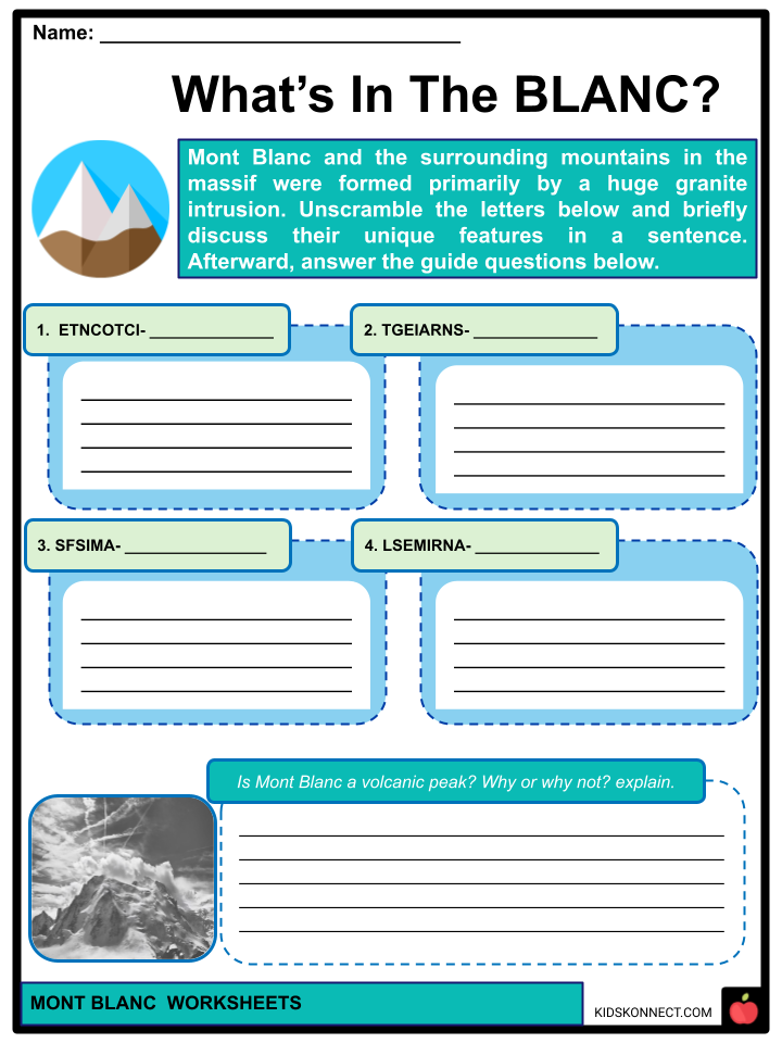
- Mont Blanc and the surrounding mountains in the massif were formed primarily by a huge intrusion of granite that was driven out above a lower layer of gneiss and mica schists over the late Palaeozoic Variscan mountain-forming episode.
- Furthermore, the granite interface is more intrusive to the southwest, while it becomes more tectonic to the northeast. The granites are generally coarse-grained, ranging from microgranites to porphyrin granites.
- The massif is tilted north-westerly and carved by near-vertical recurring faults running north-south during the Variscan orogeny. Throughout the later Alpine orogeny, more displacement with shear zones occurred.
- Separation of the granite in different directions and overlapping planes has resulted from repeated tectonic episodes. Finally, glaciation has sculpted the landscape into its current form.
- Venance Payot provided the first systematic study of the minerals of the Mont Blanc area in 1873. His list, titled “Statistique minéralogique des environs du Mont-Blanc,” included 90 mineral varieties, including those found only as minute components of rocks.
CLIMATE
- The Mont Blanc massif, discovered on the watershed between the Rhône and the Po, is also between the two distinct climate zones of the northern and western Alps and the southern Alps.
- The climate is cold and temperate (Köppen climatic classification Cfb), and altitude has a significant influence. Mont Blanc and the surrounding mountains can produce distinctive weather patterns. Temperatures plummet as the mountains rise, and Mont Blanc’s summit has a perpetual ice cap with temperatures hovering about 20 °C. The peak is also vulnerable to severe winds and unexpected weather changes. Because of its vast overall height, a significant section is continuously glaciated or snow-covered and subject to intense cold.
CLIMBING ROUTES: EXPLOITS AND INCIDENTS
- Several traditional climbing routes go to Mont Blanc’s summit:
- The Goûter Route, often called the Voie Des Cristalliers or the Voie Royale, is the most popular path. The Tramway du Mont-Blanc (TMB) is taken from Saint-Gervais-les-Bains to the Gare du Nid d’Aigle. The ascent begins toward the summit of the Refuge de Tête Rousse, passing via the Grand Couloir or Goûter Corridor, considered treacherous due to frequent rockfalls, and leads to the Goûter Hut for night refuge.
- La Traversée is another name for La Voie des 3 Monts. The Téléphérique de l’Aiguille du Midi leads from Chamonix to the Col du Midi.
- The ancient path via the Grands Mulets Hut, or the usual route on the French side, is frequently crossed by winter skiing or by descent to Chamonix in summer.
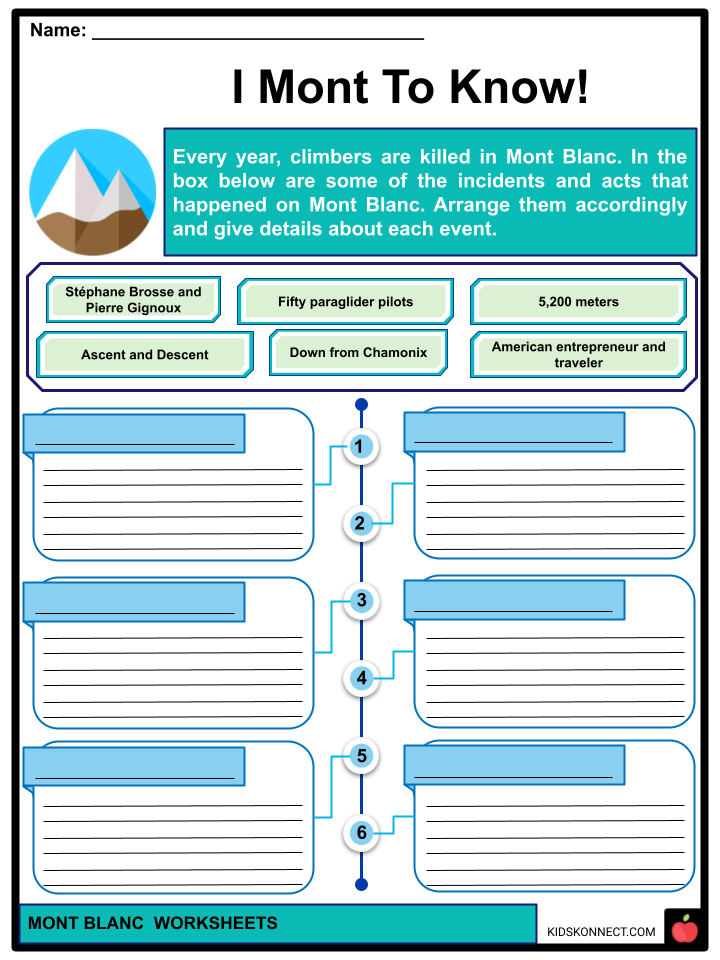
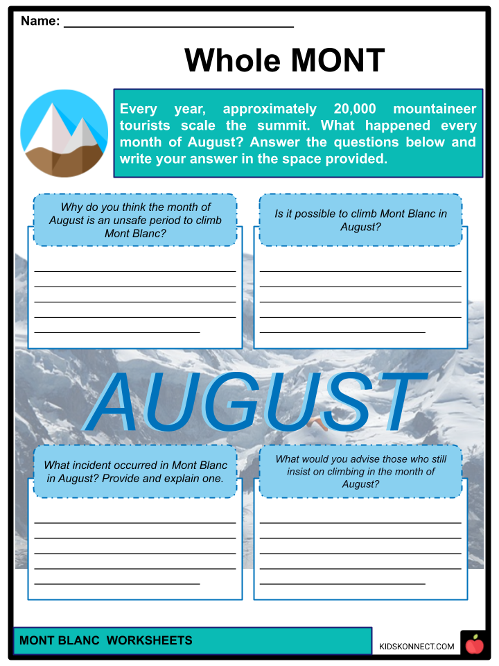
- Every year, approximately 20,000 mountaineer tourists scale the summit, and climbers are killed in Mont Blanc. On the peak weekends, usually around August, the local rescue service undertakes an average of 12 operations, most of which are directed at persons in distress on one of the mountain’s common routes. Patrick Sweeney, an American entrepreneur and traveler, attempted to beat the record by traveling with his nine-year-old son and 11-year-old daughter in July 2014. They got stuck in an avalanche, narrowly avoiding death, and decided not to continue their quest.
- Furthermore, Stéphane Brosse and Pierre Gignoux attempted to break the record via ski-walking on May 30, 2003. They ascended in 4 hours and 7 minutes and descended in 1 hour and 8 minutes. They completed the ascent and descent in 5 hours and 15 minutes. On August 9, 2012, fifty paraglider pilots landed on the summit, breaking the previous record of seven top landing pilots set in 2003. On August 13, 2003, seven French paraglider pilots arrived at the peak. They climbed to a height of 5,200 meters, where they encountered powerful hot air currents.
- Kilian Jornet set the fastest total time for ascent and descent on July 11, 2013, with 4 hours, 57 minutes, and 40 seconds. Emelie Forsberg established a women’s quickest known time up and down from Chamonix on June 21, 2018, with 7 hours, 53 minutes, and 12 seconds.
PROTECTION
- Because of its distinctiveness and cultural significance as the cradle and symbol of modern climbing, the Mont Blanc massif is being proposed as a possible World Heritage Site. Mont Blanc has become one of the world’s most popular tourist destinations. As a result, some see it as in jeopardy. The publication Le versant noir du Mont Blanc (The black hillside of Mont Blanc), released in 2002 by Pro-Mont Blanc (an international collective of groups for the protection of Mont Blanc), outlines existing and future concerns in maintaining the site.
- In 2007, Europe’s two highest toilets were flown to the summit of Mont Blanc by helicopter. Helicopters are often used to service them.
- They will assist 30,000 skiers and hikers per year, assisting with reducing urine and feces that flow down the mountain face during the spring thaw. The effects of global warming are starting to melt glaciers and produce avalanches on Mont Blanc, making climbing conditions more risky.
Mont Blanc Worksheets
This fantastic bundle includes everything you need to know about Mont Blanc across 29 in-depth pages. These ready-to-use worksheets are perfect for teaching kids about Mont Blanc. Mont Blanc, located on the French-Italian border, serves as the highest mountain in the Alps and Western Europe, as well as the highest mountain in Europe outside of the Caucasus mountains.
Complete List of Included Worksheets
Below is a list of all the worksheets included in this document.
- Mont Blanc Facts
- River of Words
- What’s In The Blanc?
- POV: POpular Visitation
- WALL OF FAME
- I Mont To Know!
- Whole MONT
- K-W-L Poster
- #A_MONT_TIP
- Take Note!
- MONT-ain-Maintain
Frequently Asked Questions
Where is Mont Blanc located?
Mont Blanc, also known as Monte Bianco, is located in the Western Alps, straddling the border between France and Italy. It is situated in the Graian Alps and belongs to the Mont Blanc Massif.
What is the elevation of Mont Blanc?
The summit of Mont Blanc stands at an elevation of 4,808.73 meters (15,777 feet) above sea level, making it the highest mountain in the Alps and the highest peak in Western Europe.
Can Mont Blanc be climbed by experienced mountaineers?
Yes, Mont Blanc is a popular destination for experienced mountaineers. Multiple routes are available, with varying levels of difficulty and technical challenges. However, climbing Mont Blanc requires proper training, physical fitness, and mountaineering skills, and it is recommended to have a qualified guide for safety.
What is the weather like on Mont Blanc?
The weather on Mont Blanc is highly changeable and can be harsh and unpredictable, even during summer months. It is known for its strong winds, low temperatures, and sudden weather shifts. Mountaineers must be prepared for rapidly changing conditions and adverse weather, including snow, fog, and storms.
What are some notable features and attractions near Mont Blanc?
Mont Blanc is surrounded by stunning natural beauty and offers numerous attractions and activities. Some notable features include the picturesque town of Chamonix in France, which serves as a popular base for climbers and outdoor enthusiasts. The Aiguille du Midi cable car provides breathtaking views of Mont Blanc and the surrounding peaks. Additionally, the Mont Blanc Tunnel, a road tunnel that passes beneath the mountain, connects Chamonix in France with Courmayeur in Italy, offering convenient access between the two countries.
Link/cite this page
If you reference any of the content on this page on your own website, please use the code below to cite this page as the original source.
Link will appear as Mont Blanc Facts & Worksheets: https://kidskonnect.com - KidsKonnect, August 9, 2023
Use With Any Curriculum
These worksheets have been specifically designed for use with any international curriculum. You can use these worksheets as-is, or edit them using Google Slides to make them more specific to your own student ability levels and curriculum standards.