Premium
 Download
Edit
Download
Edit
Download the Niger River Facts & Worksheets
Click the button below to get instant access to these worksheets for use in the classroom or at a home.
Download This Worksheet
This download is exclusively for KidsKonnect Premium members!
To download this worksheet, click the button below to signup (it only takes a minute) and you'll be brought right back to this page to start the download!
Sign Me Up
Edit This Worksheet
Editing resources is available exclusively for KidsKonnect Premium members.
To edit this worksheet, click the button below to signup (it only takes a minute) and you'll be brought right back to this page to start editing!
Sign Up
Not ready to purchase a subscription? Click to download the free sample version Download sample
Download This Sample
This sample is exclusively for KidsKonnect members!
To download this worksheet, click the button below to signup for free (it only takes a minute) and you'll be brought right back to this page to start the download!
Sign Me Up
Table of Contents
The Niger River, the main river in western Africa, spans a length of 2,600 miles (4,200 km), making it the third longest river on the continent, following the Nile and the Congo rivers. Its name is thought to have originated from Greek. As it flows, the river is referred to by various names at different points. In its upper course, it is known as the Joliba, meaning “great river.” In its central reach, it goes by the Mayo Balleo and Isa Eghirren, while in its lower stretch, it is called the Kwarra, Kworra, or Quorra.
See the fact file below for more information about the Niger River, or you can download our 28-page Niger River worksheet pack to utilize within the classroom or home environment.
Key Facts & Information
PHYSIOGRAPHY
- Originating at coordinates 9°05′ N and 10°47′ W on the eastern side of Guinea’s Fouta Djallon highlands, just 150 miles (240 km) from the Atlantic Ocean, the Niger River, initially known as the Tembi, starts its journey.
- Flowing north for the first 100 miles (160 km), it then takes a northeasterly direction, joining tributaries such as the Mafou, Niandan, Milo, and Sankarani on the right and the Tinkisso on the left as it enters Mali.
- The upper river ends just below Bamako, Mali’s capital, marked by the Sotuba Dam.
- Previously characterized by rapids dropping more than 1,000 feet (300 meters) in about 40 miles (60 km), this stretch has been altered by the Markala Dam downstream of the Sotuba Dam.
- From Koulikoro, the river changes its course to the east-northeast, with its bed relatively unobstructed for about 1,000 miles (1,600 km). At Mopti, the Niger merges with its largest right tributary, the Bani, entering a region of lakes, creeks, and backwaters known as the “internal delta.”
- The labyrinth of water features culminates at Kabara, the port of Timbuktu, where the river turns almost due east. Around 250 miles (400 km) downstream from Timbuktu, a narrow gorge pierces a rocky ridge, posing navigation challenges. Beyond this point, the river turns southeast, widens considerably, and flows through the southern fringe of the Sahara.
- The middle course of the Niger, navigable for small craft during high water up to Ansongo (1,100 miles or 1,770 km downstream from Timbuktu), experiences interruptions below Ansongo due to defiles and rapids. Navigation resumes at Labbezanga, continuing through Niger and down to the Atlantic Ocean. Seasonal variations in water levels impact navigation.
- In its lower course, downstream from Jebba in Nigeria, the Niger flows east-southeast through a broad valley, joined by the Kaduna River.
- Around 25 miles (40 km) above Lokoja, it turns south and receives its major tributary, the Benue, doubling its annual discharge volume.
- The confluence forms a lake-like stretch of water with islands and sandbanks. Between Idah and Onitsha, the Niger flows through a restricted valley, surrounded by hills and sandstone cliffs.
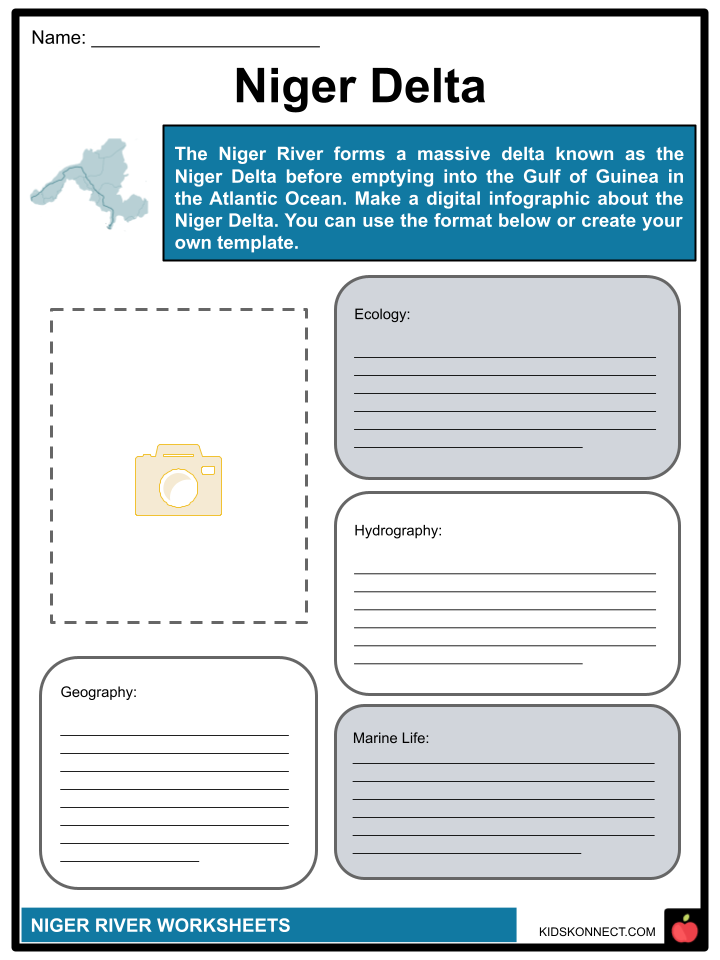
- At Onitsha, the valley narrows, and the river flows through a fault in the sandstone, emerging at Aboh and dividing into numerous branches before reaching the Gulf of Guinea through Africa’s largest delta.
- The Niger Delta occupies an area of around 14,000 square miles (36,000 square km), and it stretches along the shore for about 200 miles (320 km) for nearly 150 miles (240 km) from north to south.
- This vast delta region is characterized by an intricate network of channels called rivers. While the Nun River is considered a direct continuation of the Niger, other significant media include the Forcados, Brass, Sambreiro, and Bonny, all obstructed by sandbars at their mouths.
- Due to the river’s material, the delta has grown seaward over time, and mangrove swamps now stretch over its perimeter.
- The Benue River starts at 4,400 feet (1,350 meters) on the Adamawa Plateau in northern Cameroon. The name Benue means “Mother of Water” in the Batta language.
- Its upper course, extending north-northwest to its confluence with the Mayo Kébi near Garoua, is characterized by a mountain torrent descending more than 2,000 feet (600 meters) over 110 miles (180 km).
- The river turns westward upon entering Nigeria, flowing over a broad and fertile floodplain. Near Yola, some 850 miles (1,370 km) inland, the river’s width during floods ranges from 3,000 to 4,500 feet (910 to 1,370 meters).
- The Gongola, a significant tributary, joins the Benue on its north bank near Numan, downstream from Yola, along with other essential branches such as the Shemankar, Faro, Donga, and Katsina-Ala.
- The Niger, along with its tributaries, drains a total area of about 730,000 square miles (1,900,000 square km).
- Highlands, including the Fouta Djallon, Banfora Cliffs in Burkina Faso, Yorubaland Plateau, and Cameroon highlands, define the southern boundary of the Niger drainage system.
- These highlands act as a watershed, separating the Niger system from rivers that flow directly southward to the Atlantic Ocean.
- In contrast, the northern edge of the Niger basin, aside from highlands like the Jos Plateau, Iforas and Aïr massifs, and Ahaggar Mountains, is less distinctly delineated.
- Low-water months in the middle stretch are typically May and June. On the Benue, there is a singular high-water season, occurring from May to October, earlier than the central Niger due to the Benue’s more southerly location.
- The lower Niger, downstream from its confluence with the Benue, undergoes a high-water period starting in May or June, approximately a month earlier than the middle Niger. The low-water period is shorter by at least a month, as the southern rains commence earlier. In January, a slight rise occurred owing to floodwaters from the upper Niger. The difference between high and low water levels can often be as substantial as 35 feet (10 meters).
PLANT AND ANIMAL LIFE
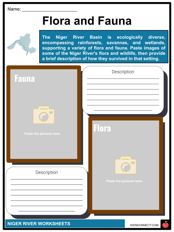
- The Niger River, in its course, spans nearly all the vegetational zones of western Africa.
- The Fouta Djallon plateau, the source of the Niger, is characterized by a type of sedge vegetation with fine, wirelike tufts and bare rock surfaces.
- Flowing from the Fouta Djallon to well below the confluence with the Benue, the river passes through savanna grassland terrain.
- The grass is short and scattered in the northern region, accompanied by thorny shrubs and acacia wood.
- Towards the south of the grassland region, tall tussocky grass intermingles with relatively dense wooded vegetation.
- Approximately at the latitude of Onitsha, the Niger enters the high rainforest belt, which blends with the mangrove swamp vegetation of the delta below Aboh.
- The Niger and its tributaries house a diverse array of fish species, with catfish, carp, and Nile perch being the primary food species. The river is home to various fauna, including hippopotamuses, three types of crocodiles (including the formidable Nile crocodile), and various lizards. The area is home to a wide variety of birds, including storks, herons, and egrets along the rivers and lakes, as well as geese in the lake area.
- The striking crown bird is prevalent in the open ground within the grassland zone, while pelicans and flamingos are notably associated with the upper Benue area. Smaller riverine bird species include white-headed plovers, crocodile birds, sandpipers, curlews, and green-red shanks.
PEOPLE AND ECONOMY
- The Niger Valley is sparsely populated, with notable concentrations of population in the lake region and around the confluence of the Niger and Benue.
- Historically, from the 13th to the 16th century, the valley served as the heartland of the Mali and Songhai empires, with some river towns dating back to this period.
- Larger groups, including the Bambara, Malinke, Songhai, and Zarma (Zerma, Djerma), make up the ethnic mix along the river; they live on both river banks above the Nigerian border.
- There are many tiny ethnic groups below this point.
- Fishing is a significant activity throughout the river system, particularly during the dry season when the catch from deep-sea and coastal fishing is at its lowest.
- River fishing is specialized in specific communities, including the Bozo and Somono in the lake region, the Sorko in the middle Niger, the Kede and Kakanda between Jebba and Lokoja, and the Wurbo and Jukun on the Benue.
- However, the discovery and exploitation of petroleum in the delta region have significantly disrupted fishing activities. Oil pollution has led to the depletion of fish stocks, impacting the economy of the Ijo (Ijaw) people in the region.
IRRIGATION
- Efforts to irrigate the Niger Valley to transform it into a densely populated agricultural corridor in the heart of western Africa have been a longstanding objective.
- In the 1930s, the French colonial administration initiated plans for extensive irrigation in the lake region, completing the Sansanding barrage in 1947 to elevate the Niger’s water level.
- This development included the construction of feeder canals, resulting in vast expanses of irrigated land that now cultivate rice, cotton, sugarcane, and vegetables.
- The British colonial administration promoted irrigated rice cultivation in the Bida region.
- Since the 1960s, Nigeria has witnessed the implementation of large-scale irrigation projects along the Niger and some of its tributaries, notably the Sokoto, Kaduna, and Benue.
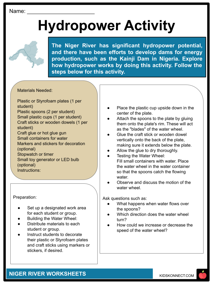
- Furthermore, the Niger serves as a significant source of hydroelectric power.
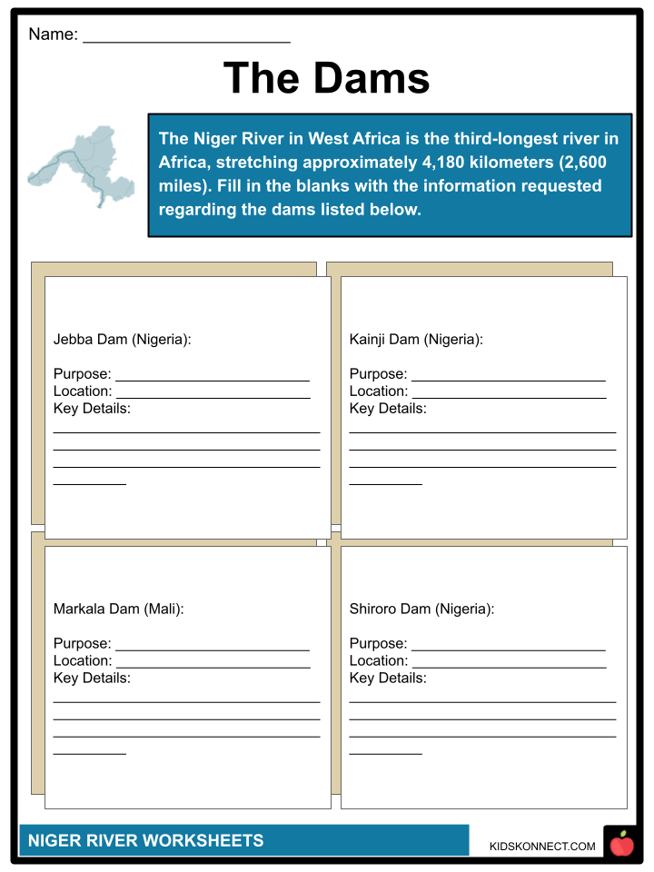
- The foremost project is the Kainji Dam in Nigeria, completed in the late 1960s, which has created a 500-square-mile (1,300-square-km) lake upstream, offering opportunities for fishing and irrigation.
- Additional projects include the Sotuba and Markala dams in Mali, along with barriers at Jebba (on the Niger) and Shiroro (on the Kaduna tributary) in Nigeria.
TRANSPORTATION
- A significant portion of the Niger River, accounting for more than three-fourths of its total length, is utilized for commercial shipping. The river is navigable year-round by large vessels from the Atlantic Ocean to Onitsha.
- Moving from Onitsha to the confluence of the Benue and the Niger, large ships can operate for ten months (June–March) due to the high water levels from the Benue River, which peaks in June. Navigation from Lokoja to Jebba is restricted from October to mid-November.
- Jebba essentially marks the uppermost point for navigation on the Niger waterway, with extreme water level fluctuations posing a challenge for vessels beyond Lokoja.
- Beyond Jebba, the Niger is navigable only for smaller craft and is contingent on local conditions when water levels are sufficient.
- Numerous rail and road routes intersect the river. Railway bridges are found at Kouroussa and Jebba, with another crossing the Benue at Makurdi.
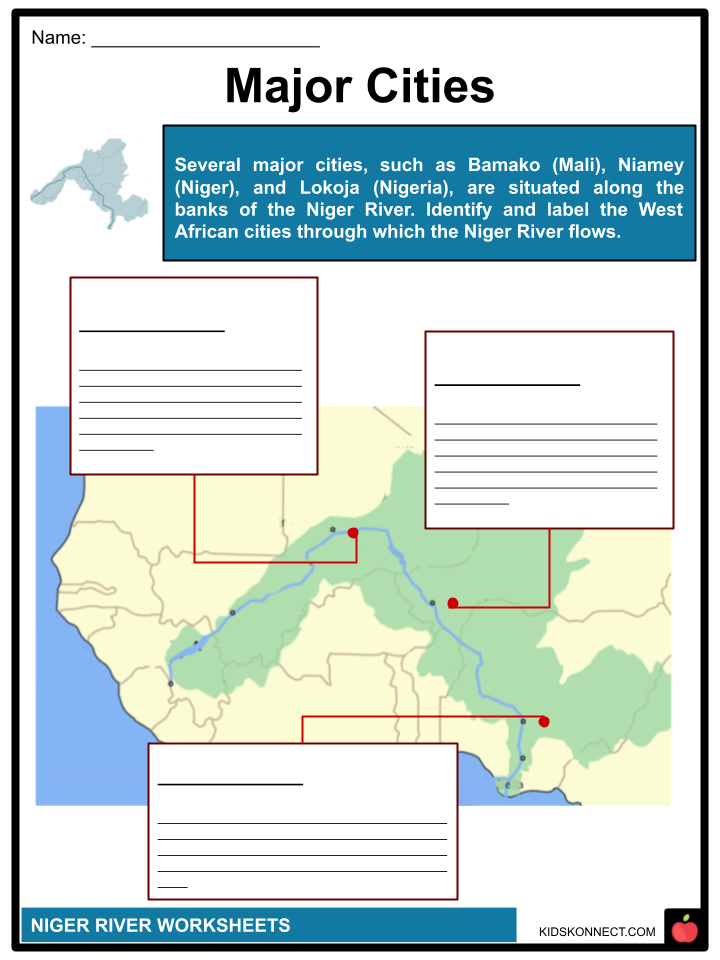
- Road bridges over the Niger are located at Bamako, Niamey, Ségou, Malanville, Kainji, Jebba, Lokoja, and Onitsha, while those over the Benue can be found at Makurdi, Numan, and Yola. Ferries operate at various points, including crossings at Bamako, Gao, Niamey, Yelwa, and Idah over the Niger, and at Garoua over the Benue.
- Key river ports include Koulikoro, Timbuktu, Baro, Onitsha, Burutu, and Koko.
- The coordination of multinational initiatives for the development of the Niger and its tributaries falls under the purview of the Niger River Commission, established in 1963.
- The Commission has sponsored a study on the navigational possibilities of the middle Niger, spanning from Gao (Mali) to Yelwa (Nigeria). Various river basin development authorities have also been set up in Nigeria to advance irrigation and fishing projects.
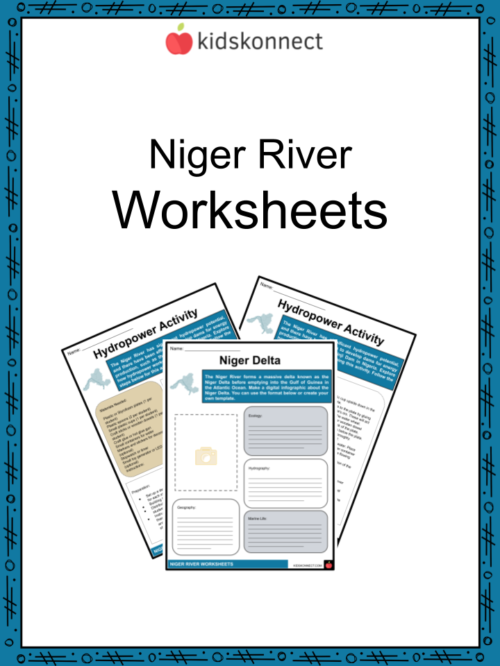
Niger River Worksheets
This fantastic bundle includes everything you need to know about the Niger River across 28 in-depth pages. These ready-to-use worksheets are perfect for teaching kids about the Niger River. Its name is thought to have originated from the Greek. As it flows, the river is referred to by various names at different points. In its upper course, it is known as the Joliba, meaning “great river.” In its central reach, it goes by the Mayo Balleo and Isa Eghirren, while in its lower stretch, it is called the Kwarra, Kworra, or Quorra.
Complete List of Included Worksheets
Below is a list of all the worksheets included in this document.
- Niger River Facts
- Major Cities
- The Dams
- Niger Delta
- Flora and Fauna
- Trading Route
- Hydropower Activity
- Show my Significance
- Video Takeaway
- Preserving Beauty
- Can You See It?
Frequently Asked Questions
Where is the Niger River located?
The Niger River is located in West Africa. It is one of the continent’s major rivers, flowing through several countries, including Guinea, Mali, Niger, Nigeria, Benin, Chad, Cameroon, and Côte d’Ivoire.
What is the significance of the Niger River for the surrounding regions?
The Niger River is of great significance for the surrounding regions as it serves as a vital water source for agriculture, providing irrigation for crops and supporting the livelihoods of many communities. Additionally, it facilitates transportation and trade, playing a crucial role in the economic development of the areas it traverses.
What is the Niger Delta, and why is it important?
The Niger Delta is the delta of the Niger River, located in Nigeria. It is a vast and ecologically diverse region. The delta is important because it is a major oil-producing area, contributing significantly to Nigeria’s oil industry. However, oil exploration has also led to environmental concerns and challenges in the region.
What are some of the major tributaries of the Niger River?
The Niger River has several major tributaries. Two significant ones are the Benue River and the Sokoto River. The Benue River is the principal tributary, originating in the Adamawa Plateau and joining the Niger River in Nigeria. The Sokoto River also flows into the Niger River in northwestern Nigeria.
Are there any notable landmarks or features along the Niger River?
One notable landmark along the Niger River is the Niger Inland Delta, also known as the Inner Niger Delta. It is a large inland delta formed by the river’s complex system of distributaries and is a critical wetland ecosystem. The city of Timbuktu in Mali is another notable historical and cultural center located near the Niger River.
Link/cite this page
If you reference any of the content on this page on your own website, please use the code below to cite this page as the original source.
Link will appear as Niger River Facts & Worksheets: https://kidskonnect.com - KidsKonnect, January 31, 2024
Use With Any Curriculum
These worksheets have been specifically designed for use with any international curriculum. You can use these worksheets as-is, or edit them using Google Slides to make them more specific to your own student ability levels and curriculum standards.