Premium
 Download
Edit
Download
Edit
Download the Northern Territory, Australia Facts & Worksheets
Click the button below to get instant access to these worksheets for use in the classroom or at a home.
Download This Worksheet
This download is exclusively for KidsKonnect Premium members!
To download this worksheet, click the button below to signup (it only takes a minute) and you'll be brought right back to this page to start the download!
Sign Me Up
Edit This Worksheet
Editing resources is available exclusively for KidsKonnect Premium members.
To edit this worksheet, click the button below to signup (it only takes a minute) and you'll be brought right back to this page to start editing!
Sign Up
Not ready to purchase a subscription? Click to download the free sample version Download sample
Download This Sample
This sample is exclusively for KidsKonnect members!
To download this worksheet, click the button below to signup for free (it only takes a minute) and you'll be brought right back to this page to start the download!
Sign Me Up
Table of Contents
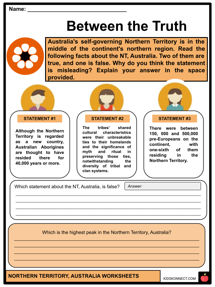
The Timor and Arafura Seas to the north, Western Australia to the west, Queensland and the Gulf of Carpentaria to the east, and South Australia to the south define the boundaries of the Northern Territory. Australia’s self-governing Northern Territory is in the middle of the continent’s northern region.
See the fact file below for more information about the Northern Territory, Australia, or you can download our 31-page Northern Territory worksheet pack to utilize within the classroom or home environment.
Key Facts & Information
HISTORICAL BACKGROUND
- Although the Northern Territory is regarded as a new country, Australian Aborigines are thought to have resided there for 40,000 years or more.
- However, the origins of the Aborigines and their settlement pattern are still unknown. There were between 250,000 and 1,000,000 pre-Europeans on the continent, with one-sixth residing in the Northern Territory.
- The tribes’ shared cultural characteristics were their unbreakable ties to their homelands and the significance of myth and ritual in preserving those ties, notwithstanding the diversity of tribal and clan systems.
- The eastern shore of the Gulf of Carpentaria was explored in 1605 by the Dutch explorer ship Duyfken under the command of Willem Jansz. Willem van Colster landed eighteen years later on the Arnhem northwest of the land that bears the ship’s name.
- Furthermore, Abel Janszoon Tasman (1642 and 1644), Pieter Pieterszoon (1636), and other Dutch explorers came after. The Aborigines had no trade products. Thus, the Dutch, being traders, were of little interest to them.
- A few French names are scattered around the western shores after the brief visit of French navigator Nicolas Baudin in Le Géographe in 1803.
- But it was Lieut Phillip Parker King, the third governor of New South Wales’s son, who initially mapped that treacherous coast in a number of historic expeditions between 1818 and 1822.
- Between 1837 and 1843, John Clements Wickham and John Lort Stokes, in the Beagle, the same vessel that had earlier transported naturalist Charles Darwin to South America in the 1830s, completed the remaining significant gaps in the coastal survey of northern Australia.
- British Settlement- Three military installations were established on the territorial coast by the British, who believed they could exploit the trade of the eastern Malay Archipelago, just as the Dutch had done in Java, and because they wanted to seize all of Australia.
- These were Victoria at Port Essington (1838–49), Fort Wellington at Raffles Bay (1827–29), and Fort Dundas on Melville Island (1824–29). All of them failed when the commerce stagnated, and no one showed up to challenge the British claim to Australia.
- The Prussian naturalist Ludwig Leichhardt, who traveled a great distance by land from southeast Queensland to Port Essington in 1844–1845, was drawn to Victoria nevertheless. Augustus Charles Gregory led a well-organized expedition from the Victoria River plains eastward across the territory to the coast of Queensland in 1855–1856.
- Sheepherding took precedence over cattle drives, the foundation of the northern region’s image since the late 1800s. The northern border region of the territory saw the introduction of sheep in 1866 due to the westward migration of Queensland graziers.
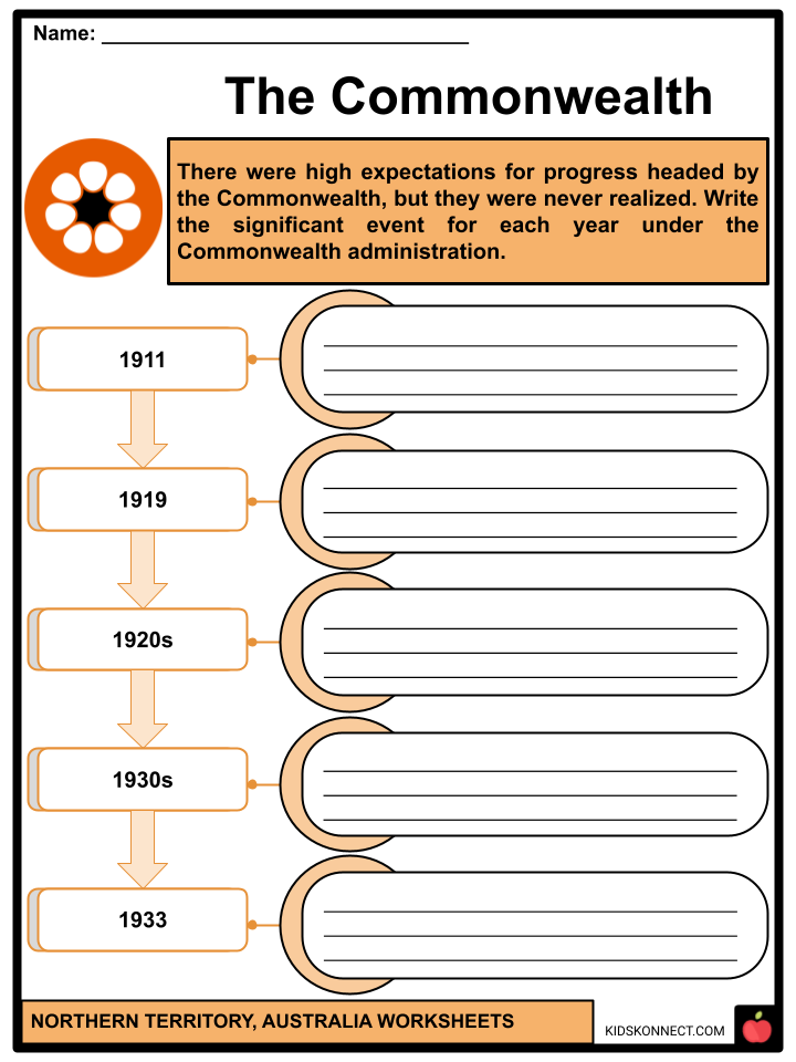
- The Northern Territory under Commonwealth administration- The Northern Territory came under the jurisdiction of the newly established Commonwealth of Australia government on January 1, 1911.
- There were high expectations for progress headed by the Commonwealth, but they were never realized. The first Commonwealth administrator, John Anderson Gilruth, was forced to leave the territory in February 1919 due to the Darwin rebellion and conflicts between labor unions and the administration caused by World War I. Despite years of relative success elsewhere in Australia during the 1920s, the territory did not see much economic growth. The 1930s Great Depression had a devastating effect on the region. In an attempt to find a way to develop the territory, the federal government offered a large portion of it to corporations that had been chartered in 1933.
GEOGRAPHY
- Mangrove swamps surround the majority of the flat. There are numerous offshore islands; the main ones are Groote Eylandt, also known as the “Big Island,” and the islands of Melville and Bathurst.
- Following rainstorms, several rivers flow from the south-central mountains, the largest being the Todd and the Finke. The Northern Territory is home to around a dozen different varieties of soil.
- Particularly prevalent are deep, earthy soils in the northern portion of the country, referred to as the “Top End.” The Victoria River basin contains minor patches of soils with elevated calcium carbonate concentrations and iron-rich basaltic soils. Cracking clays are found on the Barkly Tableland, the northern coastal floodplain, and the alluvial plains of Victoria.
- The semiarid regions of the Douglas, Daly, and Katherine Rivers have soils suitable for farming with significant potential for agricultural growth. There are two distinct seasons in the territory’s monsoonal climate: a wet summer (November to April) and a dry winter (May to October). Rainfall is somewhat erratic and mainly occurs in the summer.
- The annual rainfall in the southeast is just 5 inches compared to 60 inches in the north, reflecting the region’s growing reliance on tropical thunderstorms and the declining power of the northwest monsoon.
FLORA AND FAUNA
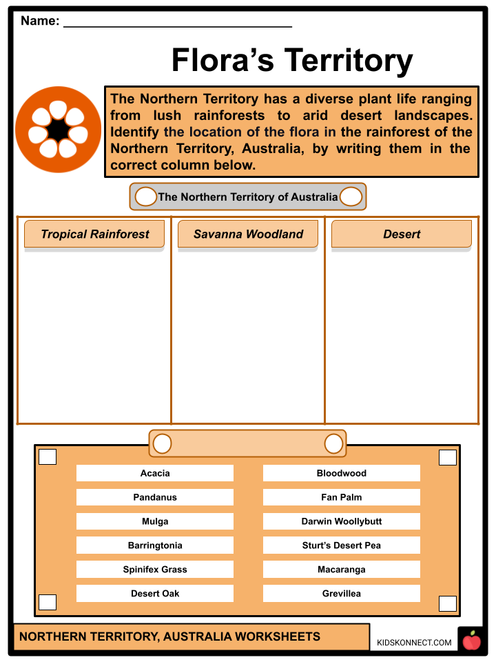
- Arnhem Land contains a few woods with vegetation typical of the Southeast Asian peninsula and archipelago. The northern vegetation primarily comprises long grasses with low nutritional value for livestock and open woodland with few eucalypts. The association of short grasses and mulga (an acacia tree) in the valleys supplies feed. The red plains of the surrounding desert are covered with mixed mulga-spinifex scrub, and further west is a desert of hummock grassland made up of widely separated clumps of Triodia and spinifex.
- The region is home to about 150 different species of mammals, including numerous bat species, nearly two dozen marine mammals, numerous species of rock rats, and a wide range of marsupials. There are more than 100 species of skinks, making them the most prevalent reptile in the area.
- Moreover, the two most famous frogs are the superb tree frog (Litoria splendida) and the green tree frog (Litoria caerulea). Only after a significant downpour do other frogs in the southern portion of the region surface. The barramundi is the most well-known fish in the region.
ECONOMY
- After migrating from nearby Southeast Asia regions, Aboriginal people have lived in the Northern Territory for at least 40,000 years. Between 35,000 and 70,000 of these native people are thought to have lived in the area when the British started establishing military colonies in the early 19th century.
- The Aboriginal people once lived in foraging regions across the territory, but due to government regulations, they were relocated. Over 25% of the population resides in urban areas, primarily in suburban homes and town camps or Aboriginal living areas.
- Meanwhile, defense, public services, and other government management have long been the foundation of the Northern Territory’s economy.
- The economic sectors of forestry, fishing, and agriculture make up very little of the territory’s total GDP. Grazing land for livestock, predominantly beef cattle, is used for nearly half of the territory’s area. The majority of the remaining land is designated for indigenous traditional use. Due to their biological and cultural significance, forest resources are typically preserved.
GOVERNMENT AND SOCIETY
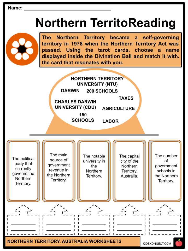
- The Northern Territory became a self-governing territory in 1978 when the Northern Territory Act was passed. The majority of the Commonwealth of Australia’s governing authority was given to the territory by this act. In areas of transferred authority, the territory’s government, which has its headquarters in Darwin, is comparable to that of the states. The Northern Territory has representation in Parliament by the federal government. The Northern Territory’s legal framework and the authority of its courts are comparable to those of the states. The Supreme Court is the highest court considering both initial cases involving severe offenses and appeals from lesser courts.
- Diabetes, disorders linked to food and alcohol consumption, TB, and other infectious diseases are among the leading health issues facing Aboriginal people. The goal of several unique initiatives is to enhance the health of Aboriginal people.
- On the other hand, the government’s preschools and elementary schools provide good service to the territory. Even though many schools in Aboriginal communities provide specific post-primary courses, most secondary schools, often known as high schools, are found in urban areas.
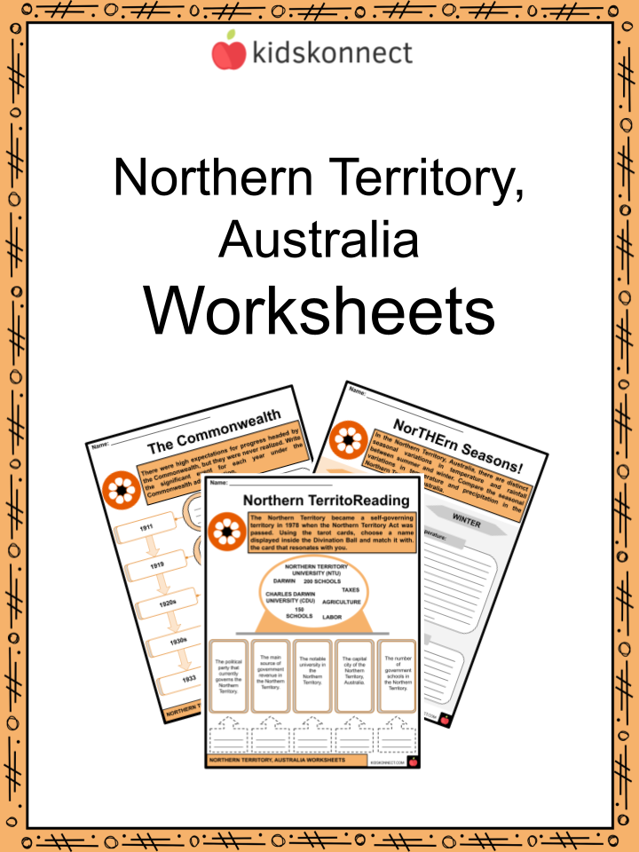
Northern Territory, Australia Worksheets
This fantastic bundle includes everything you need to know about the Northern Territory, Australia, across 31 in-depth pages. These ready-to-use worksheets are perfect for teaching kids about the Northern Territory. Australia’s self-governing Northern Territory is in the middle of the continent’s northern region.
Complete List of Included Worksheets
Below is a list of all the worksheets included in this document.
- Northern Territory, Australia Facts
- Flora’s Territory
- Northern TerritoReading
- Between the Truth
- NorTHErn Seasons!
- The Commonwealth
- Natural Beauties
- I’m Planning …
- Survival of the Fittest
- Watch From Here!
- Picture_Perfect!
Frequently Asked Questions
What is the Northern Territory known for in terms of wildlife?
The Northern Territory is renowned for its diverse and unique wildlife, including iconic species such as saltwater crocodiles, kangaroos, wallabies, and various species of native birds.
What are some key industries that contribute to the economy of the Northern Territory?
The Northern Territory’s economy is influenced by industries such as mining, agriculture, tourism, and natural gas. Mining activities include the extraction of minerals like gold, uranium, and natural gas.
Are there any significant Indigenous cultural sites in the Northern Territory?
Yes, the Northern Territory is home to numerous Indigenous cultural sites, including ancient rock art sites in places like Kakadu National Park and Arnhem Land, showcasing the rich cultural history of the Aboriginal people.
What is the Timor Sea, and how does it relate to the Northern Territory?
The Timor Sea is a relatively shallow sea situated to the north of Australia. It is significant for the Northern Territory as it forms part of its northern maritime boundary, and the city of Darwin is located on its coast.
How does the Northern Territory commemorate its history during World War II?
The Northern Territory played a crucial role during World War II, and remnants of this history can be explored at sites like the Darwin Military Museum and the Adelaide River War Cemetery, commemorating the impact of war on the region.
Link/cite this page
If you reference any of the content on this page on your own website, please use the code below to cite this page as the original source.
Link will appear as Northern Territory, Australia Facts & Worksheets: https://kidskonnect.com - KidsKonnect, February 14, 2024
Use With Any Curriculum
These worksheets have been specifically designed for use with any international curriculum. You can use these worksheets as-is, or edit them using Google Slides to make them more specific to your own student ability levels and curriculum standards.