Premium
 Download
Edit
Download
Edit
Download the Geology Facts & Worksheets
Click the button below to get instant access to these worksheets for use in the classroom or at a home.
Download This Worksheet
This download is exclusively for KidsKonnect Premium members!
To download this worksheet, click the button below to signup (it only takes a minute) and you'll be brought right back to this page to start the download!
Sign Me Up
Edit This Worksheet
Editing resources is available exclusively for KidsKonnect Premium members.
To edit this worksheet, click the button below to signup (it only takes a minute) and you'll be brought right back to this page to start editing!
Sign Up
Not ready to purchase a subscription? Click to download the free sample version Download sample
Download This Sample
This sample is exclusively for KidsKonnect members!
To download this worksheet, click the button below to signup for free (it only takes a minute) and you'll be brought right back to this page to start the download!
Sign Me Up
Table of Contents
Geology (derived from the Ancient Greek (gê) ‘earth’ and -loga ‘study of, discourse’) is a field of natural science concerned with the Earth and other celestial objects, their characteristics or rocks, and the mechanisms by which they change through time. Because modern geology integrates with all other Earth sciences, including hydrology and atmospheric sciences, it is a crucial component of integrated Earth system and planetary science.
See the fact file below for more information about Geology, or you can download our comprehensive worksheet pack to utilize within the classroom or home environment.
Key Facts & Information
OVERVIEW
- Geology studies the form of the Earth on and under its surface, as well as the processes that shape that structure.
- It also incorporates methods for defining the relative and absolute ages of rocks discovered in a particular place and describing the histories of those rocks. Geologists may document the Earth’s geological history and demonstrate the Earth’s age by combining these technologies.
- Geology is the primary source of evidence for plate tectonics, the development of life, and the historical climates of the Earth.
- Geologists study the Earth’s structure and development using several techniques, including field investigation, rock description, geophysical methods, chemical analysis, physical tests, and numerical modeling.
- In practice, geology is crucial for mineral and hydrocarbon exploration and exploitation, water resource evaluation, identifying natural hazards, environmental issue remediation, and offering insights into historical climate change.
- Geology is a vital academic field essential to geological engineering and geotechnical engineering.
GEOLOGIC MATERIAL
MINERAL
- Minerals are naturally occurring elements and compounds with a distinct homogenous chemical makeup and organized atomic structure.
- Each mineral has unique physical qualities, and there are several tests to determine them. Can check the sample for the following:
- Luster: The kind of light reflected from a mineral’s surface. Metallic, glossy, waxy, and drab are some examples.
- Color: Minerals are classified according to their color. Although primarily diagnostic, impurities can modify the color of a mineral.
- Streak: This effect is created by scratching the sample on a porcelain plate. The color of the streak might aid in identifying the mineral.
- Hardness is a mineral’s resistance to scratching.
- A mineral’s breaking pattern might be fracture or cleavage, with the former being breakage of uneven surfaces and the latter being breakage along closely spaced parallel planes.
- Specific gravity is the mass of a mineral in a given volume.
- Effervescence: is tested by dropping hydrochloric acid on the mineral to see if it fizzes.
- Magnetism testing: using a magnet to determine magnetism.
- Minerals, such as halite, can have a particular flavor (which tastes like table salt).
ROCK
- Any naturally occurring solid mass or combination of minerals or mineraloids is called rock.
- The majority of geological research is related to the study of rocks, as they give the primary record of the majority of Earth’s geological history.
- Igneous, sedimentary, and metamorphic rocks are the three primary kinds of rock. The rock cycle depicts their interrelationships.
- Igneous rock hardens or crystallizes from melt (magma or lava). This rock can weather and erode before being redeposited and lithified as a sedimentary rock.
- It can then be metamorphosed into a metamorphic rock by applying heat and pressure to modify its mineral composition, resulting in a distinctive fabric.
- All three types of rocks may melt again, forming fresh magma from which an igneous rock can crystallize anew.
- Organic matter is primarily associated with organic-rich sedimentary rocks, such as coal, bitumen, oil, and natural gas.
- Geologists investigate all three rock forms by evaluating the minerals that make them up and their other physical features, such as texture and fabric.
UNLITHIFIED MATERIAL
- Geologists also investigate unlithified materials (known as superficial deposits) that exist above the bedrock.
- This field of study is referred to as Quaternary geology, which represents the most recent period of geologic time after the Quaternary period of geologic history.
MAGMA
- The primordial unlithified source of all igneous rocks is magma.
- Volcanology closely studies the dynamic flow of molten rock, while igneous petrology attempts to establish the history of igneous rocks from their initial molten source to their ultimate crystallization.
METHODS OF GEOLOGY
- Geologists read Earth history and comprehend the processes that occur on and inside the Earth using a variety of field, laboratory, and numerical modeling methodologies.
- Geologists often employ primary data from petrology (the study of rocks), stratigraphy (the study of sedimentary layers), and structural geology in their research (the study of positions of rock units and their deformation).
- In many situations, geologists also research modern soils, rivers, landscapes, and glaciers; explore past and present life and biogeochemical cycles, and investigate the subsurface using geophysical tools. Endogenous and exogenous geology are sub-specialties of geology.
FIELD METHODS
- Depending on the task at hand, geological field labor varies. Typical fieldwork might include:
- Structural mapping is locating the locations of central rock units and the faults and folds that contributed to their placement.
- Stratigraphic mapping is locating sedimentary facies (lithofacies and biofacies) or isopachs of a similar thickness of sedimentary rock.
- Surficial mapping is documenting the locations of soils and surficial deposits.
- Topographic feature surveying compilation of topographic maps Work on understanding change across landscapes, such as erosion and deposition patterns, river-channel alteration due to migration and avulsion, and hillslope processes.
- Geophysical technologies are used to map the subsurface. These approaches include shallow seismic surveys, ground-penetrating radar, aeromagnetic surveys, and electrical resistivity tomography. They help with hydrocarbon research, groundwater discovery, and the discovery of buried archaeological items.
- Stratigraphy with high resolution. Surface stratigraphic section measurement and description Well drilling and logging
- Geomicrobiology and biogeochemistry Collecting samples to identify new types of organisms, identify new chemical compounds, and utilize these findings to understand early life on Earth and how it functioned and metabolized, locate significant molecules for use in pharmaceuticals.
- Paleontology is the excavation of fossil material for studying past life and evolution and for museums and education.
- Sample collection for geochronology and thermochronology
- Glaciology is the study of glacier features and movement.
PETROLOGY
- Petrologists classify rock samples in the laboratory in addition to recognizing rocks in the field (lithology).
- Optical microscopy and an electron microprobe are two of the most used ways of identifying rocks in the laboratory.
- Petrologists use a petrographic microscope to examine tiny pieces of rock samples to identify minerals based on their characteristics in plane-polarized and cross-polarized light, such as birefringence, pleochroism, twinning, and interference qualities using a conoscopic lens.
- Individual sites are investigated with the electron microprobe for their specific chemical compositions and variations in a piece within individual crystals. Studies of stable and radioactive isotopes shed light on the geochemical development of rock units.
- Petrologists can also employ fluid inclusion data and high-temperature and pressure physical tests to learn about the temperatures and pressures at which distinct mineral phases develop and how they change during igneous and metamorphic processes.
- May apply this research to understand metamorphic processes and igneous rock crystallization settings. This research can also assist in explaining Earth processes like subduction and magma chamber development.
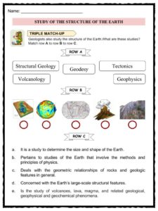
STRUCTURAL GEOLOGY
- Structural geologists study the fabric inside the rocks via microscopic inspection of oriented thin slices of geological materials, which provides information about strain within the crystalline form of the stones.
- They also plot and integrate geological structural observations to understand fault better and fold orientations and recreate the history of rock deformation in the area. They also conduct analog and numerical tests on rock deformation in big and small settings.
- Structures are frequently analyzed by projecting the orientations of various characteristics onto stereonets. A stereonet is a projection of a sphere onto a plane in which planes become lines and lines become points. These can determine the positions of fold axes, fault linkages, and other geological features.
- The most well-known structural geology experiments are orogenic wedges, zones where mountains form along convergent tectonic plate borders.
- In analog versions of similar experiments, horizontal layers of sand are dragged along a lower surface into a backstop, resulting in realistic-looking faulting patterns and the formation of a critically tapered (all angles remain constant) orogenic wedge.
- Numerical models function similarly to analog models but are frequently more advanced and can include sequences of erosion and elevation in the mountain belt.
- It helps to demonstrate the link between erosion and mountain range form. These investigations can also provide important information concerning metamorphism routes, including pressure, temperature, space, and time.
STRATIGRAPHY
- Stratigraphers evaluate samples of stratigraphic segments that can be retrieved from the field, such as drill cores, in the laboratory. Stratigraphers also examine geophysical survey data to determine the positions of stratigraphic units in the subsurface.
- May merge geophysical data and well logs to provide a complete picture of the subsurface, and stratigraphers frequently employ computer tools to do it in three dimensions.
- Stratigraphers may then use these data to recreate ancient processes on the Earth’s surface, interpret historical conditions, and pinpoint regions for water, coal, and hydrocarbon extraction.
- Biostratigraphers examine the laboratory’s rock samples from outcrops and drill cores for fossils. These fossils aid scientists in determining the center’s age and understanding the depositional environment in which the rock units developed.
- Geochronologists precisely date rocks within stratigraphic sections to offer more critical absolute limitations on deposition dates and rates. Magnetic stratigraphers examine drill cores for traces of magnetic setbacks in igneous rock formations. Other scientists study the rocks’ stable isotopes to learn more about the historical climate.
APPLIED GEOLOGY
ECONOMIC GEOLOGY
- Economic geology is a field of geology that studies the economic minerals that humans utilize to meet a variety of purposes.
- Can profitably extract economic minerals for a wide range of practical applications. Mineral wealth, such as petroleum and coal, as well as mineral resources, such as iron, copper, and uranium, are discovered and managed by economic geologists.
MINING GEOLOGY
- The extraction of mineral resources from the Earth is the subject of mining geology.
- Gems, metals such as gold and copper, and minerals such as asbestos, perlite, phosphates, zeolites, clay, quartz, and silica, as well as chemical elements such as sulfur, chlorine, and helium, are examples of economic resources.
PETROLEUM GEOLOGY
- Petroleum geologists investigate the places in the Earth’s subsurface that may contain extractable hydrocarbons, particularly petroleum and natural gas.
- Because many of these reservoirs are situated in sedimentary basins, they investigate their genesis, sedimentary and tectonic development, and the rock blocks’ current placements.
ENGINEERING GEOLOGY
- Engineering geology is the implementation of geological concepts into engineering practice to ensure that geological variables impacting the site, design, building, operation, and maintenance of engineering works are addressed effectively.
- In North America, engineering geology differs from geological engineering.
- Geological principles and analyses are utilized in civil engineering to determine the mechanical principles of the material on which buildings are built.
- It enables tunnels to be constructed without collapsing and bridges and skyscrapers to be built with solid foundations and structures that will not settle in clay and mud.
HYDROLOGY
- May use geology and geological concepts for various environmental concerns, including stream restoration, brownfield restoration, and understanding the interplay between natural habitat and the geological environment.
- Groundwater hydrology, also known as hydrogeology, is the study of groundwater, which may frequently deliver a ready supply of uncontaminated water and is primarily significant in dry places, as well as the monitoring of pollutants in groundwater wells.
PALEOCLIMATOLOGY
- Geologists collect information through stratigraphy, boreholes, core samples, and ice cores.
- Paleoclimate reconstructions employ ice and sediment cores to teach geologists about global historical and current temperatures, precipitation, and sea levels.
- These databases are our primary source of knowledge on global climate change outside observational data.
NATURAL HAZARDS
- Geologists and geophysicists investigate natural hazards to develop safe construction regulations and warning systems to prevent property and life loss.
- Avalanches, earthquakes, flooding, landslides, debris flows, river channel migration and avulsion, rockfalls, sinkholes, and soil liquefaction are significant natural hazards relevant to geology (as opposed to those primarily or only applicable to meteorology). Subsidence, tsunamis, and volcanic eruptions
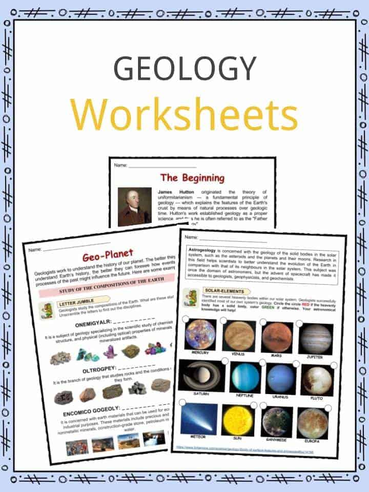
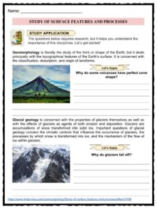
Geology Worksheets
This bundle contains 11 ready-to-use Geology Worksheets that are perfect for students who want to learn more about Geology, which is the study of the nonliving things that the Earth is made of. Geology is the study of rocks in the Earth’s crust. People who study geology are called geologists.

Download includes the following worksheets:
- Geology Facts
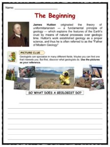
- The Beginning – Picture Clue
- Pillars of Geology
- Geo-Planet – Letter Jumble
- The Precious
- Triple Match-up
- Study Application
- Time Hop in Pictures
- Fossil Guess
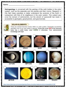
- Solar Elements
- Key Answers
Frequently Asked Questions
What is geology?
Geology studies the form of the Earth on and under its surface, as well as the processes that shape that structure.
Why is it essential to study geology?
Geology studies the form of the Earth on and under its surface, as well as the processes that shape that structure. It also incorporates methods for defining the relative and absolute ages of rocks discovered in a particular place and describing the histories of those rocks. Geologists may document the Earth’s geological history and demonstrate the Earth’s age by combining these technologies.
What do stratigraphers do?
Stratigraphers evaluate samples of stratigraphic segments that can be retrieved from the field, such as drill cores, in the laboratory. Stratigraphers also examine geophysical survey data to determine the positions of stratigraphic units in the subsurface.
What is the job of a petroleum geologist?
Petroleum geologists investigate the places in the Earth’s subsurface that may contain extractable hydrocarbons, particularly petroleum and natural gas.
What natural hazards are pertinent to geology?
Avalanches, earthquakes, flooding, landslides, debris flows, river channel migration and avulsion, rockfalls, sinkholes, and soil liquefaction are significant natural hazards relevant to geology (as opposed to those primarily or only applicable to meteorology), subsidence, tsunamis, and volcanic eruptions.
Link/cite this page
If you reference any of the content on this page on your own website, please use the code below to cite this page as the original source.
Link will appear as Geology Facts & Worksheets: https://kidskonnect.com - KidsKonnect, October 27, 2017
Use With Any Curriculum
These worksheets have been specifically designed for use with any international curriculum. You can use these worksheets as-is, or edit them using Google Slides to make them more specific to your own student ability levels and curriculum standards.