Premium
 Download
Edit
Download
Edit
Download the Kiribati Facts & Worksheets
Click the button below to get instant access to these worksheets for use in the classroom or at a home.
Download This Worksheet
This download is exclusively for KidsKonnect Premium members!
To download this worksheet, click the button below to signup (it only takes a minute) and you'll be brought right back to this page to start the download!
Sign Me Up
Edit This Worksheet
Editing resources is available exclusively for KidsKonnect Premium members.
To edit this worksheet, click the button below to signup (it only takes a minute) and you'll be brought right back to this page to start editing!
Sign Up
Not ready to purchase a subscription? Click to download the free sample version Download sample
Download This Sample
This sample is exclusively for KidsKonnect members!
To download this worksheet, click the button below to signup for free (it only takes a minute) and you'll be brought right back to this page to start the download!
Sign Me Up
Table of Contents
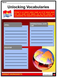
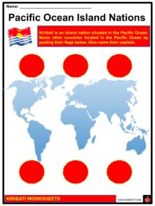
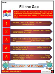
Kiribati is an island nation situated in the central Pacific Ocean, made up of 32 island atolls and one small coral island spread out over 1.3 million square miles. The country itself, however, covers only 313 square miles (811 sq km) of the area. Kiribati straddles the International Date Line on its easternmost islands and straddles the Earth’s equator.
See the fact file below for more information on the Kiribati or alternatively, you can download our 20-page Kiribati worksheet pack to utilise within the classroom or home environment.
Key Facts & Information
HISTORY
- Kiribati is an island nation in the Pacific Ocean pronounced “KiriBASS”.
- It was first settled by the I-Kiribati people around 1000 BCE.
- The earliest Europeans arrived on the island in the 1500s, but it wasn’t until the 1800s that they started to arrive in larger numbers. They introduced diseases and caused social conflicts.
- In 1892, the British took control of the islands which were called the Gilbert Islands at the time. They became an official British colony in 1916.
- During World War II, Japan gained control of some of the islands.
- The Pacific portion of the war reached Kiribati when United States forces launched attacks on the Japanese forces on the islands in 1943.
- In the 1960s, Britain began granting Kiribati more freedom of self-government.
- In 1977, the Gilbert Islands were given more self-governing powers. On July 12, 1979, they became independent with the name Kiribati and the first president of was Ieremia Tabai.
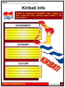
GOVERNMENT
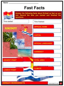
- Now, Kiribati is considered a republic. It’s officially called the Republic of Kiribati.
- The country’s capital is Tarawa.
- The executive branch of government is made up of a chief of state and a leader of the government. Both of these positions are filled by Kiribati’s president. Kiribati additionally has a unicameral House of Parliament for its legislative branch and Court of Appeal, High Court, and 26 Magistrates’ courts for its judicial branch. Kiribati is separated into three different units, the Gilbert Islands, the Line Islands, and the Phoenix Islands, for local administration.
- There are also 6 different island districts and 21 island councils for Kiribati’s islands.
ECONOMY
- Since Kiribati is in a remote location and its area is spread over 33 small islands, it is one of the least developed Pacific island nations.
- It also has limited natural resources, so its economy is mainly dependent on fishing and small handicrafts.
- Agriculture is the major industry practiced throughout the country, and the main products of the industry are copra, taro, breadfruit, sweet potatoes, and assorted vegetables.
- Kiribati’s national currency is the Australian Dollar (AUD).
GEOGRAPHY
- The islands making up Kiribati are located along the equator as well as in the International Date Line, about halfway between Hawaii and Australia.
- The adjacent nearby islands are Nauru, the Marshall Islands, and Tuvalu.
- It is made up of thirty-two very low lying coral atolls and one small island.
- Because of this, Kiribati’s topography is approximately flat and its highest point is an unnamed point on the island of Banaba at 265 feet (81 m). The lowest point is in the Pacific Ocean at 0 feet (0 m).
- The islands are also circled by large coral reefs.
- The climate of Kiribati is tropical and as such is mainly hot and humid, though its temperatures can be somewhat moderated by the trade winds.
DEMOGRAPHICS
- The nationality of Kiribati is called I-Kiribati in the singular and plural.
- The people of Kiribati speak Gilbertese or taetae ni Kiribati, or I-Kiribati (sometimes Kiribatese), an Oceanic language.
- English is another official language but is not used very often outside the island capital of South Tarawa.
- The religion in Kiribati is predominantly Catholic (57.3%), with Protestant denominations (Kiribati Protestant Church, then Kiribati Uniting Church) accounting for 31.3%. The Church of Jesus Christ of Latter-day Saints (5.3%), Baháʼí Faith (2.1%), Seventh-day Adventist Church (1.9%), Pentecostals, Jehovah’s Witnesses, and other small faiths account all for less than 10% based on the 2015 census.
CULTURE
- The people of Kiribati practice their culture, such as having community meetings under the maneaba (a traditional meeting house) to socialize and feast (known as botaki), respecting the elderly, guest hospitality, as well as knowing and cherishing the importance of family.
- Traditional Kiribati dance shows uniqueness in the form of art and expression. The movements of the body, mainly the hands and feet, imitate those of a flying bird, which symbolizes The Frigate bird (Fregata minor) on the Kiribati flag.
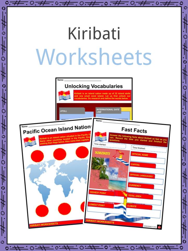
Kiribati Worksheets
This is a fantastic bundle which includes everything you need to know about the Kiribati across 20 in-depth pages. These are ready-to-use Kiribati worksheets that are perfect for teaching students about the Kiribati which is an island nation situated in the central Pacific Ocean, made up of 32 island atolls and one small coral island spread out over 1.3 million square miles. The country itself, however, covers only 313 square miles (811 sq km) of the area. Kiribati straddles the International Date Line on its easternmost islands and straddles the Earth’s equator.
Complete List Of Included Worksheets
- Kiribati Facts
- Unlocking Vocabularies
- Pacific Ocean Island Nations
- Fast Facts
- Kiribati Info
- Fill the Gap
- Pros and Cons
- Three-day Plan to Kiribati
- Kiribati Collage
- The Frigate Bird
- Country Overview
Link/cite this page
If you reference any of the content on this page on your own website, please use the code below to cite this page as the original source.
Link will appear as Kiribati Facts & Worksheets: https://kidskonnect.com - KidsKonnect, August 17, 2020
Use With Any Curriculum
These worksheets have been specifically designed for use with any international curriculum. You can use these worksheets as-is, or edit them using Google Slides to make them more specific to your own student ability levels and curriculum standards.