Premium
 Download
Edit
Download
Edit
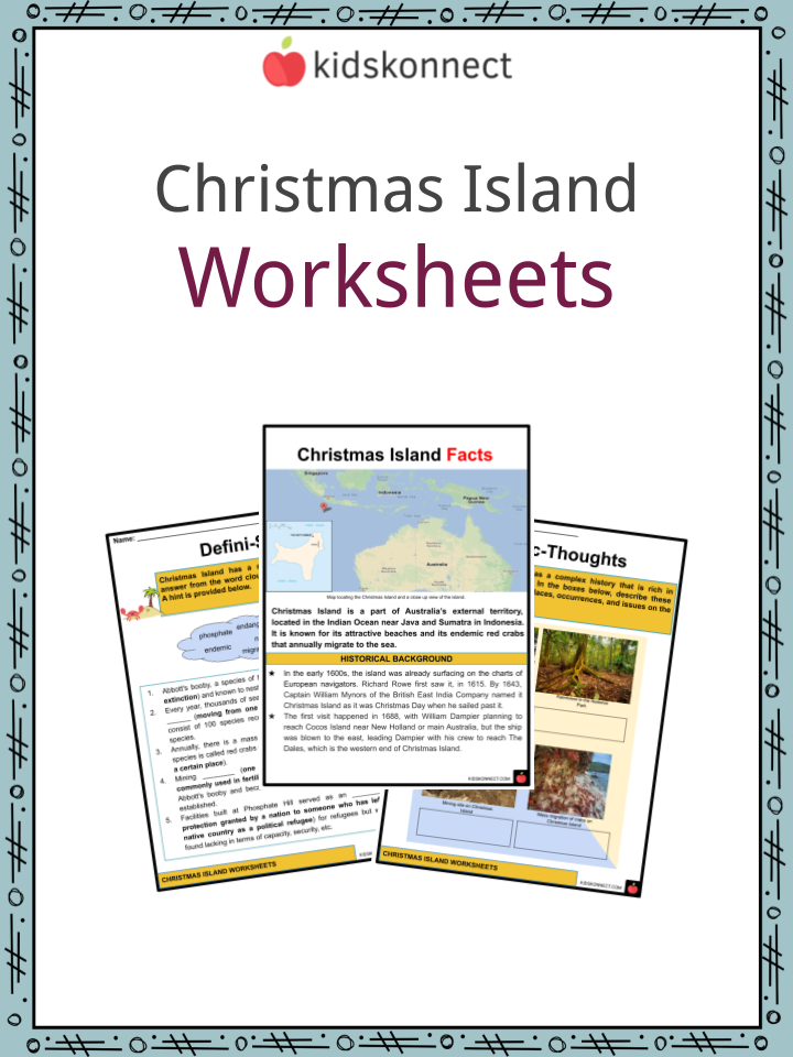
Download the Christmas Island Facts & Worksheets
Click the button below to get instant access to these worksheets for use in the classroom or at a home.
Download This Worksheet
This download is exclusively for KidsKonnect Premium members!
To download this worksheet, click the button below to signup (it only takes a minute) and you'll be brought right back to this page to start the download!
Sign Me Up
Edit This Worksheet
Editing resources is available exclusively for KidsKonnect Premium members.
To edit this worksheet, click the button below to signup (it only takes a minute) and you'll be brought right back to this page to start editing!
Sign Up
Not ready to purchase a subscription? Click to download the free sample version Download sample
Download This Sample
This sample is exclusively for KidsKonnect members!
To download this worksheet, click the button below to signup for free (it only takes a minute) and you'll be brought right back to this page to start the download!
Sign Me Up
Table of Contents
Christmas Island is a part of Australia’s external territory, located in the Indian Ocean near Java and Sumatra in Indonesia. It is known for its attractive beaches and its endemic red crabs that annually migrate to the sea.
See the fact file below for more information on Christmas Island or alternatively, you can download our 31-page Christmas Island worksheet pack to utilize within the classroom or home environment.
Key Facts & Information
HISTORICAL BACKGROUND
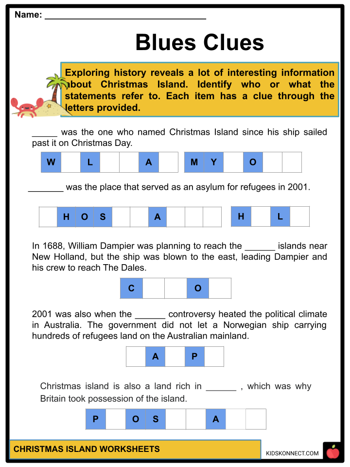
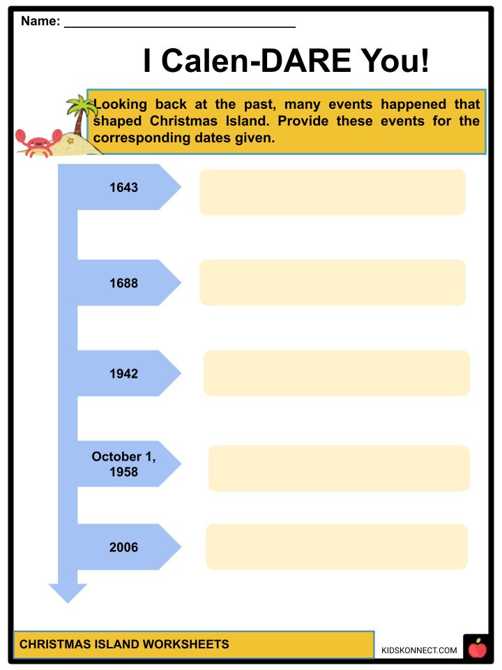
- In the early 1600s, the island was already surfacing on the charts of European navigators. Richard Rowe first saw it, in 1615. By 1643, Captain William Mynors of the British East India Company named it Christmas Island as it was Christmas Day when he sailed past it.
- The first visit happened in 1688, with William Dampier planning to reach Cocos Island near New Holland or main Australia, but the ship was blown to the east, leading Dampier with his crew to reach The Dales, which is the western end of Christmas Island.
- After this, Dampier saw the island was uninhabited and wrote an account of what happened upon their landing on the island.
- Christmas Island was also a land rich in phosphate that Britain took possession of and later passed under the authority of Singapore.
- Many migrant workers were part of the industry, which established a foundation for a multicultural center.
- In 1942, the Japanese during World War II were also pulled by this resource to provide fertilizer for the Empire of Japan.
- After the war, Australia bought the island from Singapore but still paid the revenue loss since it became a source of income for the latter country, and on October 1, 1958, it became an official territory of Australia. The date is celebrated as their Territory Day.
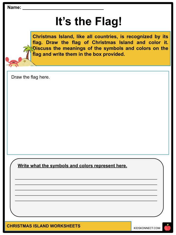
- Background colors of green and blue portray the separation of the sea and the island’s vegetation. The Southern Cross constellation represents Australia, as seen in the country’s flag. The bird is a Bosun bird that is native to the island. The gold disk surrounding the island in the center represents the territory’s mining industry.
PEOPLE AND CULTURE
- Since the island became a melting pot, many cultures have been homed in this Australian territory.
- Forty percent of the population are Australian-born and the others are Chinese, which is the dominant group, Malay, English, Irish, and other Eurasian communities.
- Because of the intersections of backgrounds, Christmas Island also became a welcoming place for different religions. According to 2016 data, there are still people with unspecified or no religions, but the record still shows three religions having numerous followers: Islam 19.4%, Buddhism 18.3%, and Roman Catholicism 8.8%.
- On the other hand, with regard to their language, the official language of Christmas Island is English but more than half of the population speak Mandarin, Malay, Cantonese, Min An, etc.
GOVERNMENT AND ECONOMY
- The Christmas Island Act 1958 provides the basis for the administrative, legislative, and judicial system.
- This act states the application of laws of the Western Australian government to the territory, the responsibility of the appointed minister, and the powers of the Western Australian government over the territory.
- Christmas Island is a non-self-governing territory, meaning it still relies on what the Australian government imposes unless a rule explicitly excludes the said territory.
- It is administered by the Department of Infrastructure, Transport, Cities & Regional Development, with a minister, representing the island appointed by the Governor-General.
- The Shire of Christmas Island is the local government of the territory in charge of providing services for the community.
- The island, as seen in history, is rich in phosphate, which became the driver of its economy. Through phosphate mining, the place can support life.
- The Observatory of Economic Complexity revealed that Christmas Island’s top export products are chemical fertilizers, phosphatic fertilizers, calcium phosphates, semiconductor devices, and broadcasting equipment.
- Limited tourism also contributes to the economy of Christmas Island. Many tourists are attracted to its beautiful beaches and tranquil atmosphere.
FLORA AND FAUNA
- The strategic location of Christmas Island allows it also to enjoy biodiversity as it is situated near Southeast Asia and the equator.
- With how rich it is in terms of its nature, it is also referred to as the Galapagos of the Indian Ocean.
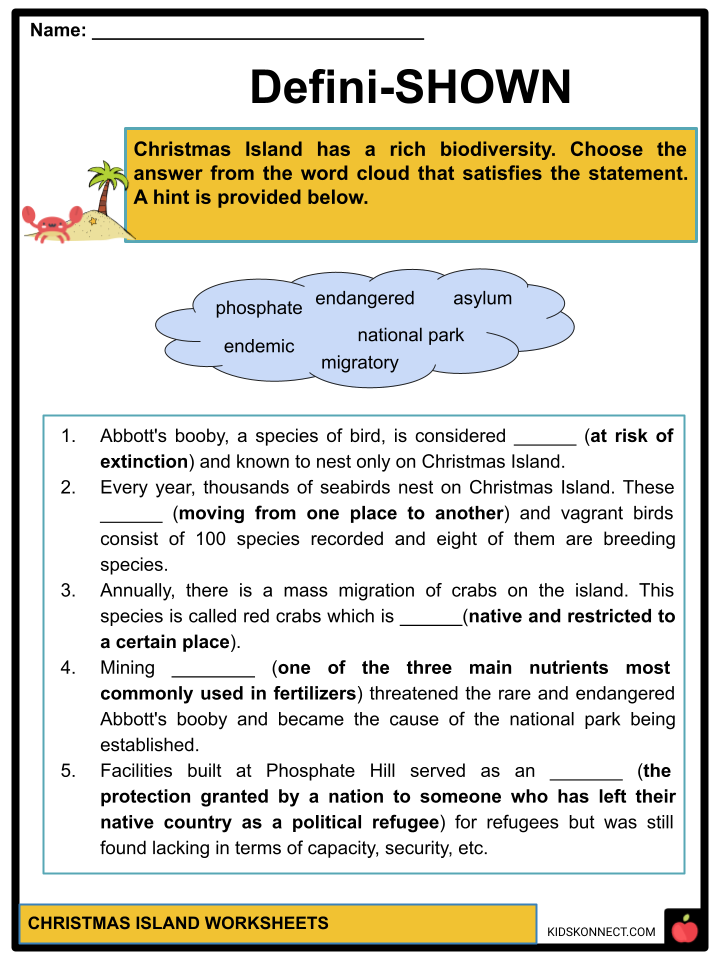
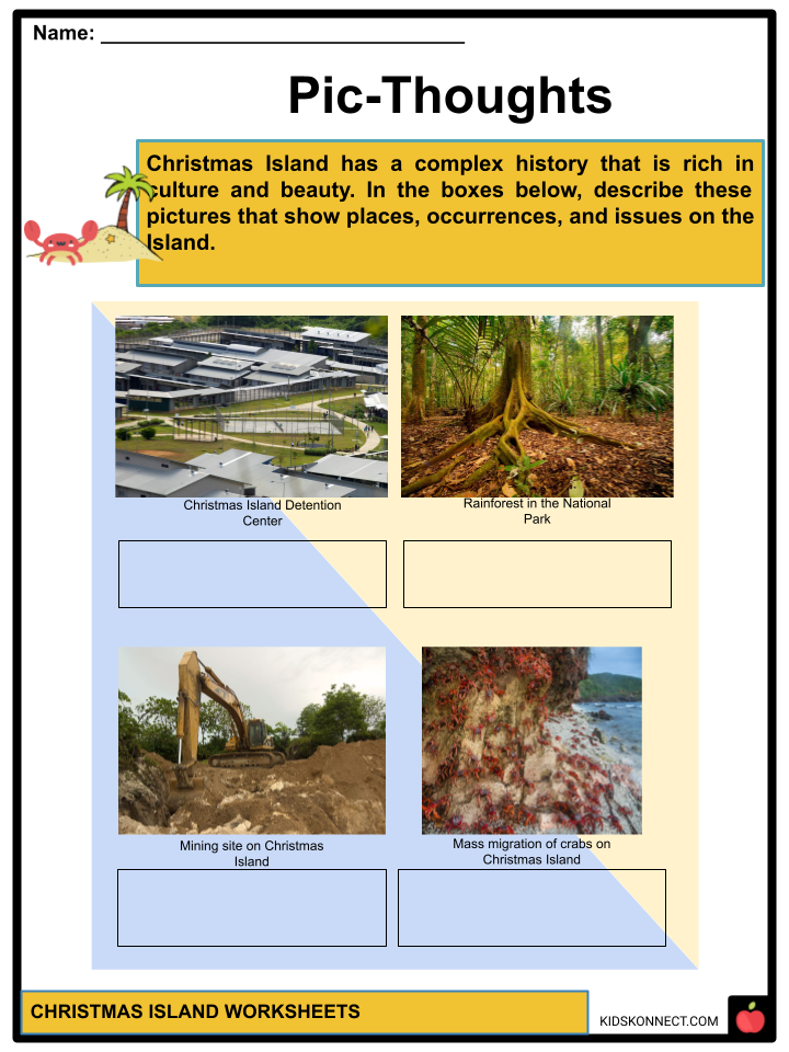
- A highlight of the flora of Christmas Island is its established national park. Since mining phosphate threatened the rare and endangered species of seabird called Abbott’s Booby, the government called on environment conservation, especially for the rainforests on the territory.
- In 1980, the national park was developed and extended its scope fully in 1986. In this project, the areas are protected, and the habitats of diverse species are improved, and now, this park covers 54% of the land area.
- Christmas Island is also famous for its crabs. More than 20 species have already been identified. Every year, thousands of crabs can be seen migrating from the rainforests to the oceans.
- One of the most known crab species on the island is the red crab, which is endemic to it and Cocos Island. It is the type usually seen in pictures when mass migrations occur.
- Eighty thousand seabirds nest annually on the island. From these migratory and vagrant birds, there are 100 species recorded, and eight are breeding species.
- One of these is Abbott’s booby which is also considered endangered and known to nest only on Christmas Island.
- The White-tailed Tropicbird or the Golden Bosun bird is another treasure the island keeps. This species with unique gold-tinged feathers can be found on Christmas Island.
ISSUES
- Christmas Island’s phosphate mining industry became a significant contributor to its economy. In relation to its history as countries like Japan, Britain, and Singapore benefited from this practice, exploitation posed a huge threat to its biodiversity.
- One of the impacts was, as mentioned, the endangering of the seabird species, Abbott’s Booby.
- This pushed a committee on the House of Representatives Standing Committee on Environment and Conservation for an area of conservation and eventually, in 1980, the national park was conceived as a project.
- In 1983, an extension for the area was reserved and in 1986, all three were combined.
- Since the 1980s and 1990s, as it is near Indonesia, people seeking asylum often landed on the island. This gave ground for the island to be an asylum as the years passed.
- In 2001, facilities were built at Phosphate Hill serving as an asylum for refugees but were still lacking in capacity, security, etc.
- The same year, the Tampa controversy sparked issues in the political climate of Australia. This controversy meant that the government did not allow a Norwegian ship carrying refugees to land on the Australian Mainland, but rather on Christmas Island.
- From 2001 to 2007, the government removed the island from its migration zone and relocated asylum seekers to Manus Island and Nauru.
- In 2006, the immigration detention center was established to accommodate asylum seekers.
- The Rudd government in 2007 transferred the processing of asylum seekers back to Christmas Island.
- Finally, in 2010, asylum seekers were granted protection by the Migration Act of 2010.
- The facility was commanded to stop its operations in 2018, but this was reversed in 2019.
Christmas Island Worksheets
This is a fantastic bundle that includes everything you need to know about Christmas Island across 31 in-depth pages. These are ready-to-use worksheets that are perfect for teaching about Christmas Island which is part of Australia’s external territory located in the Indian Ocean.
Complete List Of Included Worksheets
- Christmas Island Facts
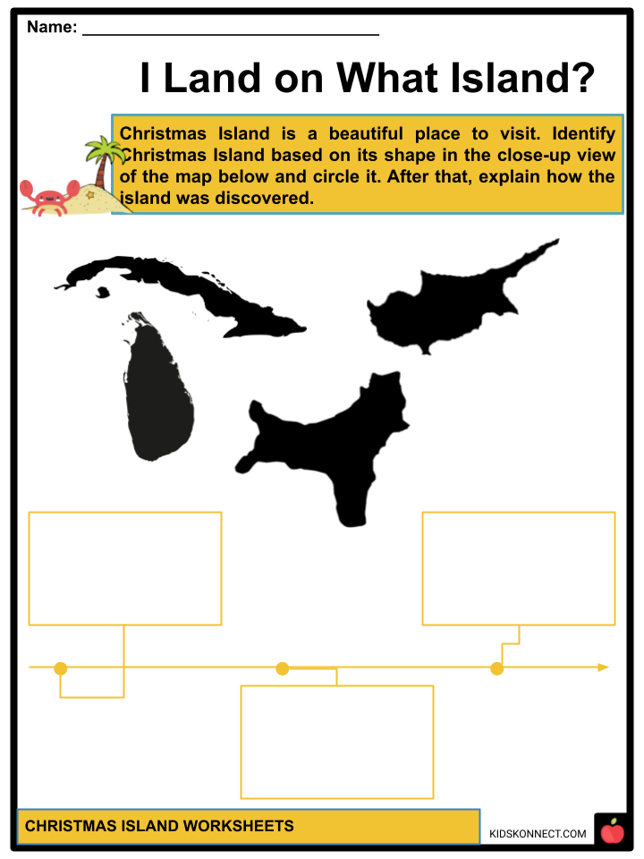
- I Land on What Island?
- It’s the Flag!
- Blues Clues
- I Calen-DARE You!
- GEM-bled
- Word Find
- Fact or Fake?
- Defini-SHOWN
- Pic-Thoughts
- Reflecting
Frequently Asked Questions
Q: When was Christmas Island discovered?
In the early 1600s, the island was already surfacing on the charts of European navigators. Richard Rowe first saw it, in 1615.
Q: Why was it named Christmas Island?
In 1643, Captain William Mynors of the British East India Company named it Christmas Island as it was Christmas Day when he sailed past it.
Q: What is Christmas Island famous for?
The strategic location of Christmas Island allows it also to enjoy biodiversity as it is situated near Southeast Asia and the equator. With how rich it is in terms of its nature, it is also referred to as the Galapagos of the Indian Ocean.
Link/cite this page
If you reference any of the content on this page on your own website, please use the code below to cite this page as the original source.
Link will appear as Christmas Island Facts & Worksheets: https://kidskonnect.com - KidsKonnect, June 17, 2022
Use With Any Curriculum
These worksheets have been specifically designed for use with any international curriculum. You can use these worksheets as-is, or edit them using Google Slides to make them more specific to your own student ability levels and curriculum standards.