Premium
 Download
Edit
Download
Edit
Download the Sahel Region Facts & Worksheets
Click the button below to get instant access to these worksheets for use in the classroom or at a home.
Download This Worksheet
This download is exclusively for KidsKonnect Premium members!
To download this worksheet, click the button below to signup (it only takes a minute) and you'll be brought right back to this page to start the download!
Sign Me Up
Edit This Worksheet
Editing resources is available exclusively for KidsKonnect Premium members.
To edit this worksheet, click the button below to signup (it only takes a minute) and you'll be brought right back to this page to start editing!
Sign Up
Not ready to purchase a subscription? Click to download the free sample version Download sample
Download This Sample
This sample is exclusively for KidsKonnect members!
To download this worksheet, click the button below to signup for free (it only takes a minute) and you'll be brought right back to this page to start the download!
Sign Me Up
Table of Contents
The Sahel region is a semi-arid area in the west and north-central Africa. It is a transitional zone between the dry Sahara to the north and the more humid Sudanian Savannas to the south.
See the fact file below for more information about the Sahel Region, or you can download our 29-page Sahel Region worksheet pack to utilize within the classroom or home environment.
Key Facts & Information
GEOGRAPHY
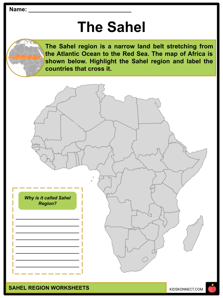
- The Sahel region of Africa is a narrow belt of land that stretches from the Atlantic Ocean in the west to the Red Sea in the east.
- The Sahel came from the Arabic word Sahel, or Sahil, which means shore or coast. It has been regarded as a symbolic reference to the vast Sahara.
- The Sahel region, with hot steppe conditions, is a zone of climatic and ecological transition that borders the Sahara desert and the Sudanian savannas.
- In honor of its most notable and highly drought-tolerant tree genus, this ecoregion is also known as the Sahelian Acacia savanna.
- Most of the Sahel’s terrain is flat, with an elevation range of 200 to 400 meters. Isolated plateaus and mountain ranges rise; however, because their flora and fauna differ from that of the nearby lowlands, they are classified as distinct ecoregions.
- The Sahel region passes through northern Senegal, southern Mauritania, the Niger River in Mali, Burkina Faso, southern Niger, northeastern Nigeria, south-central Chad, Sudan, and Eritrea.
CLIMATE
- Tropical semi-arid weather prevails in the Sahel.
- Sahel’s climate is similar to, but less extreme than, that of the Sahara desert to the north. Cold temperatures are unusual.
- The Sahel is known for its consistently high temperatures and intense heat. Many trees lose their leaves during the dry season, and grasses perish.
- The Sahel lies between the Sahara and tropical rainforests. The climate is highly variable in many transitional zones adjacent to low rain belts.
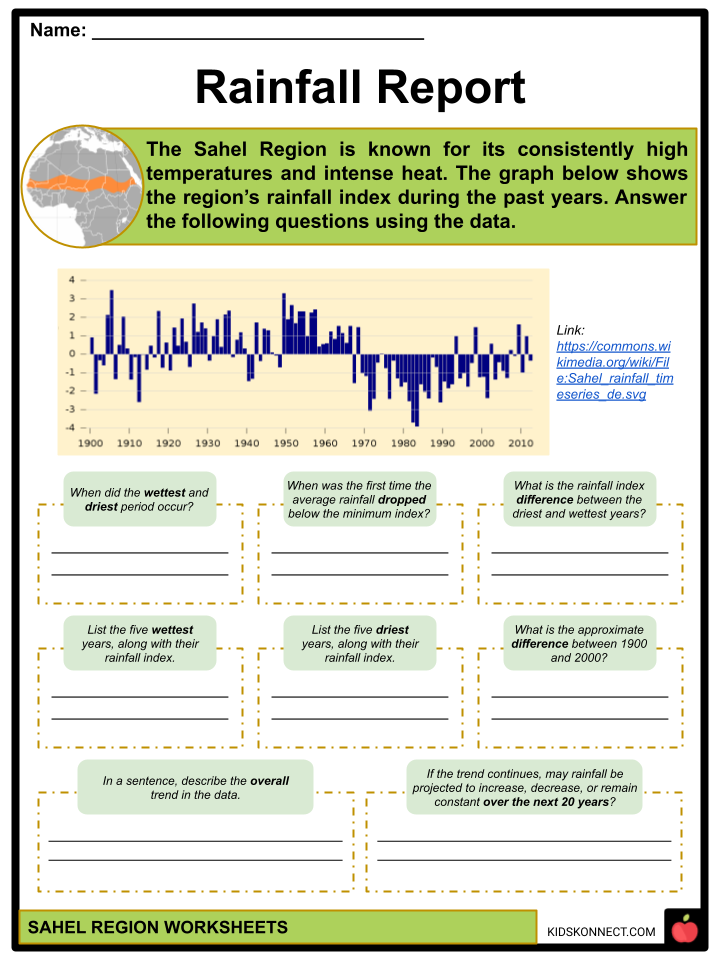
- Since 1970, the region has experienced below-average rainfall. Rainfall is limited to a brief season, occurring in June, July, and August. The remaining months remain completely dry.
FLORA AND FAUNA
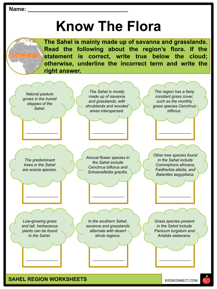
- Natural pasture grows in the semi-arid steppes of the Sahel, with low-growing grass and tall, herbaceous plants.
- The Sahel is mainly made up of savanna and grasslands, with shrublands and wooded areas interspersed.
- The region has a reasonably constant grass cover, such as the annual grass species Cenchrus biflorus and Schoenefeldia gracilis.
- The predominant trees are acacia species, of which Acacia tortilis, Acacia senegal, and Acacia laeta are the most common. Commiphora africana, Faidherbia albida, Boscia senegalensis, and Balanites aegyptiaca are some other species of trees.
- Savanna and grassland areas alternate with desert shrub regions in the northern portion of the Sahel, including Panicum turgidum and Aristida sieberana.
- Grazing mammals such as the giant prehistoric buffalo, cheetahs, gazelles (dama, red-fronted, Dorcas), scimitar-horned oryx, and Bubal hartebeest were once found in the Sahel, as well as predators like African wild dog and lion.
- However, overhunting and competition with livestock have led to a significant decline in the larger species, making several vulnerable, endangered, or extinct.
- Sahel’s seasonal wetlands are also crucial for migratory birds traveling across Africa and along the African-Eurasian flyways.
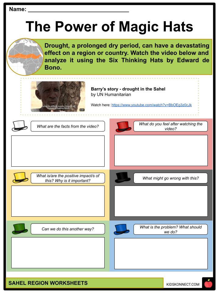
DROUGHTS
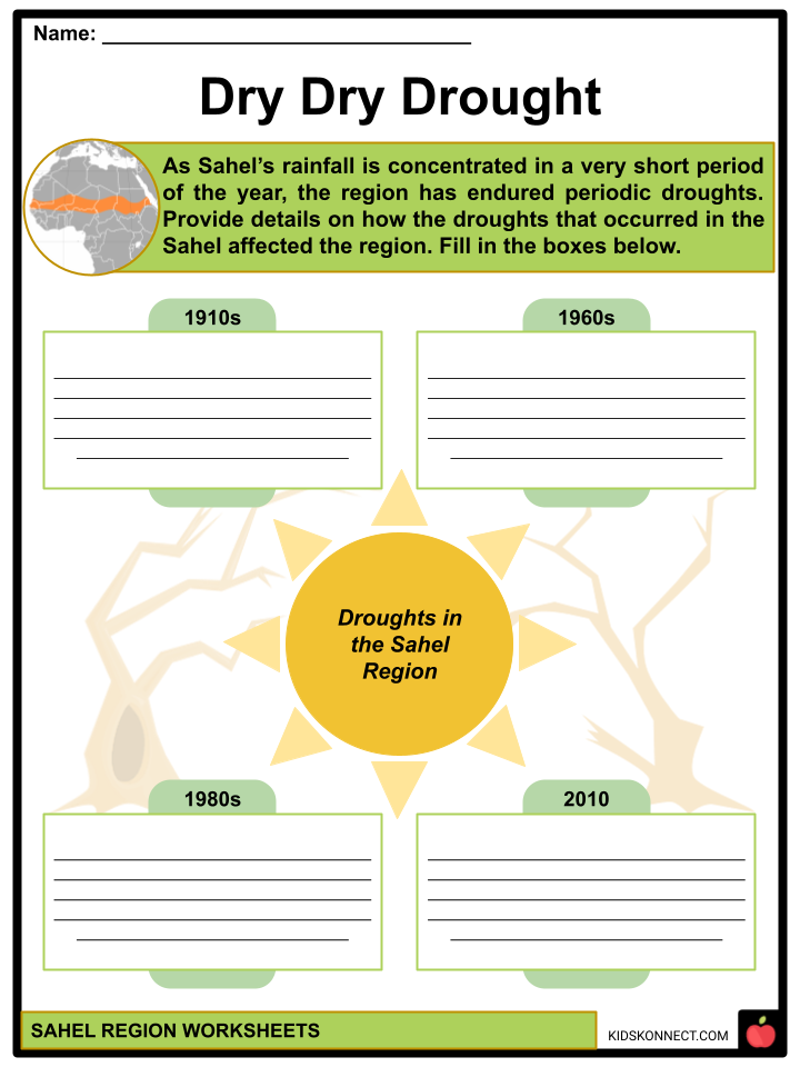
- As Sahel’s rainfall is concentrated in a very short period of the year, the region has endured periodic droughts.
- In 1914, Sahel experienced a drought due to substantially less than average yearly rainfall, resulting in widespread starvation.
- A prolonged drought in 1968 nearly destroyed all of the region’s crops and resulted in the loss of 50-70% of its cattle.
- Rainfall decreased in 1972, and by 1973, parts of the Sahara had moved up to 60 miles (100 km) southward. The number of deaths from disease and starvation was estimated at 100,000.
- The United Nations organized a conference in response to the food crises, primarily in Africa’s Sahelian countries. The International Fund for Agricultural Development (IFAD) was founded in 1977.
- From 1983 to 1985, the Sahel experienced severe drought and famine, which increased desertification. The Sahara trailed behind the Sahel as it spread southward into nearby savannas.
The 2010 Drought
- Famine was reported to have started in south-eastern Sudan. Neighboring Niger, Burkina Faso, Mali, Chad, northern Nigeria, Mauritania, and Senegal were then hit by severe drought and harsh heat.
- Crops failed to mature due to the heat. People suffered from malnourishment, dehydration, and starvation.
- Food scarcity caused prices to rise, making it impossible for most people to afford. Families fleeing starvation have migrated in search of work or food.
- Many children became ill, and some died as a result of respiratory infections, starvation, gastroenteritis, diarrhea, and malnutrition.
- By September, significant rainfall in central and southern Chad fueled hopes that the drought might end.
- The famine was lessened in October when rains hit Benin, Nigeria, Ghana, and Niger. Flooding began as a result of the Niger River overflowing and breaching its banks.
DESERTIFICATION AND SOIL LOSS
- One of the leading causes of global warming in the Sahel region is environmental problems.
- Due to growing human populations placing greater demands on the land than before, the Sahel is experiencing increasing soil erosion and desertification. This interferes with the natural resources critical to livelihood.
- Climate change is also reducing accessible agricultural land and making water scarce, compromising people’s survival.
- The rich topsoils were subsequently carried away by wind and rainfall runoff, leaving behind desolate wastelands.
- The Great , a reforestation project, is a significant effort to promote sustainable land use practices, increase soil fertility, and fight desertification in the Sahel.
- There are also often large-scale dust storms. The Bodele Depression is the source of several significant dust storms that struck Chad in November 2004.
- A sandstorm struck Western Sahara, Mauritania, Senegal, The Gambia, Guinea Bissau, Guinea, and Sierra Leone in March 2010. Simultaneously, another hit the northern Ivory Coast, Mauritania, Mali, and southern Algeria.
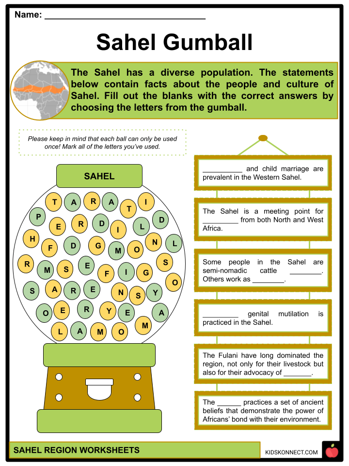
PEOPLE AND CULTURE
- The Sahel has a diverse population. Some are semi-nomadic cattle herders who use the difference in soil nutrients between the wetter, more vegetated South and the dry, more arid North by traveling. Others work as farmers, growing millet and sorghum for a living.
- The boundary with the Sahara is fluid, and many individuals who live in one region can also be found in the other. The Sahel is a meeting point for traditions from both North and West Africa. Several communities owe their culture entirely to the Sahel.
- The Fulani, a nomadic herder community, have long dominated the region, not only for their livestock but also for their advocacy of Islam. Their artifacts express a sense of strength in the country and glorify the products it produces (gold and amber).
- The Dogon, from Mali, practices a set of ancient beliefs that demonstrate the power of Africans’ bond with their environment. They are recognized for the preservation of their indigenous religious beliefs and rituals. Dogon artisans’ work can be found in galleries all over the world.
- Polygamy and child marriage are prevalent in the Western Sahel. Female genital mutilation is also practiced in the region.
ATTRACTIONS
- Agadez Mosque, Niger. It is a prominent mosque built of clay and is the tallest mud-brick structure in the world. It is a notable religious institution and has been a prayer site for generations.
- Bandiagara Escarpment, Mali. A 500-meter-high sandstone escarpment. It is approximately 150 kilometers long. It was added to the UNESCO World Heritage List in 1989.
- Lake Retba, Senegal. Also called Lac Rose (“pink lake”), it is well known for having a high salt content and its pink waters caused by the algae Dunaliella salina. In 2022, floods interfered with salt harvesting operations and caused the lake to lose color.
- W National Park. A park in the shape of the letter W. It is renowned for having various plant and massive mammal species. It is also notable for its bird populations. It has received the designation of Important Bird Area from Bird Life International.
- The Great Mosque of Djenne, Mali. A massive brick or adobe structure was constructed in the Sudano-Sahelian architectural style. In 1988, UNESCO listed it as a World Heritage Site.
- Pyramids of Meroe, Sudan. A collection of several Nubian pyramids where the Kushite monarchs and other royal family members were buried. Altogether, the three cemeteries (West, North, and South) include more than a thousand tombs.
- Djoudj National Bird Sanctuary, Senegal. A range of wetland environments are popular by migratory birds, many of whom have recently traversed the Sahara. It is home to a diverse array of animals and is recognized as a World Heritage Site.
- Oualata, Mauritania. Also known as Walata, it is a small oasis village known for its richly decorated vernacular architecture. It is recognized as a World Heritage Site.
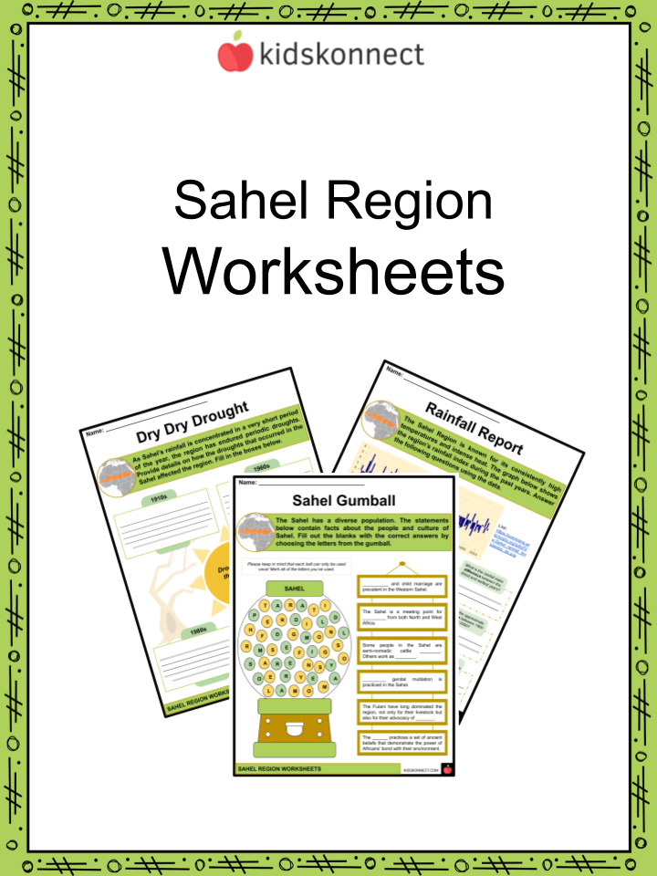
Sahel Region Worksheets
This fantastic bundle includes everything you need to know about the Sahel Region across 29 in-depth pages. These ready-to-use worksheets are perfect for teaching kids about the Sahel Region. The Sahel region is a semi-arid area in the west and north-central Africa. It is a transitional zone between the dry Sahara to the north and the more humid Sudanian Savannas to the south.
Complete List of Included Worksheets
Below is a list of all the worksheets included in this document.
- Sahel Region Facts
- The Sahel
- Rainfall Report
- Know the Flora
- Sahelian Animals
- Dry Dry Drought
- The Power of Magic Hats
- Around Sahel
- Awareness Poster
- Sahel Gumball
- Exit Ticket
Frequently Asked Questions
What is the Sahel region?
The Sahel is a transitional zone in Africa that stretches across the continent from the Atlantic Ocean to the Red Sea. It includes parts of several countries, such as Senegal, Mauritania, Mali, Burkina Faso, Niger, Nigeria, Chad, Sudan, and Eritrea. The region is characterized by a semi-arid climate and is situated between the Sahara Desert to the north and the savannas to the south.
What are the major challenges facing the Sahel region?
The Sahel faces a combination of challenges, including recurrent droughts, desertification, food insecurity, poverty, and political instability. The region is also prone to conflicts and has been a hotspot for militant and terrorist activities. These challenges are often interconnected, creating a complex web of issues that hinder development and stability.
How does climate change impact the Sahel region?
Climate change has exacerbated existing challenges in the Sahel. The region is experiencing shifts in rainfall patterns, leading to increased frequency and intensity of droughts. This, in turn, affects agricultural productivity and contributes to desertification. Rising temperatures further intensify water scarcity and make it difficult for communities to adapt to the changing climate.
What initiatives are in place to address the issues in the Sahel region?
Various international organizations, governments, and NGOs have implemented initiatives to address the challenges in the Sahel. The “Great Green Wall” is a notable example, aiming to create a mosaic of green and productive landscapes across the Sahel to combat desertification. Additionally, there are efforts to improve water management, enhance agricultural practices, and promote sustainable development to alleviate poverty and food insecurity.
How does conflict impact the Sahel region’s development?
Conflict, including ethnic tensions, political instability, and the presence of extremist groups, has a severe impact on the development of the Sahel region. It disrupts economic activities, displaces populations, hampers education, and exacerbates existing challenges. International efforts are underway to address the root causes of conflict and promote stability through diplomatic, peacekeeping, and development initiatives
Link/cite this page
If you reference any of the content on this page on your own website, please use the code below to cite this page as the original source.
Link will appear as Sahel Region Facts & Worksheets: https://kidskonnect.com - KidsKonnect, January 31, 2024
Use With Any Curriculum
These worksheets have been specifically designed for use with any international curriculum. You can use these worksheets as-is, or edit them using Google Slides to make them more specific to your own student ability levels and curriculum standards.