Premium
 Download
Edit
Download
Edit
Download the Lesotho Facts & Worksheets
Click the button below to get instant access to these worksheets for use in the classroom or at a home.
Download This Worksheet
This download is exclusively for KidsKonnect Premium members!
To download this worksheet, click the button below to signup (it only takes a minute) and you'll be brought right back to this page to start the download!
Sign Me Up
Edit This Worksheet
Editing resources is available exclusively for KidsKonnect Premium members.
To edit this worksheet, click the button below to signup (it only takes a minute) and you'll be brought right back to this page to start editing!
Sign Up
Not ready to purchase a subscription? Click to download the free sample version Download sample
Download This Sample
This sample is exclusively for KidsKonnect members!
To download this worksheet, click the button below to signup for free (it only takes a minute) and you'll be brought right back to this page to start the download!
Sign Me Up
Table of Contents
Lesotho is officially known as the Kingdom of Lesotho and is located in southern Africa. Lesotho is one of only three enclaved countries, along with Vatican City and San Marino. It is entirely bordered by the nation of South Africa.
See the fact file below for more information on the Lesotho or alternatively, you can download our 19-page Lesotho worksheet pack to utilise within the classroom or home environment.
Key Facts & Information
BRIEF HISTORY
- Lesotho was originally occupied by the Khoisan, which were local tribes of hunter-gatherers.
- Afterward, the Bantu tribes came, and they were followed eventually by the Sotho-Tswana peoples.
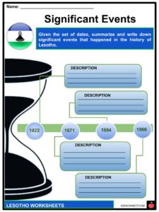
- King Moshoeshoe I united the land under one rule for the first time in 1822.
- Formerly named Basutoland, Lesotho was constituted as a native state under British protection in 1843 by a treaty signed with the native chief, Moshoeshoe.
- Lesotho was annexed to Cape Colony in 1871. However, it was restored to direct control by the Crown in 1884.
- The colony of Basutoland turned into the independent nation of Lesotho on October 4th, 1966, with King Moshoeshoe II as sovereign.
- For the first 20 years, the Basotho National Party prevailed in power.
- Lesotho has since had shifts in power and leaders with some protests and some unrest.
GEOGRAPHY
- Lesotho is a small mountainous country, with the capital being Maseru.
- Lesotho is located on the African continent. The country is landlocked and is an enclave of South Africa, which means Lesotho is entirely enclosed and surrounded by South Africa.
- Lesotho is approximately the size of Belgium, or a little bit smaller than Massachusetts in the USA.
- The country lies on a high plateau with hills and mountains.
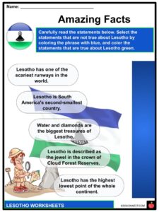
- Lesotho is the world’s highest country considering the entire country is situated over 1,000m (3,280ft.) above sea level. Eighty percent of the county lies above 1,800m (5,906ft) above sea level.
- The highest point of Lesotho is Thabana Ntlenyana at 3,482m (11,423ft.) high.
- Lesotho’s climate is a temperate climate with cold and dry winters from May until September. The rainy, hot summer season is experienced from November to March.
- The Sehlabathebe National Park belongs to the UNESCO world heritage site.
- Maloti-Drakensberg Park houses several endangered species, such as the Cape vulture.
- There is a small international airport in the capital city of Maseru, in which only smaller planes can land and depart from the country.
ECONOMY
- The main economy in Lesotho is driven by manufacturing, agriculture, and tourism.
- Lesotho’s main agricultural products include corn, wheat, pulses, and sorghum.
- Katse Dam is the main source of energy in Lesotho. The country is one of the few in the world that generates and uses only renewable energy through hydroelectric power. However, most of the locals (70%) in Lesotho live without electricity.
- In common Basotho families, the main breadwinners work either on their own farms, in the textile industry, or in the government, which is the biggest employer in the country.
- Most of them also have at least one family member who works in South Africa on farms or in the mines.
- These members of the family send remittances (money) back home to support their family in Lesotho.
- The main exports are clothing, footwear, wool, food, electricity, water, and diamonds. The biggest export partners are South Africa (57%) and the USA.
PEOPLE IN LESOTHO
- Basotho is what the people in Lesotho are called. More than half of the population is extremely poor, with many still residing in thatched-roof huts made from bricks and mud. These huts are called rondavels.
- These rondavels have been replaced by contemporary houses and multi-story buildings in the towns and cities, as you can observe in the capital city of Maseru. Additionally, about 75% of the population lives in rural areas.
- The traditional clothing attire of the Basotho people is a blanket, a beautiful patterned woolen garment that every Basotho person wears proudly!
- Lesotho has the world’s second-highest HIV rate. This means that one in four people is infected with AIDS. Thus, the life expectancy of the Basotho people is quite low.
- The health system is very limited, with only 7 doctors for every 100,000 people in Lesotho.
- However, education has developed significantly in the last decade. Most adults in the country can now read and write, as seen by the literacy rate of 80%.
- Sesotho and English are the official languages in Lesotho, but some people also speak Xhosa or Zulu.
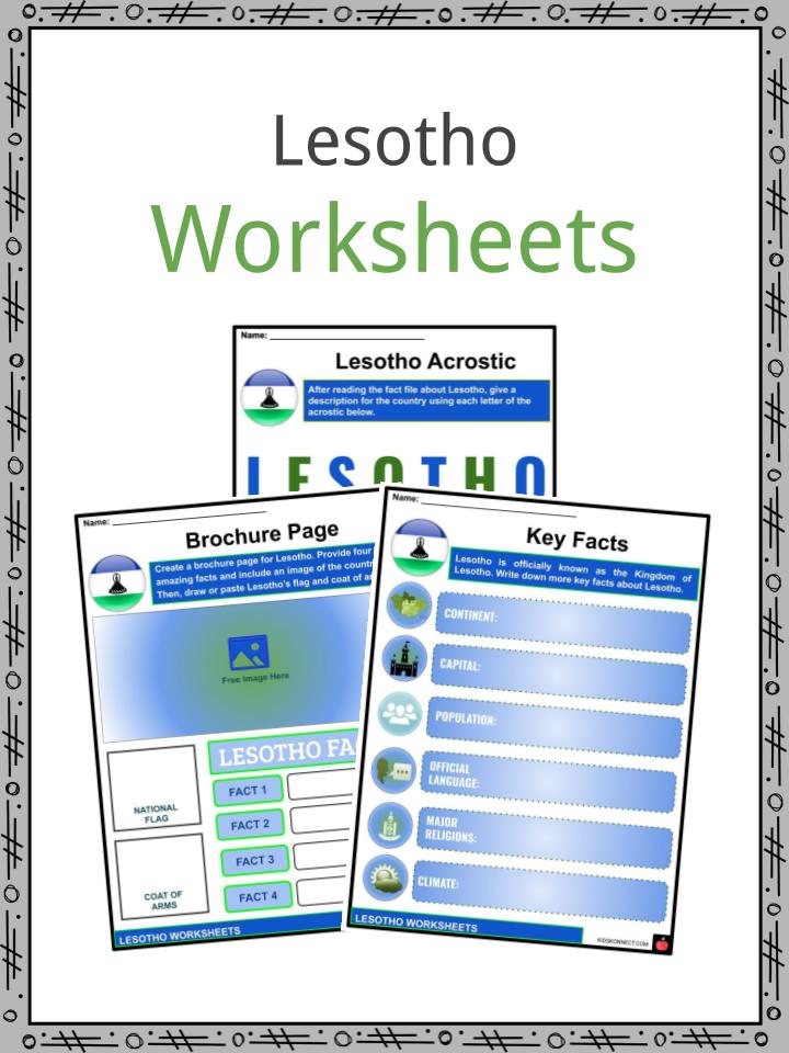
Lesotho Worksheets
This is a fantastic bundle which includes everything you need to know about the Lesotho across 19 in-depth pages. These are ready-to-use Lesotho worksheets that are perfect for teaching students about the Lesotho which is officially known as the Kingdom of Lesotho and is located in southern Africa. Lesotho is one of only three enclaved countries, along with Vatican City and San Marino. It is entirely bordered by the nation of South Africa.
Complete List Of Included Worksheets
- Lesotho Facts
- Lesotho Acrostic
- Brochure Page
- Key Facts
- Pros and Cons
- Significant Events
- Amazing Facts
- Lesotho Economy
- Breaking News
- People of Lesotho
- Tourist Collage
Link/cite this page
If you reference any of the content on this page on your own website, please use the code below to cite this page as the original source.
Link will appear as Lesotho Facts & Worksheets: https://kidskonnect.com - KidsKonnect, August 26, 2020
Use With Any Curriculum
These worksheets have been specifically designed for use with any international curriculum. You can use these worksheets as-is, or edit them using Google Slides to make them more specific to your own student ability levels and curriculum standards.