Premium
 Download
Edit
Download
Edit
Download the Lagoon City Facts & Worksheets
Click the button below to get instant access to these worksheets for use in the classroom or at a home.
Download This Worksheet
This download is exclusively for KidsKonnect Premium members!
To download this worksheet, click the button below to signup (it only takes a minute) and you'll be brought right back to this page to start the download!
Sign Me Up
Edit This Worksheet
Editing resources is available exclusively for KidsKonnect Premium members.
To edit this worksheet, click the button below to signup (it only takes a minute) and you'll be brought right back to this page to start editing!
Sign Up
Not ready to purchase a subscription? Click to download the free sample version Download sample
Download This Sample
This sample is exclusively for KidsKonnect members!
To download this worksheet, click the button below to signup for free (it only takes a minute) and you'll be brought right back to this page to start the download!
Sign Me Up
Table of Contents
The Venetian Lagoon, also known as Lagoon City, is a harbor of the Adriatic Sea in the northern Italy city of Venice. Laguna Veneta (cognate of Latin lacus) lake provided the English name for an enclosed, low embayment of saline water known as a lagoon.
See the fact file below for more information on Lagoon City or you can download our 25-page Lagoon City worksheet pack to utilize within the classroom or home environment.
Key Facts & Information
DEVELOPMENT
- The Venice Lagoon is the most prominent survival of a series of estuarine lagoons that once stretched from Ravenna north to Trieste. The Lagoon provided security to Romanized refugees fleeing invaders (mainly Huns) in the sixth century.
- Later, it provided inherently sheltered conditions for the Venetian Republic and its maritime empire’s rise. It continues to serve as a basis for a seaport, the Venetian Arsenal, fishing, hunting, and the fish farming sector. The Lagoon began six to seven thousand years ago after the upper Adriatic coastal plain was flooded by a marine transgression caused by the Ice Age.
- The current state of the Lagoon is the result of human meddling. During the sixteenth and seventeenth centuries, Venetian hydraulic initiatives to keep the Lagoon from becoming a marsh reversed the Lagoon’s natural progression.
- Since the nineteenth century, aquifer pumping has increased subsidence. Many of the Lagoon’s islands remained swampy, but a progressive drainage campaign made them habitable. Some smaller islands are entirely artificial, and certain regions around the Mestre’s harbor are also reclaimed islands. The remaining islands, including those along the coast (Lido, Pellestrina, and Treporti), are dunes.
- Venice Lagoon has been inhabited since prehistoric times. However, it was only during and after the demise of the Western Roman Empire that a considerable number of Venetian mainland residents settled in sufficient numbers to create the city of Venice.
- Urban settlements have transformed. Because of the large drop in population, the change in the use of many structures, and the substitution of traditional producing activities and services with other activities, the old city’s urban functions have changed.
- Since the nineteenth century, aquifer pumping has increased subsidence. Many of the lagoon’s islands remained swampy, but a progressive drainage campaign made them habitable. In contrast, some smaller islands are entirely artificial.
LOCATION
- With a surface area of approximately 550 square kilometers (212 square miles), the Venetian Lagoon spans from the River Sile in the north to the Brenta south. It is around 8% land, comprising Venice and several smaller islands.
- Around 11% of the land is constantly covered by open water, or canals, as the network of dredged channels is known; the remaining 80% consists of mud flats, tidal shallows, and salt marshes. The lagoon is the Mediterranean Basin’s largest wetland. Furthermore, three inlets join it to the Adriatic Sea: Lido, Malamocco, and Chioggia.
- The lagoon, located at the end of a fully contained sea, is subject to significant changes in water level, the most extreme of which are the spring tides known as acqua alta (Italian for “high water”), which regularly flood most of Venice.
ECOSYSTEM
- Large phytoplankton and macroalgae blooms in the late 1980s were especially damaging. The lagoon has been recognized by researchers as one of the key locations in which non-indigenous species have been introduced to the Mediterranean Sea.
- Moreover, the lagoon’s contamination level was previously a source of concern. Due to the emissions and consequences of cruise ships passing into the Venetian Lagoon, negative environmental effects such as air pollution, landscape loss, surface water pollution, erosion, and diminishing water quality have occurred.
- The Venice Lagoon was affected by a significant decline in nutrient inputs and macroalgal biomasses due to climate change; the concentration distributions of total nitrogen, organic phosphorus, and organic carbon in the upper sediments from 1987 to 2003.
- The seagrasses began a natural recolonization process, restoring the pristine conditions of the marine habitat.
- Meanwhile, the lagoon city is teeming with birdlife, including cormorants, egrets, grebes, herons, hawks, falcons, black-legged stilts, ducks, plovers, and pink flamingos.
ISLANDS
- The Venice Lagoon is mainly part of the Metropolitan City of Venice, but the area to the southwest is part of the Province of Padua. Furthermore, barrier islands are shoreline structures and a type of dune system that are exceptionally flat or lumpy regions of sand that form parallel to the mainland shore due to wave and tide activity. They are frequently found in groups of several islands, ranging from a handful to more than a dozen.
- The largest islands or archipelagos in terms of area, omitting coastal reclaimed land and barrier beaches:
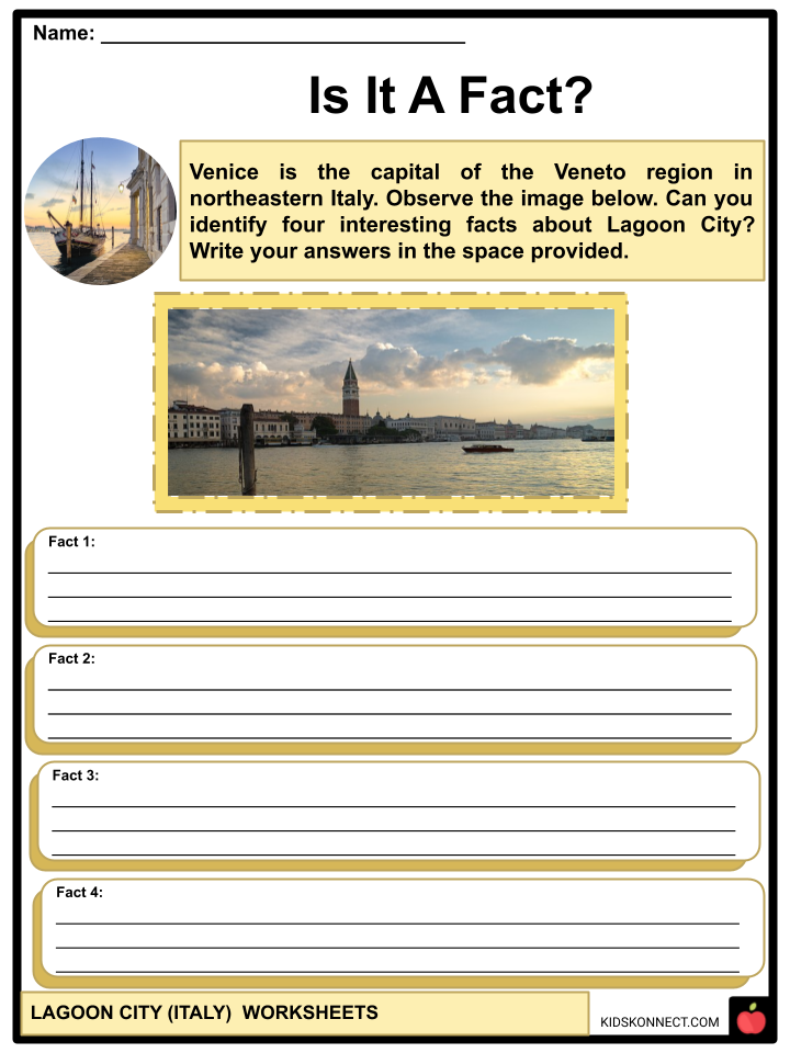
- Venice is the capital of the Veneto region in northeastern Italy. Situated on a series of 118 small islands separated by open water and canals, parts of the city are connected by approximately 400 bridges.
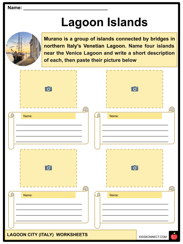
- Murano is a group of islands connected by bridges in northern Italy’s Venetian Lagoon. It is roughly 1.5 kilometers north of Venice and about 1.5 kilometers across, with more than 5,000 people. It is well-known for its glass production.
- Chioggia is a coastal town and comune of the Metropolitan City of Venice in Northern Italy’s Veneto region.
- Giudecca is situated immediately south of the central islands of Venice. It is in the Dorsoduro sestiere and a comune of Venice.
- Mazzorbo is one of the islands in the northern part of Venice’s Lagoon. It was the site of one of the earliest villages, predating the creation of Venice, like the other islands in the region of the Lagoon. This island, however, decayed and was eventually deserted.
- Torcello is a small island at the northern end of the Venetian Lagoon. It was first colonized in 452 CE and is known as the initial island from which Venice grew.
- La Certosa is situated northeast of Venice, less than 250 meters from San Pietro di Castello and 500 meters from the Venice Lido.
- Sant’Elena is situated at the eastern end of the main island group and is part of Castello Sestiere.
- Sacca Fisola is an artificial island in the Venetian Lagoon. It is primarily a modern residential neighborhood.
- Sacca Sessola, informally translated as “Bailing-Scoop Cove,” is an artificial island created in 1870 and one of the largest and youngest in the Lagoon.
- San Michele was a popular place for local travelers and fishermen to land and was home to the first Renaissance church in Venice.
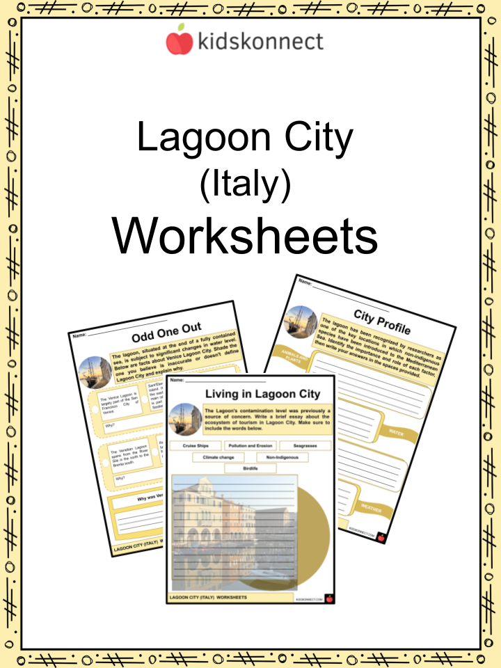
Lagoon City Worksheets
This fantastic bundle includes everything you need to know about Lagoon City across 25 in-depth pages. These ready-to-use worksheets are perfect for teaching kids about Lagoon City. The Venetian Lagoon, also known as Lagoon City, is a harbor of the Adriatic Sea in the northern Italy city of Venice.
Complete List of Included Worksheets
Below is a list of all the worksheets included in this document.
- Lagoon City (Italy) Facts
- Is It A Fact?
- Collect The Facts
- Lagoon Islands
- Odd One Out
- City Profile
- Living in Lagoon City
- My L.C.I Project
- Lagoon ITALY-erary
- My City of Dreams
- #Featured_Time
Frequently Asked Questions
What is the Venetian Lagoon?
The Venetian Lagoon is a shallow body of water located in northeastern Italy, near the city of Venice. It is enclosed by the Adriatic Sea to the east and is separated from the mainland by a series of barrier islands known as the Venetian Lido. The lagoon is famous for its unique ecosystem, historical significance, and its role as the setting for the city of Venice.
How did the Venetian Lagoon form?
The Venetian Lagoon is believed to have formed around 6,000 years ago as a result of the rising sea levels at the end of the last ice age. The lagoon was created when the Adriatic Sea flooded a coastal area, leaving behind a shallow, marshy basin. Over time, sedimentation and the growth of vegetation, including saltwater-tolerant plants like reeds, helped stabilize the lagoon’s ecosystem.
What is the significance of the Venetian Lagoon?
The Venetian Lagoon has immense historical and cultural significance. It played a crucial role in the development of the city of Venice, serving as a natural defense system against invaders and providing a navigable waterway for trade and transportation. The lagoon is also home to numerous islands, including the main island of Venice, which is renowned for its architectural wonders, art, and unique canal network.
What are the main islands in the Venetian Lagoon?
The Venetian Lagoon encompasses several islands, the main ones being:
- Venice (Venezia): The most famous and populated island, known for its canals, gondolas, historic palaces, and iconic landmarks like St. Mark’s Square and the Rialto Bridge.
- Murano: Famous for its glassmaking tradition, Murano is known for its exquisite glass products and glassblowing demonstrations.
- Burano: Renowned for its colorful houses and lace-making heritage, Burano is a charming island known for its vibrant atmosphere.
- Lido di Venezia: A long, narrow sandbar that separates the lagoon from the Adriatic Sea, the Lido is a popular destination with beautiful beaches and the Venice Film Festival.
These are just a few examples, as there are many other smaller islands within the Venetian Lagoon.
What activities can visitors enjoy in the Venetian Lagoon?
Visitors to the Venetian Lagoon can partake in a wide range of activities. Some popular options include:
- Exploring Venice’s historic sites, such as St. Mark’s Basilica, Doge’s Palace, and the Grand Canal.
- Taking a gondola ride or a vaporetto (water bus) tour to navigate the canals and enjoy the city’s unique ambiance.
- Visiting the islands of Murano to witness glassblowing demonstrations and shop for exquisite glassware, and Burano to experience its colorful charm and lace-making heritage.
- Relaxing on the sandy beaches of the Lido di Venezia and enjoying water sports like swimming, sunbathing, and sailing.
- Discovering the lagoon’s natural beauty through boat tours, birdwatching, or fishing excursions.
Link/cite this page
If you reference any of the content on this page on your own website, please use the code below to cite this page as the original source.
Link will appear as Lagoon City Facts & Worksheets: https://kidskonnect.com - KidsKonnect, August 16, 2023
Use With Any Curriculum
These worksheets have been specifically designed for use with any international curriculum. You can use these worksheets as-is, or edit them using Google Slides to make them more specific to your own student ability levels and curriculum standards.