Premium  Download Edit
Download the Pacific Ring of Fire Facts & Worksheets
Click the button below to get instant access to these worksheets for use in the classroom or at a home.
Download This Worksheet
This download is exclusively for KidsKonnect Premium members!
To download this worksheet, click the button below to signup (it only takes a minute) and you'll be brought right back to this page to start the download!
Sign Me Up
Edit This Worksheet
Editing resources is available exclusively for KidsKonnect Premium members.
To edit this worksheet, click the button below to signup (it only takes a minute) and you'll be brought right back to this page to start editing!
Sign Up
Not ready to purchase a subscription? Click to download the free sample version Download sample
Download This Sample
This sample is exclusively for KidsKonnect members!
To download this worksheet, click the button below to signup for free (it only takes a minute) and you'll be brought right back to this page to start the download!
Sign Me Up
Table of Contents
The Pacific Ring of Fire is estimated to be around 25,000 miles long. It comprises an arc of mountains, active volcanoes, and oceanic trenches that extends from New Zealand northward along Asia’s eastern boundary, then east over Alaska’s Aleutian Islands, and finally south down the western coastlines of North America, including California and South America. It covers much of the Earth’s total land and ocean surface area.
See the fact file below for more information on the Pacific Ring of Fire, or you can download our 30-page Pacific Ring of Fire worksheet pack to utilize within the classroom or home environment.
Key Facts & Information
HISTORICAL BACKGROUND
- When Ferdinand Magellan first went westward over the hazardous waters off South America’s southern point, he dubbed the area the Pacific Ocean after its calm waters.
- He did not know that the Pacific Ring of Fire ringed the world’s biggest and deepest ocean.
- The tectonic plates that make up the Pacific basin are slipping and sliding against other plates on the ocean’s edge, creating stunning mountainous scenery that masks the volcanic and earthquake-prone terrain.
- Ferdinand Magellan maneuvered his way around the southern tip of South America into the Atlantic basin and beyond in November 1520.
- His ships had to battle the Antarctic Circumpolar Current, which runs to the northeast along the east coast of South America.
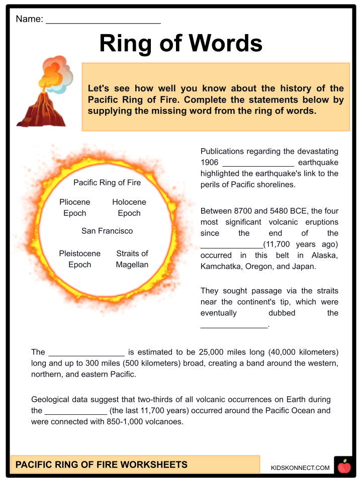
- Then, to escape the strongest section of the current to the south, they sought passage via the straits near the continent’s tip, which were eventually dubbed the Straits of Magellan.
- Once the voyage discovered a safe route through the Straits, they encountered a magnificent quiet ocean with good winds. They christened it as the peaceful sea—today’s Pacific Ocean—or Mare Pacificum.
- Magellan had no idea that the Earth’s largest and deepest ocean basin is surrounded by about a thousand volcanoes along practically continuous earthquake-prone subduction zones and transform faults.
- The Pacific Ring of Fire is estimated to be 25,000 miles (40,000 kilometers) long and up to 300 miles (500 kilometers) broad, creating a band around the western, northern, and eastern Pacific.
- The tectonically active region encompasses the western coastlines of the Americas, Alaska’s Aleutian Islands, Russia’s Kamchatka Peninsula, and the eastern coasts of Japan, Taiwan, the Philippines, Papua New Guinea, various Pacific Islands, and New Zealand.
- Researchers in the nineteenth century noted the prevalence of volcanism encircling the Pacific basin in writings as early as 1825.
- The phenomena were noted in an 1878 Scientific American article titled “The Ring of Fire and the Volcanic Peaks of the West Coast of the United States.”
- Publications regarding the devastating 1906 San Francisco earthquake highlighted the earthquake’s link to the perils of Pacific shorelines.
- The mechanism for the Ring of Fire was ultimately discovered when plate tectonics theory emerged in the 1960s.
- The Pacific Ring of Fire is governed by plate tectonics.
- While the East Pacific Rise produces oceanic crust, the Ring of Fire is a continuous ring of subduction zones and transforms faults that circle the Pacific.
- Oceanic trenches, volcanic belts, volcanic arcs, and back-arc basins emerge as the oceanic lithosphere is devoured near convergent plate boundaries.
- While subduction has happened in portions of the belt for far longer, the Ring of Fire has been around for more than 35 million years—since the beginning of the Oligocene Epoch.
- The region’s volcanoes are mostly explosive andesitic stratovolcanoes, but there are a few subaerial basaltic shield volcanoes in the belt.
- Geological data suggest that two-thirds of all volcanic occurrences on Earth during the Holocene Epoch (the last 11,700 years) occurred around the Pacific Ocean and were connected with 850-1,000 volcanoes.
- Between 8700 and 5480 BCE, the four most significant volcanic eruptions since the end of the Pleistocene Epoch (11,700 years ago) occurred in this belt in Alaska, Kamchatka, Oregon, and Japan.
GEOGRAPHIC STRETCH OF PACIFIC RING OF FIRE
- The Ring of Fire stretches for around 40,000 kilometers (24,900 miles). It follows the boundary of many tectonic plates, such as the Pacific, Juan de Fuca, Cocos, Indian-Australian, Nazca, North American, and Philippine Plates.
- The chain stretches across the western coasts of South and North America, over the Aleutian Islands in Alaska, down the eastern coast of Asia via New Zealand, and into Antarctica’s northern shore.
- Some key areas in the Ring of Fire include Bolivia, Chile, Ecuador, Peru, Costa Rica, Guatemala, Mexico, the United States, Canada, Russia, Japan, the Philippines, Australia, Papua New Guinea, Indonesia, New Zealand, and Antarctica.
FEATURES OF THE RING OF FIRE
Active Volcanoes
- In the Ring of Fire, more than 450 active and dormant volcanoes (75% of Earth’s total volcanoes) form a semicircle or horseshoe around the border of the Pacific Ocean.
- Most of the Ring of Fire’s active volcanoes are on its western border, from Russia to New Zealand.
- Major volcanic events within the Ring of Fire have occurred since 1800, including the eruptions of Mount Tambora in Indonesia (1815), Mount Ruiz in Columbia (1985), and Mount Pinatubo in the Philippines (1991).
- Mount Tambora in Indonesia erupted in 1815, becoming the biggest volcanic eruption in recorded history.
- After losing most of its summit in the 1815 eruption, it is presently 2,851 meters (9,354 feet) tall.
- New Zealand’s Mount Ruapehu is one of the Ring of Fire’s most active volcanoes, with modest eruptions occurring on a regular basis and big eruptions occurring every 50 years.
- Krakatoa, an island volcano, erupts less frequently but significantly more dramatically than Mount Ruapehu.
- The entire island was destroyed by a historical eruption in 1883, which sent volcanic gas, ash, and boulders as high as 80 kilometers (50 miles) into the air.
- Mount Fuji, Japan’s highest and most renowned peak, is also an active volcano in the Ring of Fire.
- Mount Fuji is located in a “triple junction” of three tectonic plates (the Amur Plate, the Okhotsk Plate, and the Philippine Plate).
- The eastern portion of the Ring of Fire is also home to several active volcanic zones, including the Aleutian Islands, the Cascade Mountains in the western United States, the Trans-Mexican Volcanic Belt, and the Andes Mountains.
- Mount Saint Helens is an active volcano in the Cascade Mountain range in the United States.
- It is situated in a brittle crust zone, which makes it more vulnerable to eruptions. The historical eruption lasted 9 hours and deposited tons of volcanic ash in nearby areas.
- Popocatépetl is one of the Ring of Fire’s most deadly volcanoes.
- With 15 known eruptions since 1519, the peak is one of Mexico’s most active volcanoes.
Famous Volcanoes and Regions in the Belt:
- Mount Saint Helens is an active volcano in the Cascade Mountains in the United States’ northwest.
- Popocatépetl is a volcano in Mexico’s Trans-Mexican Volcanic Belt near Mexico City.
- Mount Fuji, Japan’s tallest peak, erupted last in 1707.
- The Aleutian Islands include 52 volcanoes, including Cleveland, Okmok, and Akutan, which are all quite active.
- The Andes are home to Ecuador’s Cotopaxi, Mexico’s Cerro Azul, and the world’s highest active volcano, Ojos del Salado, which stands 22,615 feet (6,893 meters) above sea level on the Argentina-Chile border.
- In early 2022, the Pacific nation of Tonga’s Hunga Tonga-Hunga Haapai erupted, ringing the Earth’s atmosphere like a bell.
Earthquakes
- 90% of earthquakes occur along their course, including the most powerful and spectacular seismic occurrences worldwide.
- The Ring of Fire has been the site of some of the most deadly earthquakes in recorded history, including the 1960 and 2010 Chile earthquakes, the 1964 Alaska earthquake, the 2011 Japan earthquake, and the 2004 Indian Ocean tsunami.
- The Valdivia Earthquake in Chile in 1960 was the greatest recorded earthquake, measuring 9.5 on the Richter scale.
- The Chile Earthquake is followed closely by the 1964 Great Alaska Earthquake (magnitude 9.2).
- The December 26, 2004 earthquake in Northern Sumatra (the Indian Ocean Tsunami) (magnitude 9.1)
- A 9.0 magnitude earthquake rocked Honshu, Japan, on March 11, 2011, generating a tsunami and, later, the Fukushima nuclear disaster.
Island Arcs
- They are long, curving chains of oceanic islands characterized by significant volcanic and seismic activity and orogenic (mountain-building) activities.
- On its concave side, an island arc usually has a land mass or partially contained exceptionally shallow water.
- A long, narrow deep-sea trench nearly always exists along the convex side.
- The deepest ocean depths are located in these seabed depressions, such as the Mariana (the world’s deepest trench) and Tonga.
- The Aleutian-Alaska Arc and the Kuril-Kamchatka Arc are prime examples of this type of geologic phenomenon.
Trenches
- Ocean trenches are deep depressions in the ocean caused by an ancient ocean crust pushed beneath another plate, building mountains, producing earthquakes, and forming volcanoes on the seafloor and land.
SOURCES OF GEOTHERMAL RESOURCES
- The Ring of Fire is formed by tectonic plates, which are massive slabs of the Earth’s crust that fit together like jigsaw pieces.
- These moving plates occasionally clash, move apart, or slide close to one another, establishing convergent, divergent, or transform borders (respectively).
- This ongoing collision, diversion, or sliding-past-each-other movement of tectonic plates causes deep ocean trenches, volcanic eruptions, and earthquake epicenters along fault lines, the boundaries where the plates meet.
- The subduction process forms volcanoes, and most of the planet’s subduction zones are located in the Ring of Fire.
- A major exception is the border between the Pacific and North American Plates.
- This section of the Ring of Fire is a transform boundary, meaning plates move sideways past one another.
- As strain in the Earth’s crust builds up and is released, this barrier causes many earthquakes.
- Subduction occurs when tectonic plates change, causing one plate to be forced beneath another. This ocean floor movement causes “mineral transmutation,” which causes magma to melt and solidify, resulting in the development of volcanoes.
- When a “downgoing” oceanic plate is driven into a hotter mantle plate, it warms up, volatile components mix, and magma is created. The magma rises to the surface via the underlying plate.
- A subduction zone is the largest crash site on the planet. These borders denote the meeting of two tectonic plates.
- When two tectonic plates collide in a subduction zone, one bends and slips beneath the other, curving down into the mantle, the hotter layer beneath the crust.
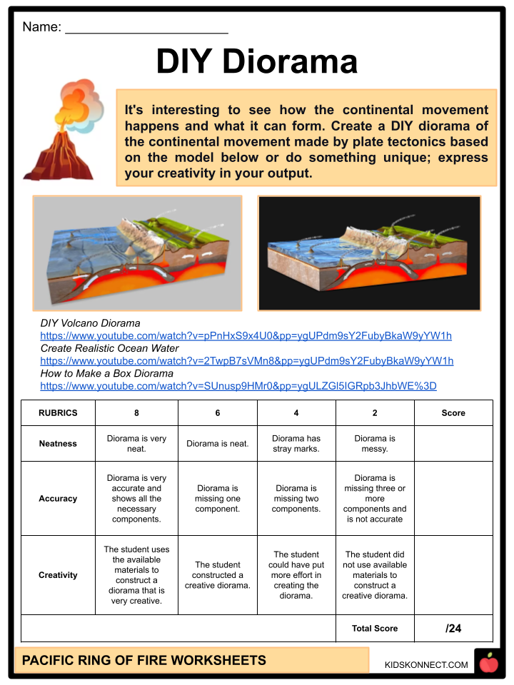
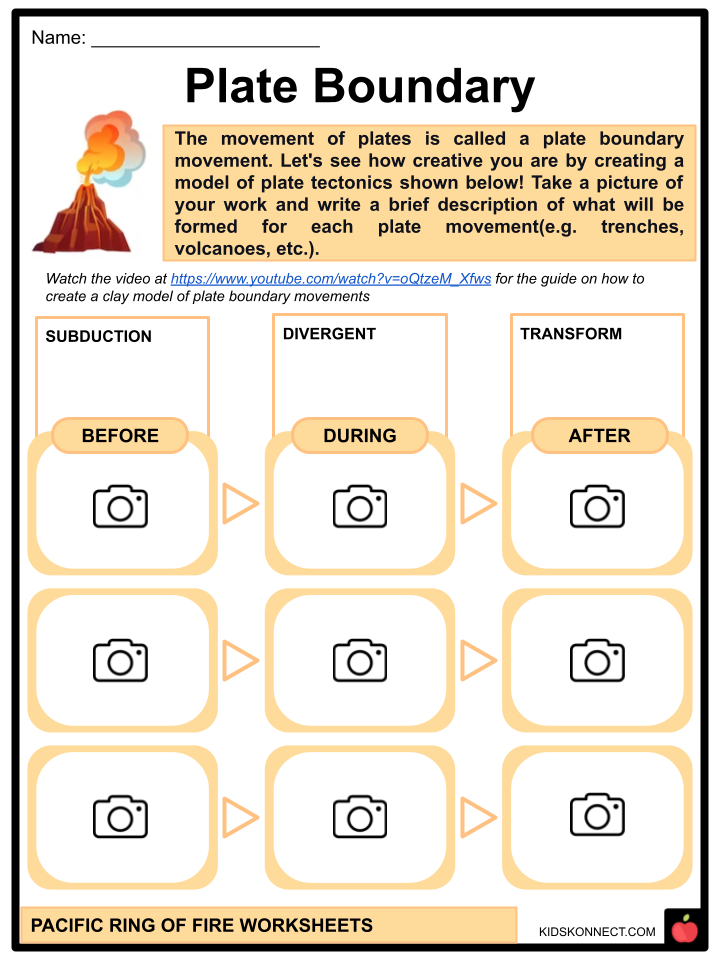
Pacific Ring of Fire Worksheets
This fantastic bundle includes everything you need to know about the Pacific Ring of Fire across 30 in-depth pages. These ready-to-use worksheets are perfect for teaching kids about the Pacific Ring of Fire. The Pacific Ring of Fire is estimated to be around 25,000 miles long. It comprises an arc of mountains, active volcanoes, and oceanic trenches.
Complete List of Included Worksheets
Below is a list of all the worksheets included in this document.
- Pacific Ring of Fire Facts
- Ring of Words
- Mapping PROF
- What’s More?
- Active Volcanoes
- Eruption Alert!
- Ring of Fire
- Plate Boundary
- The Tectonic Plates
- Be Smart, Be Ready
- DIY Diorama
Frequently Asked Questions
What is the Pacific Ring of Fire?
The Pacific Ring of Fire is a major area in the basin of the Pacific Ocean where a large number of earthquakes and volcanic eruptions occur. It is a 40,000-kilometer (25,000-mile) horseshoe-shaped region that encompasses the coasts of several countries, including the western coast of North and South America, eastern Asia, and the islands of the western Pacific.
Why is it called the Pacific Ring of Fire?
The name “Pacific Ring of Fire” comes from the fact that the region is characterized by a nearly continuous series of tectonic plate boundaries, which form a ring around the Pacific Ocean. These boundaries are associated with frequent seismic and volcanic activity, hence the term “Ring of Fire.”
What causes the high seismic and volcanic activity in the Pacific Ring of Fire?
The Pacific Ring of Fire is located along the boundaries of several tectonic plates, where they interact and collide. The majority of the world’s earthquakes and volcanic eruptions occur in this region due to the subduction of one tectonic plate beneath another. The intense geologic activity is a result of the complex interactions between the Pacific Plate and several other plates, such as the North American, Eurasian, Philippine, and Australian plates.
What are some notable features of the Pacific Ring of Fire?
The Pacific Ring of Fire is home to several notable geological features. It includes the Cascade Range in North America, which has active volcanoes such as Mount St. Helens and Mount Rainier. The region also encompasses the Aleutian Islands in Alaska, known for their volcanic activity. In Asia, the Ring of Fire includes the infamous Mount Fuji in Japan and the volcanic islands of the Philippines. Additionally, it features the Pacific Ocean’s deepest point, the Mariana Trench.
Are there any hazards associated with the Pacific Ring of Fire?
Yes, the Pacific Ring of Fire is associated with various hazards. It experiences frequent earthquakes, some of which can be highly destructive. The region also has numerous active volcanoes, which pose risks of eruptions and volcanic ash fallout. Additionally, the Ring of Fire is susceptible to tsunamis triggered by undersea earthquakes. Countries located within the Pacific Ring of Fire often have measures in place to monitor and mitigate these hazards to protect their populations.
Link/cite this page
If you reference any of the content on this page on your own website, please use the code below to cite this page as the original source.
Link will appear as Pacific Ring of Fire Facts & Worksheets: https://kidskonnect.com - KidsKonnect, June 28, 2023
Use With Any Curriculum
These worksheets have been specifically designed for use with any international curriculum. You can use these worksheets as-is, or edit them using Google Slides to make them more specific to your own student ability levels and curriculum standards.


