Premium
 Download
Edit
Download
Edit
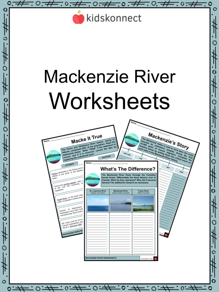
Download the Mackenzie River Facts & Worksheets
Click the button below to get instant access to these worksheets for use in the classroom or at a home.
Download This Worksheet
This download is exclusively for KidsKonnect Premium members!
To download this worksheet, click the button below to signup (it only takes a minute) and you'll be brought right back to this page to start the download!
Sign Me Up
Edit This Worksheet
Editing resources is available exclusively for KidsKonnect Premium members.
To edit this worksheet, click the button below to signup (it only takes a minute) and you'll be brought right back to this page to start editing!
Sign Up
Not ready to purchase a subscription? Click to download the free sample version Download sample
Download This Sample
This sample is exclusively for KidsKonnect members!
To download this worksheet, click the button below to signup for free (it only takes a minute) and you'll be brought right back to this page to start the download!
Sign Me Up
Table of Contents
The Mackenzie River flows through the Canadian boreal forest. It constitutes the most extended river system in Canada, along with the Slave, Peace, and Finlay, and has the second-greatest drainage area of any North American river behind the Mississippi.
See the fact file below for more information about the Mackenzie River, or you can download our 30-page Mackenzie River worksheet pack to utilize within the classroom or home environment.
Key Facts & Information
HISTORICAL BACKGROUND
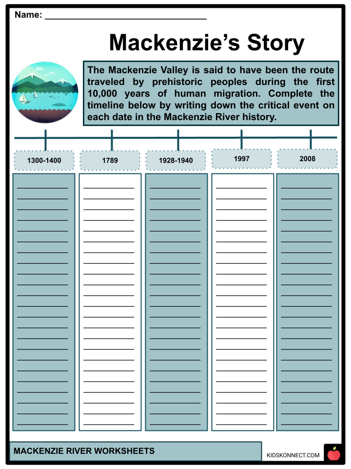
- The Mackenzie Valley is said to have been the route traveled by prehistoric peoples during the first 10,000 years of human migration from Asia to North America. Despite the efforts of many scholars, archaeological evidence of habitation by humans along the Mackenzie is limited. Flooding, freeze-thaw, and erosion have most likely destroyed many arch sites.
- The Inuvialuit, Gwich’in, and other indigenous groups have resided along the river for thousands of years. Still, the oldest continuous habitation evidence dates back only around 1300-1400, at the Gwich’in settlement of Tsiigehtchic.
- The Mackenzie provided a vital passage into Canada’s northern core for European explorers. On July 14, 1789, Scottish adventurer Alexander Mackenzie traveled the river to reach the Pacific Ocean but instead went to its mouth in the Arctic Ocean.
- Meanwhile, during the late nineteenth and early twentieth centuries, outbreaks of introduced European diseases swept across Indigenous settlements along the river, killing thousands of Aboriginal people. One in every ten native people near the Mackenzie River died as a result of a particularly severe influenza outbreak in 1928. Fort Providence lost 20% of its inhabitants, while other smaller settlements and camps were destroyed.
- On the other hand, steamboats were replaced by sophisticated gas and diesel-powered crafts by the 1940s, and they continue to service the river today.
- During WWII, oil from Norman Wells was transported to Fairbanks, Alaska, via the 1,000-kilometer Canol pipeline. The pipeline was deemed a “failure,” running five times over budget and squandering up to 20% of the oil due to inadequate building.
- Because of its cultural, social, and spiritual value to the Gwichya Gwich’in, a cultural landscape along the Mackenzie River near Tsiigehtchic was declared the Nagwichoonjik (Mackenzie River) National Historic Site of Canada in 1997.
- In 2008, Canadian and Japanese researchers extracted a steady stream of natural gas from the Mallik methane hydrate formation in the Mackenzie Delta as part of a test operation.
- The drilling was the second of its kind at Mallik; the first, in 2002, used heat to discharge methane. Researchers collected gas in 2008 by reducing the pressure without heating, requiring substantially less energy.
GEOGRAPHY
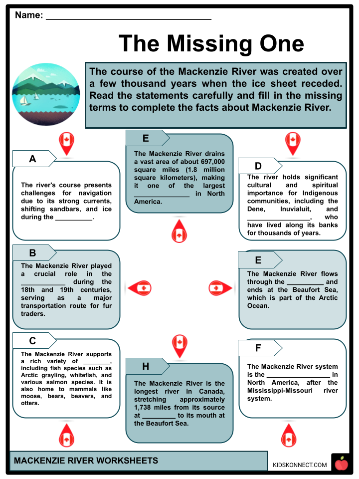
- Headwaters- The Mackenzie River basin includes parts of five Canadian provinces and territories: British Columbia (BC), Alberta, Saskatchewan, Yukon, and the Northwest Territories.
- On the other hand, the Peace River contributes the most water, approximately 66 km3 (54 million acre-feet) each year, while the Athabasca provides 25 km3 (20 million acre-feet).
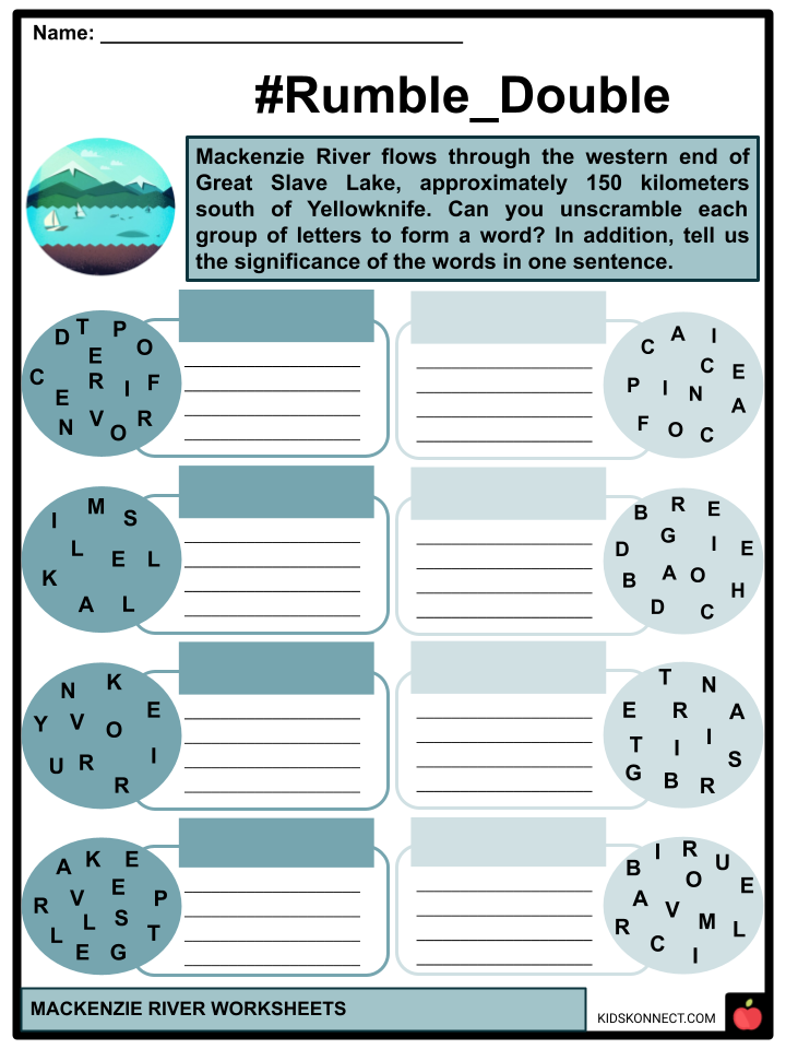
- Moreover, the Mackenzie River flows through the western end of Great Slave Lake, approximately 150 kilometers south of Yellowknife. The waterway is initially several kilometers wide but narrows to around 800 meters at Fort Providence.
- The Deh Cho Bridge, which provides a safer permanent passage around 10 kilometers upstream, was completed in 2012. It is the only bridge that spans the Mackenzie’s main stem. The Mackenzie River widens significantly west of Fort Providence, resembling a shallow, muddy lake rather than a river. One significant expansion here is Mills Lake.
- Drainage Basin– The Mackenzie River drainage area covers roughly 20% of Canada at 1,805,000 km2. Above Great Slave Lake, approximately 980,000 km2 (380,000 sq mi), or 54% of the basin, lies. Above Great Slave Lake, about 980,000 km2 (380,000 sq mi), or 54% of the basin, lies.
- Permafrost covers almost three-quarters of the watershed, reaching depths of up to 100 meters (330 feet) in the Mackenzie Delta. The Mackenzie basin receives only tiny to moderate rainfall, an average of 410 millimeters.
- The Mackenzie Basin’s western boundary follows the Continental Divide. The split separates the Mackenzie watershed from the Yukon River, which flows to the Bering Strait, and the Fraser and Columbia River systems, which also discharge into the Pacific Ocean.
- Flow Characteristics– By late October or November, the river usually freezes, beginning in the north. With enormous amounts of warmer fresh water mixing with the cold ocean, Mackenzie’s discharge significantly stabilizes the area temperature above the Arctic Ocean all year.
- During spring peak flow, the discharge differential between the two sections of the watershed is considerably more pronounced. Spring floods from the Peace-Athabasca system are slowed by the delta area at the western end of Lake Athabasca, causing the lake to increase, and the surplus water can only flow out once the rivers have receded.
GEOLOGY
- The course of the Mackenzie River was created over a few thousand years when the ice sheet receded. At the time of the ice ages, only the Peel River tributary flowed into the Arctic Ocean through the Mackenzie Delta.
- The Mackenzie bears a huge sediment load, sending around 128 million tonnes to its delta yearly. The Liard River alone accounts for 32% of the total, with the Peel River accounting for around 20%. Because upstream material is held in Great Slave Lake, places down Fort Providence provide virtually all of the sediment.
ECOLOGY
- Meanwhile, the Mackenzie bears a huge sediment load, sending around 128 million tonnes to its delta yearly. The Liard River alone accounts for 32% of the total, with the Peel River accounting for about 20%. Because upstream material is held in Great Slave Lake, places down Fort Providence provide virtually all of the sediment.
- The basin contains 53 fish species, none of which are indigenous. The fish fauna of the Mackenzie River is comparable with that of the Mississippi River’s system. The two river systems are thought to have been linked during the Ice Ages by meltwater lakes and canals, allowing fish from the two rivers to interbreed. Northern pike, various minnow creatures, and lake whitefish are among the fish found in the Mackenzie River.
HUMAN USE
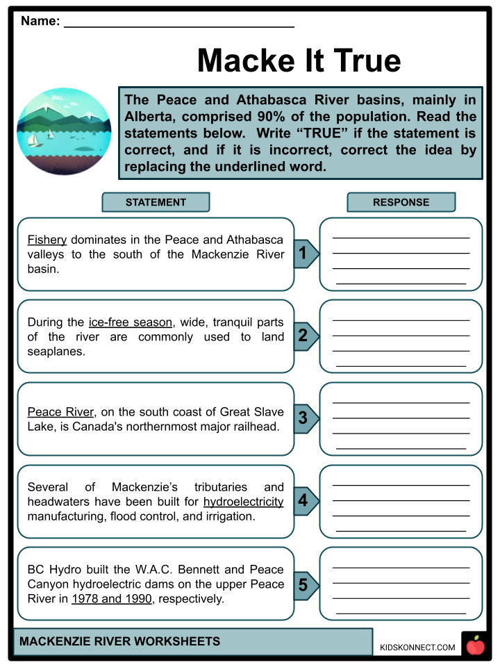
- In 2001, the Mackenzie River basin was home to around 400,000 people, accounting for less than one percent of Canada’s population. The Peace and Athabasca River basins, mainly in Alberta, comprised 90% of the population.
- Natural Resources– agriculture dominates in the Peace and Athabasca valleys south of the Mackenzie River basin. Because of the substantial amount of minerals in the soil, the valley of the old river is regarded as among the best northern agriculture in Canada.
- Transportation– during the ice-free season, the Mackenzie is a significant transit link through northern Canada’s immense wilderness, connecting the many isolated towns along its route. During the ice-free season, comprehensive, tranquil parts of the river are commonly used to land seaplanes.
- Hydroelectricity– Mackenzie’s tributaries and headwaters have been built for hydroelectricity manufacturing, flood control, and irrigation. BC Hydro built the W.A.C. Bennett and Peace Canyon hydroelectric dams on the upper Peace River in 1968 and 1980, respectively.
Mackenzie River Worksheets
This fantastic bundle includes everything you need to know about the Mackenzie River across 30 in-depth pages. These ready-to-use worksheets are perfect for teaching kids about the Mackenzie River. It constitutes the most extended river system in Canada, along with the Slave, Peace, and Finlay, and has the second-greatest drainage area of any North American river behind the Mississippi.
Complete List of Included Worksheets
Below is a list of all the worksheets included in this document.
- Mackenzie River Facts
- The Missing One
- Macke It True
- #Rumble_Double
- Mackenzie’s Story
- Mackenzie’s Sherlock
- Mackenzie Word Pool
- FAQs
- What’s The Difference?
- Facts About Mackenzie
- For Sale!
Frequently Asked Questions
Where is the Mackenzie River located?
The Mackenzie River is located in Canada, flowing through the Northwest Territories. It is the longest river in Canada and the second-longest in North America.
What is the length of the Mackenzie River?
The Mackenzie River is approximately 1,080 miles (1,738 kilometers) long. It originates from the Great Slave Lake and discharges into the Beaufort Sea in the Arctic Ocean.
What is the significance of the Mackenzie River in terms of drainage?
The Mackenzie River basin is one of the largest drainage systems in North America, covering an area of about 1.8 million square kilometers. It plays a crucial role in draining water from the interior of the continent to the Arctic Ocean.
How does the Mackenzie River contribute to the ecosystem?
The Mackenzie River and its surrounding areas support diverse ecosystems, providing habitats for various wildlife species. The river and its tributaries are home to fish such as Arctic grayling and whitefish, and the surrounding tundra and boreal forests are important for migratory birds and mammals.
Are there any communities along the Mackenzie River?
Yes, several communities are situated along the Mackenzie River, including the town of Inuvik. These communities often rely on the river for transportation, as well as for fishing and other subsistence activities. The Mackenzie River has been historically significant for Indigenous peoples in the region, playing a crucial role in their cultural and economic practices.
Link/cite this page
If you reference any of the content on this page on your own website, please use the code below to cite this page as the original source.
Link will appear as Mackenzie River Facts & Worksheets: https://kidskonnect.com - KidsKonnect, February 14, 2024
Use With Any Curriculum
These worksheets have been specifically designed for use with any international curriculum. You can use these worksheets as-is, or edit them using Google Slides to make them more specific to your own student ability levels and curriculum standards.